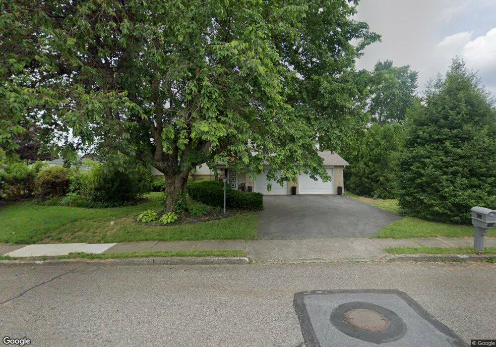
899 Frank Dr Emmaus, PA 18049
Estimated Value: $449,810 - $504,000
3
Beds
2
Baths
2,319
Sq Ft
$207/Sq Ft
Est. Value
About This Home
This home is located at 899 Frank Dr, Emmaus, PA 18049 and is currently estimated at $480,703, approximately $207 per square foot. 899 Frank Dr is a home located in Lehigh County with nearby schools including Jefferson Elementary School, Lower Macungie Middle School, and Emmaus High School.
Ownership History
Date
Name
Owned For
Owner Type
Purchase Details
Closed on
May 26, 2009
Sold by
Kwon Joo Y
Bought by
Reichardt Eike
Current Estimated Value
Home Financials for this Owner
Home Financials are based on the most recent Mortgage that was taken out on this home.
Original Mortgage
$253,326
Outstanding Balance
$160,486
Interest Rate
4.82%
Mortgage Type
FHA
Estimated Equity
$320,217
Purchase Details
Closed on
May 6, 1991
Sold by
Vargas Manuel and Vargas Linda L
Bought by
Kwon Joo Y and Kwon Soon J
Purchase Details
Closed on
Jan 2, 1976
Bought by
Vargas Manuel and Vargas Linda L
Create a Home Valuation Report for This Property
The Home Valuation Report is an in-depth analysis detailing your home's value as well as a comparison with similar homes in the area
Home Values in the Area
Average Home Value in this Area
Purchase History
| Date | Buyer | Sale Price | Title Company |
|---|---|---|---|
| Reichardt Eike | $258,000 | -- | |
| Kwon Joo Y | $125,000 | -- | |
| Vargas Manuel | -- | -- |
Source: Public Records
Mortgage History
| Date | Status | Borrower | Loan Amount |
|---|---|---|---|
| Open | Reichardt Eike | $253,326 |
Source: Public Records
Tax History Compared to Growth
Tax History
| Year | Tax Paid | Tax Assessment Tax Assessment Total Assessment is a certain percentage of the fair market value that is determined by local assessors to be the total taxable value of land and additions on the property. | Land | Improvement |
|---|---|---|---|---|
| 2025 | $7,112 | $201,900 | $38,700 | $163,200 |
| 2024 | $6,514 | $201,900 | $38,700 | $163,200 |
| 2023 | $6,388 | $201,900 | $38,700 | $163,200 |
| 2022 | $6,177 | $201,900 | $163,200 | $38,700 |
| 2021 | $6,022 | $201,900 | $38,700 | $163,200 |
| 2020 | $5,971 | $201,900 | $38,700 | $163,200 |
| 2019 | $5,811 | $201,900 | $38,700 | $163,200 |
| 2018 | $5,592 | $201,900 | $38,700 | $163,200 |
| 2017 | $5,420 | $201,900 | $38,700 | $163,200 |
| 2016 | -- | $201,900 | $38,700 | $163,200 |
| 2015 | -- | $201,900 | $38,700 | $163,200 |
| 2014 | -- | $201,900 | $38,700 | $163,200 |
Source: Public Records
Map
Nearby Homes
- 3514 Daylily Dr
- 943 N 6th St
- 4088 Eveningstar Rd
- 507 Iroquois St
- 3149 Sheffield Dr
- 3430 Gentlewind Way Unit IC 109
- 4109 Eveningstar Rd
- 3420 Gentlewind Way Unit IC 110
- 3623 Daylily Dr
- 4490 Canterbury Dr
- 3810 Allen St
- 2834 Sheffield Dr
- 4476 Stonebridge Dr
- 657 Walnut St
- 2300 S Cedar Crest Blvd
- 3703 Samantha Ln Unit Lot 70
- 3707 Samantha Ln Unit Lot 71
- 3736 Samantha Ln Unit Lot 7
- 3734 Samantha Ln Unit Lot 8
- 3748 Samantha Ln Unit Lot 3