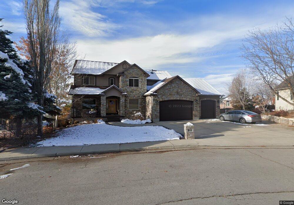
899 N 1100 E Unit 2 Pleasant Grove, UT 84062
Estimated Value: $828,000 - $1,048,000
5
Beds
4
Baths
2,572
Sq Ft
$364/Sq Ft
Est. Value
About This Home
This home is located at 899 N 1100 E Unit 2, Pleasant Grove, UT 84062 and is currently estimated at $935,141, approximately $363 per square foot. 899 N 1100 E Unit 2 is a home located in Utah County with nearby schools including Grovecrest Elementary School, Pleasant Grove Junior High School, and Pleasant Grove High School.
Ownership History
Date
Name
Owned For
Owner Type
Purchase Details
Closed on
Aug 13, 2010
Sold by
Ford Robin and Ford Walter
Bought by
Hutchings John L and Hutchings Tracie K
Current Estimated Value
Home Financials for this Owner
Home Financials are based on the most recent Mortgage that was taken out on this home.
Original Mortgage
$344,800
Outstanding Balance
$227,715
Interest Rate
4.52%
Mortgage Type
New Conventional
Estimated Equity
$707,426
Purchase Details
Closed on
May 18, 2005
Sold by
Hansen Jerry and Hansen Georgia L
Bought by
Ford Walter and Ford Robin
Home Financials for this Owner
Home Financials are based on the most recent Mortgage that was taken out on this home.
Original Mortgage
$91,000
Interest Rate
5.84%
Mortgage Type
Stand Alone Second
Purchase Details
Closed on
Jun 23, 2004
Sold by
Cornerstone Group Investments Inc
Bought by
Hansen Jerry and Hansen Georgia L
Home Financials for this Owner
Home Financials are based on the most recent Mortgage that was taken out on this home.
Original Mortgage
$336,000
Interest Rate
6.29%
Mortgage Type
Purchase Money Mortgage
Create a Home Valuation Report for This Property
The Home Valuation Report is an in-depth analysis detailing your home's value as well as a comparison with similar homes in the area
Home Values in the Area
Average Home Value in this Area
Purchase History
| Date | Buyer | Sale Price | Title Company |
|---|---|---|---|
| Hutchings John L | -- | Utah Commercial Title | |
| Ford Walter | -- | Inwest Title Services Inc | |
| Hansen Jerry | -- | Bartlett Title Insurance Ag |
Source: Public Records
Mortgage History
| Date | Status | Borrower | Loan Amount |
|---|---|---|---|
| Open | Hutchings John L | $344,800 | |
| Previous Owner | Ford Walter | $91,000 | |
| Previous Owner | Ford Walter | $364,000 | |
| Previous Owner | Hansen Jerry | $336,000 |
Source: Public Records
Tax History Compared to Growth
Tax History
| Year | Tax Paid | Tax Assessment Tax Assessment Total Assessment is a certain percentage of the fair market value that is determined by local assessors to be the total taxable value of land and additions on the property. | Land | Improvement |
|---|---|---|---|---|
| 2025 | $3,708 | $473,550 | $388,100 | $472,900 |
| 2024 | $3,708 | $442,420 | $0 | $0 |
| 2023 | $3,561 | $435,105 | $0 | $0 |
| 2022 | $3,916 | $476,080 | $0 | $0 |
| 2021 | $3,322 | $614,900 | $220,800 | $394,100 |
| 2020 | $3,137 | $569,300 | $204,400 | $364,900 |
| 2019 | $2,716 | $509,700 | $192,400 | $317,300 |
| 2018 | $2,828 | $501,700 | $184,400 | $317,300 |
| 2017 | $2,757 | $260,480 | $0 | $0 |
| 2016 | $2,638 | $240,570 | $0 | $0 |
| 2015 | $2,717 | $234,685 | $0 | $0 |
| 2014 | $2,419 | $206,965 | $0 | $0 |
Source: Public Records
Map
Nearby Homes
- 1085 E Grove Creek Dr
- 1022 E Hillside Dr Unit 233
- 482 Canyon View Ln
- 428 N 1180 E
- 1161 E 200 N
- 348 N 1350 E
- 1192 N 730 E
- 641 E 700 N
- 26 S 1185 E
- 540 E 990 N
- 575 E 500 N
- 10 S 1400 E
- 819 E 50 S
- Prelude Plan at Blossom Hill
- Treble Plan at Blossom Hill
- Browning Plan at Blossom Hill
- Cantata Plan at Blossom Hill
- 176 S 1150 E
- Accord Plan at Blossom Hill
- Canon Plan at Blossom Hill
- 899 N 1100 E
- 861 N 1100 E
- 861 N 1100 E Unit 1
- 1050 E Grove Dr
- 933 N 1100 E
- 933 N 1100 E Unit 3
- 930 N 1050 E
- 1070 E Grove Dr
- 916 N 1100 E
- 916 N 1100 E Unit 13
- 960 N Grove Dr
- 967 N 1100 E
- 967 N 1100 E Unit 4
- 1046 Grove Creek Dr
- 1046 Grove Cir
- 1121 Grove Creek Dr
- 958 N 1100 E
- 958 N 1100 E Unit 12
- 1049 E Grove Dr
- 1105 Grove Creek Dr