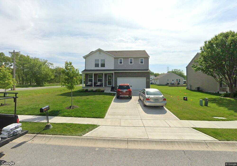
899 Saint Andrews Dr Chesterton, IN 46304
Porter County NeighborhoodEstimated Value: $338,000
4
Beds
3
Baths
1,812
Sq Ft
$187/Sq Ft
Est. Value
About This Home
This home is located at 899 Saint Andrews Dr, Chesterton, IN 46304 and is currently priced at $338,000, approximately $186 per square foot. 899 Saint Andrews Dr is a home located in Porter County with nearby schools including Liberty Elementary School, Liberty Intermediate School, and Chesterton Middle School.
Ownership History
Date
Name
Owned For
Owner Type
Purchase Details
Closed on
Feb 7, 2023
Sold by
Wjh Llc
Bought by
Scellato Rosetta A
Current Estimated Value
Home Financials for this Owner
Home Financials are based on the most recent Mortgage that was taken out on this home.
Original Mortgage
$289,646
Outstanding Balance
$277,896
Interest Rate
4.87%
Mortgage Type
FHA
Purchase Details
Closed on
May 17, 2021
Sold by
St Andrews Development Llc
Bought by
Wjh Llc
Create a Home Valuation Report for This Property
The Home Valuation Report is an in-depth analysis detailing your home's value as well as a comparison with similar homes in the area
Home Values in the Area
Average Home Value in this Area
Purchase History
| Date | Buyer | Sale Price | Title Company |
|---|---|---|---|
| Scellato Rosetta A | $294,990 | First American Title | |
| Wjh Llc | -- | None Available |
Source: Public Records
Mortgage History
| Date | Status | Borrower | Loan Amount |
|---|---|---|---|
| Open | Scellato Rosetta A | $289,646 |
Source: Public Records
Tax History Compared to Growth
Tax History
| Year | Tax Paid | Tax Assessment Tax Assessment Total Assessment is a certain percentage of the fair market value that is determined by local assessors to be the total taxable value of land and additions on the property. | Land | Improvement |
|---|---|---|---|---|
| 2024 | $1,835 | $311,200 | $56,800 | $254,400 |
| 2023 | $1,004 | $213,600 | $55,700 | $157,900 |
| 2022 | $890 | $55,700 | $55,700 | $0 |
| 2021 | $7 | $400 | $400 | $0 |
| 2020 | $7 | $400 | $400 | $0 |
| 2019 | $9 | $500 | $500 | $0 |
| 2018 | $12 | $500 | $500 | $0 |
| 2017 | $12 | $500 | $500 | $0 |
| 2016 | $15 | $600 | $600 | $0 |
| 2014 | $16 | $600 | $600 | $0 |
| 2013 | -- | $500 | $500 | $0 |
Source: Public Records
Map
Nearby Homes
- 875 Dunhill Dr
- 70 Fairmont Dr
- ESSEX Plan at St. Andrews
- NANDINA Plan at St. Andrews
- DUPONT Plan at St. Andrews
- ASPEN Plan at St. Andrews
- 886 Argyle Ct
- 877 Argyle Ct
- 882 Hemingway Trail
- 38 Elderberry Ln
- 928 N Calumet Ave
- 8 W Shakespeare Dr
- 17 Mark Twain Dr
- 843 Mirmar Dr
- 22 Karner Blue Ct
- 0 Village Point
- 26 Karner Blue Ct
- 28 Karner Blue Ct
- 1022 N Old State Road 49
- Integrity 2280 Plan at The Preserve Indiana
- 899 St Andrews Dr
- 0 Canondale Dr Unit 1899179
- 897 Saint Andrews Dr
- 898 Dunhill Dr
- 896 Dunhill Dr
- 895 Saint Andrews Dr
- 895 St Andrews Dr
- 894 Dunhill Dr
- 894 Dunhill Dr
- 899 Dunhill Dr
- 893 Saint Andrews Dr
- 892 Dunhill Dr
- 892 Dunhill Dr
- 897 Dunhill Dr
- 895 Dunhill Dr
- 891 Saint Andrews Dr
- 895 Dunhill Dr
- 891 St Andrews Dr
- 890 St Andrews Dr
- 890 Saint Andrews Dr