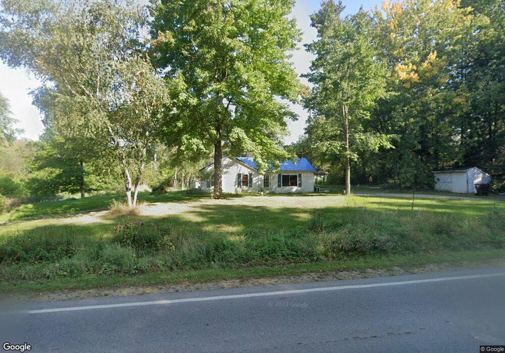
8996 King Rd Spring Arbor, MI 49283
Estimated Value: $149,000 - $192,000
Studio
--
Bath
1,264
Sq Ft
$136/Sq Ft
Est. Value
About This Home
This home is located at 8996 King Rd, Spring Arbor, MI 49283 and is currently estimated at $171,351, approximately $135 per square foot. 8996 King Rd is a home with nearby schools including Western High School.
Ownership History
Date
Name
Owned For
Owner Type
Purchase Details
Closed on
Oct 14, 2020
Sold by
King Road Llc
Bought by
Rogers Michael A and Rogers Debra M
Current Estimated Value
Purchase Details
Closed on
Mar 15, 2011
Sold by
Prebble Leland D and Prebble Carolyn M
Bought by
King Road Llc
Purchase Details
Closed on
Aug 27, 1998
Sold by
Vanmarter Jack and Vanmarter Ann L
Bought by
Prebble Leland and Prebble Carolyn
Purchase Details
Closed on
Aug 26, 1998
Bought by
Vanmarter
Purchase Details
Closed on
Apr 1, 1992
Bought by
Vanmarter
Create a Home Valuation Report for This Property
The Home Valuation Report is an in-depth analysis detailing your home's value as well as a comparison with similar homes in the area
Purchase History
| Date | Buyer | Sale Price | Title Company |
|---|---|---|---|
| Rogers Michael A | $90,000 | None Available | |
| King Road Llc | -- | None Available | |
| Prebble Leland | $70,000 | -- | |
| Vanmarter | $70,000 | -- | |
| Vanmarter | $65,000 | -- |
Source: Public Records
Tax History
| Year | Tax Paid | Tax Assessment Tax Assessment Total Assessment is a certain percentage of the fair market value that is determined by local assessors to be the total taxable value of land and additions on the property. | Land | Improvement |
|---|---|---|---|---|
| 2025 | $2,548 | $77,400 | $0 | $0 |
| 2024 | $15 | $69,200 | $0 | $0 |
| 2023 | $1,513 | $63,600 | $0 | $0 |
| 2022 | $2,313 | $62,500 | $0 | $0 |
| 2021 | $2,272 | $58,660 | $0 | $0 |
| 2020 | $2,246 | $47,980 | $0 | $0 |
| 2019 | $2,157 | $43,720 | $0 | $0 |
| 2018 | $2,136 | $41,230 | $8,190 | $33,040 |
| 2017 | $2,045 | $40,290 | $0 | $0 |
| 2016 | $1,543 | $39,680 | $39,680 | $0 |
| 2015 | $30,368 | $36,570 | $36,570 | $0 |
| 2014 | $30,368 | $32,950 | $32,950 | $0 |
| 2013 | -- | $32,950 | $32,950 | $0 |
Source: Public Records
Map
Nearby Homes
- 68 Dickens St
- 4055 Mathews Rd
- 7969 Brandon Dr
- 2503 Milford Rd
- 0 S Parma Rd Unit 26002151
- 0 S Parma Rd Unit 26002152
- 1864 Chapel Rd
- 7315 King Rd
- 1570 Chapel Rd
- 2635 S Dearing Rd
- 2625 S Dearing Rd
- V/L S Dearing Rd Unit 40 Acres Vacant Land
- 1126 Chapel Rd
- 228 Eastlawn
- 6728 King Rd
- 219 Elizabeth St
- 0 King Rd Unit 25060444
- V/L N Concord Rd
- Parcel A N Concord Rd
- Parcel 1 N Concord Rd
- 8994 King Rd
- 8990 King Rd
- 9006 King Rd
- 8520 King Rd
- 8980 King Rd
- 8974 King Rd
- 8989 King Rd
- 8989 King Rd Unit 8995 King Rd.
- 8995 King Rd
- 8819 King Rd
- 8868 King Rd
- 8700 King Rd
- 8860 King Rd
- 9335 King Rd
- 0 King Rd Unit 543289712
- 0 King Rd Unit 3289712
- 0 King Rd
- VL King Rd
- 8820 King Rd
- 8820 King Rd Unit VL
Your Personal Tour Guide
Ask me questions while you tour the home.