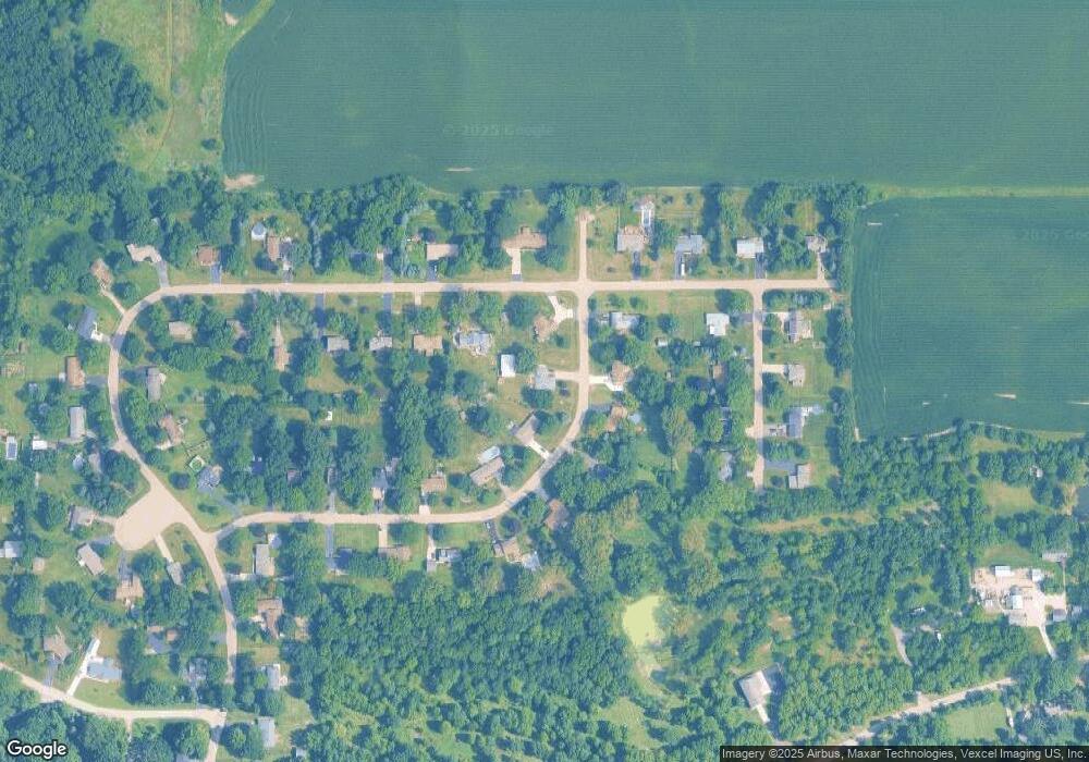
8S600 Bergman Dr Big Rock, IL 60511
Estimated Value: $384,422 - $452,000
--
Bed
1
Bath
2,521
Sq Ft
$166/Sq Ft
Est. Value
About This Home
This home is located at 8S600 Bergman Dr, Big Rock, IL 60511 and is currently estimated at $419,606, approximately $166 per square foot. 8S600 Bergman Dr is a home located in Kane County with nearby schools including Hinckley-Big Rock Elementary School and Hinckley-Big Rock High School.
Ownership History
Date
Name
Owned For
Owner Type
Purchase Details
Closed on
Dec 17, 2002
Sold by
Geisert Dennis L and Geisert Michelle M
Bought by
Catalanotto Michael and Catalanotto Dana
Current Estimated Value
Home Financials for this Owner
Home Financials are based on the most recent Mortgage that was taken out on this home.
Original Mortgage
$174,400
Outstanding Balance
$74,320
Interest Rate
6.13%
Estimated Equity
$345,286
Purchase Details
Closed on
Oct 20, 1998
Sold by
Rausch Norman and Rausch Norman R
Bought by
Geisert Dennis L and Geisert Michelle M
Home Financials for this Owner
Home Financials are based on the most recent Mortgage that was taken out on this home.
Original Mortgage
$172,300
Interest Rate
6.88%
Mortgage Type
VA
Create a Home Valuation Report for This Property
The Home Valuation Report is an in-depth analysis detailing your home's value as well as a comparison with similar homes in the area
Home Values in the Area
Average Home Value in this Area
Purchase History
| Date | Buyer | Sale Price | Title Company |
|---|---|---|---|
| Catalanotto Michael | $218,000 | -- | |
| Geisert Dennis L | $169,000 | First American Title Ins Co |
Source: Public Records
Mortgage History
| Date | Status | Borrower | Loan Amount |
|---|---|---|---|
| Open | Catalanotto Michael | $174,400 | |
| Previous Owner | Geisert Dennis L | $172,300 |
Source: Public Records
Tax History Compared to Growth
Tax History
| Year | Tax Paid | Tax Assessment Tax Assessment Total Assessment is a certain percentage of the fair market value that is determined by local assessors to be the total taxable value of land and additions on the property. | Land | Improvement |
|---|---|---|---|---|
| 2024 | $6,257 | $99,540 | $18,539 | $81,001 |
| 2023 | $6,008 | $91,861 | $17,109 | $74,752 |
| 2022 | $5,856 | $86,181 | $16,051 | $70,130 |
| 2021 | $5,969 | $80,982 | $15,083 | $65,899 |
| 2020 | $5,850 | $78,213 | $14,567 | $63,646 |
| 2019 | $5,523 | $73,341 | $13,846 | $59,495 |
| 2018 | $5,972 | $74,886 | $13,348 | $61,538 |
| 2017 | $5,764 | $70,820 | $12,623 | $58,197 |
| 2016 | $5,641 | $66,691 | $12,623 | $54,068 |
| 2015 | -- | $64,914 | $12,418 | $52,496 |
| 2014 | -- | $63,140 | $12,418 | $50,722 |
| 2013 | -- | $64,919 | $12,768 | $52,151 |
Source: Public Records
Map
Nearby Homes
- 45W127 Jericho Rd
- 1650 Highway 30
- 240 Snow St
- 126 S Sugar Grove Pkwy
- 92 Maple St
- 307 Jefferson Ave
- 191 Meadows Dr
- 204 S Lincoln Ave
- 389 Mallard Ln
- 369 Mallard Ln
- 110 S Sugar Grove Pkwy
- 226 W Park Ave Unit A
- 193 W Park Ave Unit A
- 73 Neil Rd
- 213 Oak St
- 124 W Park Ave Unit D
- 199 Vale Ave Unit 1
- 171 Willoughby Ct Unit E
- 4568 Garritano St Unit A
- 181 Willoughby Ct Unit B
- 8S644 Bergman Dr
- 45W393 John St
- 45W433 John St
- 8S621 Bergman Dr Unit 3
- 8S603 Bergman Dr
- 45W406 Bergman Dr
- 45W349 John St
- 45W453 John St
- 8S649 Bergman Dr
- 45W394 John St Unit 2
- 45W444 Bergman Dr
- 45W379 Bergman Dr
- 45W469 John St
- 45W348 John St
- 45W448 John St
- 8S610 Bourtzos Rd
- 45W407 Bergman Dr
- 8S632 Bourtzos Rd
- 8S580 Bourtzos Rd
- 45W466 Bergman Dr
