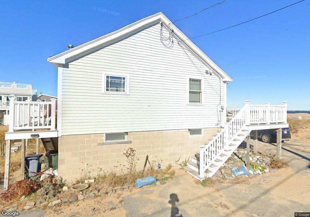
9 75th St Newburyport, MA 01950
Estimated Value: $901,000 - $1,224,000
3
Beds
1
Bath
720
Sq Ft
$1,448/Sq Ft
Est. Value
About This Home
This home is located at 9 75th St, Newburyport, MA 01950 and is currently estimated at $1,042,831, approximately $1,448 per square foot. 9 75th St is a home located in Essex County with nearby schools including Francis T. Bresnahan Elementary School, Edward G. Molin Elementary School, and Rupert A. Nock Middle School.
Create a Home Valuation Report for This Property
The Home Valuation Report is an in-depth analysis detailing your home's value as well as a comparison with similar homes in the area
Home Values in the Area
Average Home Value in this Area
Tax History Compared to Growth
Tax History
| Year | Tax Paid | Tax Assessment Tax Assessment Total Assessment is a certain percentage of the fair market value that is determined by local assessors to be the total taxable value of land and additions on the property. | Land | Improvement |
|---|---|---|---|---|
| 2025 | $10,142 | $1,058,700 | $901,100 | $157,600 |
| 2024 | $9,333 | $936,100 | $784,300 | $151,800 |
| 2023 | $8,379 | $780,200 | $651,700 | $128,500 |
| 2022 | $8,059 | $671,000 | $543,000 | $128,000 |
| 2021 | $7,047 | $557,500 | $447,800 | $109,700 |
| 2020 | $7,072 | $550,800 | $447,800 | $103,000 |
| 2019 | $6,898 | $527,400 | $436,300 | $91,100 |
| 2018 | $6,728 | $507,400 | $415,600 | $91,800 |
| 2017 | $6,557 | $487,500 | $395,700 | $91,800 |
| 2016 | $6,404 | $478,300 | $386,900 | $91,400 |
| 2015 | $6,262 | $469,400 | $386,900 | $82,500 |
Source: Public Records
Map
Nearby Homes
- 11 71st St
- 12 Barker St
- 5 Harbor St
- 11 Harbor St
- 5 65th St
- 12 63rd St
- 10 61st St Unit 10
- 2 Shore St
- 12 53rd St
- 163 Old Point Rd
- 128 Old Point Rd
- 7 Davoli Way
- 10 Meadowview Ln Unit B
- 82 Northern Blvd
- 2 Northern Blvd
- 11 Sunset Dr
- 4 Plum Bush Downs
- 2 Sunset Dr
- 28 & 30 Plum Island Turnpike
- 141 Atlantic Ave