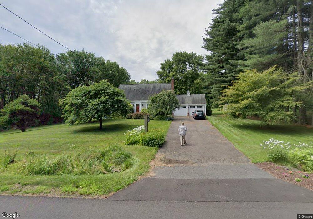
9 Adams Rd Bloomfield, CT 06002
Estimated Value: $416,000 - $514,000
3
Beds
2
Baths
2,264
Sq Ft
$206/Sq Ft
Est. Value
About This Home
This home is located at 9 Adams Rd, Bloomfield, CT 06002 and is currently estimated at $465,769, approximately $205 per square foot. 9 Adams Rd is a home located in Hartford County with nearby schools including Laurel School, Carmen Arace Intermediate School, and Metacomet School.
Ownership History
Date
Name
Owned For
Owner Type
Purchase Details
Closed on
Apr 5, 2024
Sold by
Bonfatto Joseph A and Kapp Corinne R
Bought by
Kapp Bonfatto Lt and Bonfatto
Current Estimated Value
Purchase Details
Closed on
Apr 1, 2024
Sold by
Bonfatto Michael J
Bought by
Bonfatto Joseph A and Kapp Corinne R
Purchase Details
Closed on
Jul 2, 2015
Sold by
Bonfatto Joseph A and Kapp Corrine R
Bought by
Bonfatto Michael J
Purchase Details
Closed on
Aug 28, 1985
Bought by
Bonfatto Michael J
Create a Home Valuation Report for This Property
The Home Valuation Report is an in-depth analysis detailing your home's value as well as a comparison with similar homes in the area
Home Values in the Area
Average Home Value in this Area
Purchase History
| Date | Buyer | Sale Price | Title Company |
|---|---|---|---|
| Kapp Bonfatto Lt | -- | None Available | |
| Kapp Bonfatto Lt | -- | None Available | |
| Kapp Bonfatto Lt | -- | None Available | |
| Bonfatto Joseph A | -- | None Available | |
| Bonfatto Joseph A | -- | None Available | |
| Bonfatto Joseph A | -- | None Available | |
| Bonfatto Michael J | -- | -- | |
| Bonfatto Michael J | -- | -- | |
| Bonfatto Michael J | $122,000 | -- |
Source: Public Records
Mortgage History
| Date | Status | Borrower | Loan Amount |
|---|---|---|---|
| Previous Owner | Bonfatto Michael J | $120,000 | |
| Previous Owner | Bonfatto Michael J | $25,000 | |
| Previous Owner | Bonfatto Michael J | $50,000 |
Source: Public Records
Tax History
| Year | Tax Paid | Tax Assessment Tax Assessment Total Assessment is a certain percentage of the fair market value that is determined by local assessors to be the total taxable value of land and additions on the property. | Land | Improvement |
|---|---|---|---|---|
| 2025 | $10,723 | $285,950 | $62,230 | $223,720 |
| 2024 | $7,161 | $182,490 | $47,180 | $135,310 |
| 2023 | $7,031 | $182,490 | $47,180 | $135,310 |
| 2022 | $6,575 | $182,490 | $47,180 | $135,310 |
| 2021 | $6,721 | $182,490 | $47,180 | $135,310 |
| 2020 | $6,617 | $182,490 | $47,180 | $135,310 |
| 2019 | $7,004 | $181,160 | $47,180 | $133,980 |
| 2018 | $7,123 | $184,450 | $46,480 | $137,970 |
| 2017 | $7,112 | $184,450 | $46,480 | $137,970 |
| 2016 | $6,945 | $184,450 | $46,480 | $137,970 |
| 2015 | $6,815 | $184,450 | $46,480 | $137,970 |
| 2014 | -- | $179,830 | $45,920 | $133,910 |
Source: Public Records
Map
Nearby Homes
- 24 Hunting Ridge Dr
- 50 Habitat Ln
- 322 Tunxis Ave
- 434 Tunxis Ave
- 68 Tariffville Rd
- 406 Tunxis Ave
- 74 Tariffville Rd
- 5 Butternut Dr
- 30 Vista Way
- 63 Duncaster Rd
- 10 Massaco St Unit G
- 31 Oxford Ct
- 9 1/2 E Tomstead Rd
- 42 Library Ln Unit 42
- 1 West St Unit 112
- 234 Woodland Ave
- 60 Barry Ln
- 6 Heritage Ln
- 40 Firetown Rd Unit 22
- 59 Cambridge Ct