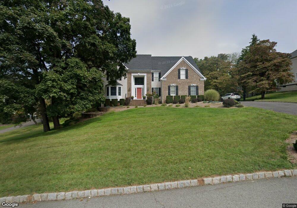
9 Andreann Dr Annandale, NJ 08801
Estimated Value: $852,000 - $973,000
Studio
--
Bath
3,119
Sq Ft
$291/Sq Ft
Est. Value
About This Home
This home is located at 9 Andreann Dr, Annandale, NJ 08801 and is currently estimated at $907,443, approximately $290 per square foot. 9 Andreann Dr is a home located in Hunterdon County with nearby schools including Patrick McGaheran School, Spruce Run School, and Round Valley School.
Ownership History
Date
Name
Owned For
Owner Type
Purchase Details
Closed on
Aug 18, 2006
Sold by
Debow Gerard J and De Bow Kathleen M
Bought by
Scott David M and Scott Christine M
Current Estimated Value
Home Financials for this Owner
Home Financials are based on the most recent Mortgage that was taken out on this home.
Original Mortgage
$250,000
Outstanding Balance
$150,666
Interest Rate
6.83%
Mortgage Type
Purchase Money Mortgage
Estimated Equity
$756,777
Purchase Details
Closed on
Jan 29, 1993
Sold by
Parisi Building & Invest Co Inc
Bought by
Wallace Kathleen M and Wallace Debow,Gerard
Create a Home Valuation Report for This Property
The Home Valuation Report is an in-depth analysis detailing your home's value as well as a comparison with similar homes in the area
Home Values in the Area
Average Home Value in this Area
Purchase History
| Date | Buyer | Sale Price | Title Company |
|---|---|---|---|
| Scott David M | $650,000 | None Available | |
| Wallace Kathleen M | $334,200 | -- |
Source: Public Records
Mortgage History
| Date | Status | Borrower | Loan Amount |
|---|---|---|---|
| Open | Scott David M | $250,000 |
Source: Public Records
Tax History
| Year | Tax Paid | Tax Assessment Tax Assessment Total Assessment is a certain percentage of the fair market value that is determined by local assessors to be the total taxable value of land and additions on the property. | Land | Improvement |
|---|---|---|---|---|
| 2025 | $15,761 | $528,700 | $140,000 | $388,700 |
| 2024 | $15,274 | $528,700 | $140,000 | $388,700 |
Source: Public Records
Map
Nearby Homes
- 54 Meadowview Dr Unit 6F
- 19 Lexington Rd
- 7 Summit Ct
- 5 Southgate Dr
- 5 Westminster Dr
- 312 Hamden Rd
- 18 Farview Dr
- 201 Sidney Rd
- 210 Sidney Rd
- 68 Westchester Terrace
- 59 La Costa Dr
- 61 Westchester Terrace Unit 5
- 7 Westchester Terrace
- 66 Leigh St
- 61 and 63 W Main St
- 29 Inverrary Place
- 64 Hogback Rd
- 13 Mission Hills Rd Unit 3
- 62 Allerton Rd
- 111 Allerton Rd
Your Personal Tour Guide
Ask me questions while you tour the home.