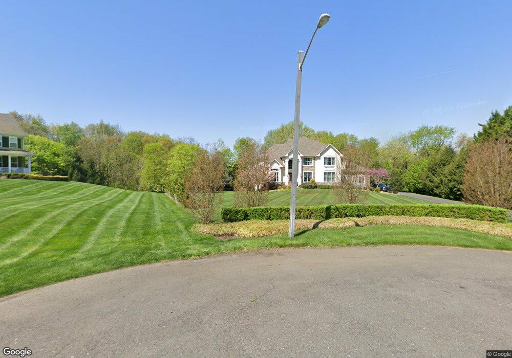
9 Apple Ln Moorestown, NJ 08057
Estimated Value: $1,449,000 - $1,576,000
5
Beds
--
Bath
4,411
Sq Ft
$339/Sq Ft
Est. Value
About This Home
This home is located at 9 Apple Ln, Moorestown, NJ 08057 and is currently estimated at $1,496,154, approximately $339 per square foot. 9 Apple Ln is a home located in Burlington County with nearby schools including South Valley Elementary School, Moorestown Upper Elementary School, and William Allen Middle School.
Ownership History
Date
Name
Owned For
Owner Type
Purchase Details
Closed on
Nov 24, 2010
Sold by
Paparone Housing Company Inc
Bought by
Sweeney Sanya M
Current Estimated Value
Home Financials for this Owner
Home Financials are based on the most recent Mortgage that was taken out on this home.
Original Mortgage
$740,000
Outstanding Balance
$487,245
Interest Rate
4.23%
Mortgage Type
New Conventional
Estimated Equity
$1,008,909
Purchase Details
Closed on
Apr 24, 2007
Sold by
Decou Richard T and Decou Gretchen C
Bought by
Paparone Housing Co Inc
Home Financials for this Owner
Home Financials are based on the most recent Mortgage that was taken out on this home.
Original Mortgage
$0
Interest Rate
6.21%
Mortgage Type
Undefined Multiple Amounts
Create a Home Valuation Report for This Property
The Home Valuation Report is an in-depth analysis detailing your home's value as well as a comparison with similar homes in the area
Home Values in the Area
Average Home Value in this Area
Purchase History
| Date | Buyer | Sale Price | Title Company |
|---|---|---|---|
| Sweeney Sanya M | $980,000 | Integrity Title Agency Inc | |
| Paparone Housing Co Inc | $1,500,000 | American Title Abstract Corp |
Source: Public Records
Mortgage History
| Date | Status | Borrower | Loan Amount |
|---|---|---|---|
| Open | Sweeney Sanya M | $740,000 | |
| Previous Owner | Paparone Housing Co Inc | $0 | |
| Closed | Paparone Housing Co Inc | $0 |
Source: Public Records
Tax History Compared to Growth
Tax History
| Year | Tax Paid | Tax Assessment Tax Assessment Total Assessment is a certain percentage of the fair market value that is determined by local assessors to be the total taxable value of land and additions on the property. | Land | Improvement |
|---|---|---|---|---|
| 2025 | $22,696 | $800,000 | $252,700 | $547,300 |
| 2024 | $22,008 | $800,000 | $252,700 | $547,300 |
| 2023 | $22,008 | $800,000 | $252,700 | $547,300 |
| 2022 | $21,784 | $800,000 | $252,700 | $547,300 |
| 2021 | $12,578 | $800,000 | $252,700 | $547,300 |
| 2020 | $21,360 | $800,000 | $252,700 | $547,300 |
| 2019 | $20,984 | $800,000 | $252,700 | $547,300 |
| 2018 | $20,416 | $800,000 | $252,700 | $547,300 |
| 2017 | $20,592 | $800,000 | $252,700 | $547,300 |
| 2016 | $20,520 | $800,000 | $252,700 | $547,300 |
| 2015 | $20,272 | $800,000 | $252,700 | $547,300 |
| 2014 | $19,248 | $800,000 | $252,700 | $547,300 |
Source: Public Records
Map
Nearby Homes
- 693 Garwood Rd
- 415 Bridgeboro Rd
- 4327 Bridgeboro Rd
- 628 Windsock Way
- 7 Whitetail Ct
- 103 Congressional Ct
- 110 Kathleen Ave
- 139 Patricia Ave
- 740 Garwood Rd
- 751 Garwood Rd
- 700 Bentley Ct
- 347 Tom Brown Rd
- 142 Fox Chase Dr
- 343 Tom Brown Rd
- 164 Fox Chase Dr
- 0 0 Swarthmore Dr
- 744 Signal Light Rd
- 57 Brooks Rd
- 863 Golf View Rd
- 128 Dorado Dr