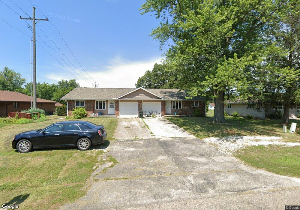
9 Apple Tree Ln East Peoria, IL 61611
Estimated Value: $224,000 - $284,000
4
Beds
2
Baths
1,828
Sq Ft
$138/Sq Ft
Est. Value
About This Home
This home is located at 9 Apple Tree Ln, East Peoria, IL 61611 and is currently estimated at $252,647, approximately $138 per square foot. 9 Apple Tree Ln is a home located in Tazewell County with nearby schools including Woodrow Wilson Elementary School, Glendale Elementary School, and Central Junior High School.
Ownership History
Date
Name
Owned For
Owner Type
Purchase Details
Closed on
Oct 9, 2019
Sold by
Griffin Tony H and Griffin Mary M
Bought by
Hillenburg Logan Scott Andrew
Current Estimated Value
Home Financials for this Owner
Home Financials are based on the most recent Mortgage that was taken out on this home.
Original Mortgage
$132,000
Outstanding Balance
$115,639
Interest Rate
3.5%
Mortgage Type
New Conventional
Estimated Equity
$137,008
Create a Home Valuation Report for This Property
The Home Valuation Report is an in-depth analysis detailing your home's value as well as a comparison with similar homes in the area
Home Values in the Area
Average Home Value in this Area
Purchase History
| Date | Buyer | Sale Price | Title Company |
|---|---|---|---|
| Hillenburg Logan Scott Andrew | $165,000 | Hometown Title |
Source: Public Records
Mortgage History
| Date | Status | Borrower | Loan Amount |
|---|---|---|---|
| Open | Hillenburg Logan Scott Andrew | $132,000 |
Source: Public Records
Tax History Compared to Growth
Tax History
| Year | Tax Paid | Tax Assessment Tax Assessment Total Assessment is a certain percentage of the fair market value that is determined by local assessors to be the total taxable value of land and additions on the property. | Land | Improvement |
|---|---|---|---|---|
| 2024 | $4,349 | $67,470 | $6,850 | $60,620 |
| 2023 | $4,349 | $61,950 | $6,290 | $55,660 |
| 2022 | $4,073 | $57,300 | $5,820 | $51,480 |
| 2021 | $3,896 | $55,100 | $5,600 | $49,500 |
| 2020 | $3,888 | $56,380 | $5,600 | $50,780 |
| 2019 | $4,325 | $56,380 | $5,600 | $50,780 |
| 2018 | $4,192 | $56,380 | $5,600 | $50,780 |
| 2017 | $4,123 | $56,380 | $5,600 | $50,780 |
| 2016 | $4,052 | $56,380 | $5,600 | $50,780 |
| 2015 | $3,867 | $0 | $0 | $0 |
| 2013 | $3,873 | $54,620 | $5,420 | $49,200 |
Source: Public Records
Map
Nearby Homes
- 322 Schulzki Ln
- 1513 Bloomington Rd
- 310 Amelia Dr
- 308 Amelia Dr
- 309 Amelia Dr
- 110 Joyce Ct
- 305 Amelia Dr
- 104 Magdalena Dr
- 303 Amelia Dr
- 125 Canterbury Ct
- 301 Amelia Dr
- 300 Amelia Dr
- 103 Magdalena Dr
- 331 Oakwood Ave
- 108 Ursula Ct
- 205 Amelia Dr
- 206 Amelia Dr
- 102 Ursula Ct
- Lot 9 Abigail Dr
- 104 Ursula Ct
- 9 Apple Tree Ln
- 13 Apple Tree Ln
- 7 Apple Tree Ln
- 10 Apple Tree Ln
- 17 Apple Tree Ln
- 6 Apple Tree Ln
- 12 Apple Tree Ln
- 2104 Bloomington Rd
- 14 Apple Tree Ln
- 4 Apple Tree Ln
- 19 Apple Tree Ln
- 16 Apple Tree Ln
- 21 Apple Tree Ln
- 2018 Bloomington Rd
- 18 Apple Tree Ln
- 2105 Bloomington Rd
- 20 Apple Tree Ln
- 23 Apple Tree Ln
- 2017 Bloomington Rd
- 2108 Bloomington Rd