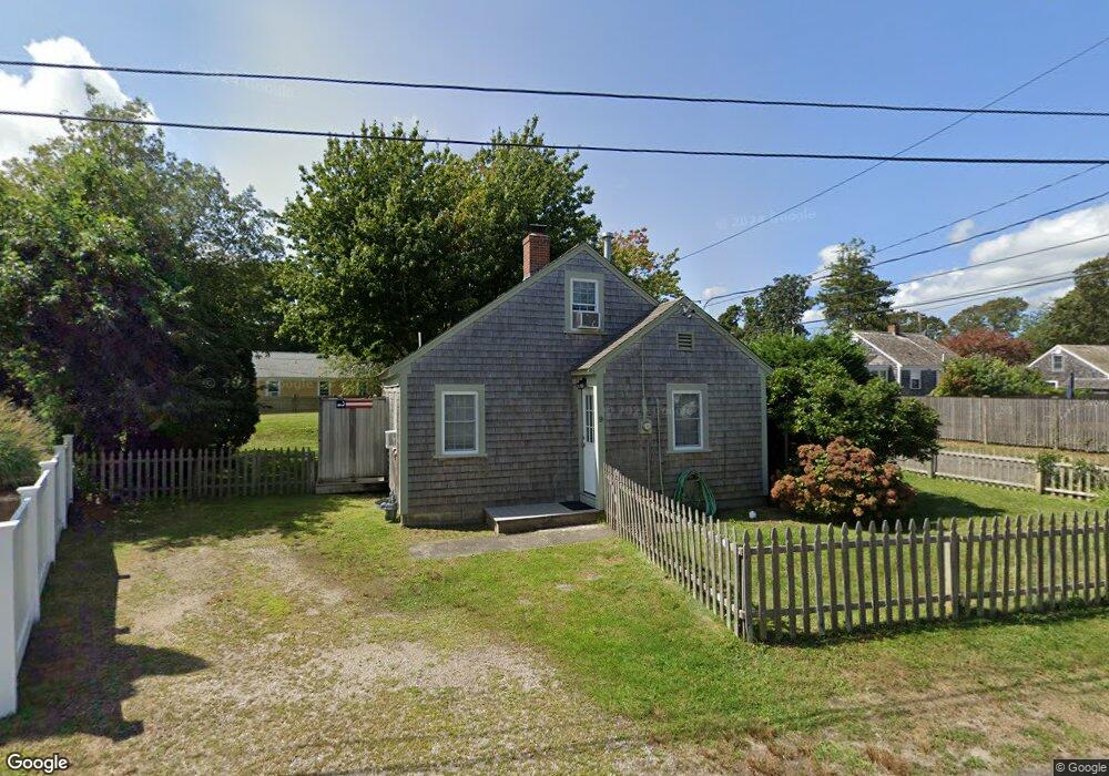
9 Arbor Way Dennis Port, MA 02639
Dennis Port NeighborhoodEstimated Value: $509,000 - $584,726
2
Beds
1
Bath
650
Sq Ft
$853/Sq Ft
Est. Value
About This Home
This home is located at 9 Arbor Way, Dennis Port, MA 02639 and is currently estimated at $554,432, approximately $852 per square foot. 9 Arbor Way is a home located in Barnstable County with nearby schools including Dennis-Yarmouth Regional High School and St. Pius X. School.
Ownership History
Date
Name
Owned For
Owner Type
Purchase Details
Closed on
Apr 25, 2014
Sold by
Healy Kathleen
Bought by
Kwaak William P and Healy Kathleen L
Current Estimated Value
Purchase Details
Closed on
Dec 16, 2004
Sold by
Humphrey Jennifer M and Keane Jennifer M
Bought by
Healy Kathleen and Healy Susan
Home Financials for this Owner
Home Financials are based on the most recent Mortgage that was taken out on this home.
Original Mortgage
$208,000
Interest Rate
5.68%
Mortgage Type
Purchase Money Mortgage
Purchase Details
Closed on
Dec 18, 1998
Sold by
Cooney Bernard P and Cooney Sandra L
Bought by
Keane Peter R and Humphrey Jennifer M
Home Financials for this Owner
Home Financials are based on the most recent Mortgage that was taken out on this home.
Original Mortgage
$74,400
Interest Rate
6.85%
Mortgage Type
Purchase Money Mortgage
Create a Home Valuation Report for This Property
The Home Valuation Report is an in-depth analysis detailing your home's value as well as a comparison with similar homes in the area
Home Values in the Area
Average Home Value in this Area
Purchase History
| Date | Buyer | Sale Price | Title Company |
|---|---|---|---|
| Kwaak William P | -- | -- | |
| Kwaak William P | -- | -- | |
| Kwaak William P | $236,000 | -- | |
| Healy Kathleen | $260,000 | -- | |
| Healy Kathleen | $260,000 | -- | |
| Keane Peter R | $93,000 | -- | |
| Keane Peter R | $93,000 | -- |
Source: Public Records
Mortgage History
| Date | Status | Borrower | Loan Amount |
|---|---|---|---|
| Previous Owner | Healy Kathleen | $208,000 | |
| Previous Owner | Keane Peter R | $74,400 | |
| Closed | Kwaak William P | $0 |
Source: Public Records
Tax History Compared to Growth
Tax History
| Year | Tax Paid | Tax Assessment Tax Assessment Total Assessment is a certain percentage of the fair market value that is determined by local assessors to be the total taxable value of land and additions on the property. | Land | Improvement |
|---|---|---|---|---|
| 2025 | $2,384 | $550,500 | $301,300 | $249,200 |
| 2024 | $2,222 | $506,100 | $289,700 | $216,400 |
| 2023 | $2,149 | $460,100 | $263,400 | $196,700 |
| 2022 | $1,974 | $352,500 | $207,600 | $144,900 |
| 2021 | $1,899 | $314,900 | $203,500 | $111,400 |
| 2020 | $1,882 | $308,500 | $203,500 | $105,000 |
| 2019 | $1,921 | $311,300 | $216,700 | $94,600 |
| 2018 | $1,880 | $296,600 | $206,200 | $90,400 |
| 2017 | $1,724 | $280,400 | $190,000 | $90,400 |
| 2016 | $1,663 | $254,600 | $179,100 | $75,500 |
| 2015 | $1,629 | $254,600 | $179,100 | $75,500 |
| 2014 | $1,532 | $241,300 | $168,300 | $73,000 |
Source: Public Records
Map
Nearby Homes
- 37-A Beach Hills Rd
- 22 Ferncliff Rd
- 37 Beach Hills Rd
- 102 Sea St
- 262 Old Wharf Rd Unit 67
- 262 Old Wharf Rd Unit 5
- 262 Old Wharf Rd Unit 5
- 262 Old Wharf Rd Unit 20
- 262 Old Wharf Rd Unit 87
- 241 Old Wharf Rd Unit 82
- 241 Old Wharf Rd Unit 127
- 241 Old Wharf Rd Unit 90
- 402 Old Wharf Rd
- 402 Old Wharf Rd
- 405 Old Wharf Rd Unit B204
- 405 Old Wharf Rd Unit B204
- 217 Old Wharf Rd Unit 64
- 31 Easy St
- 9 Chase Ave Unit 6
- 11 Ocean Park W
- 27 Myrtle Rd
- 37 Myrtle Rd
- 24 Laurel Rd
- 32 Myrtle Rd
- 36 Myrtle Rd
- 244 Shad Hole Rd
- 244 Shad Hole Rd Unit 3
- 244 Shad Hole Rd Unit 1-2-3
- 244 Shad Hole Rd Unit 1-3
- 38 Myrtle Rd
- 246 Shad Hole Rd
- 23 Myrtle Rd
- 28 Myrtle Rd
- 20 Laurel Rd
- 35 Ferncliff Rd
- 33 Ferncliff Rd
- 234 Shad Hole Rd
- 250 Shad Hole Rd
- 6 Arbor Way
- 42 Myrtle Rd