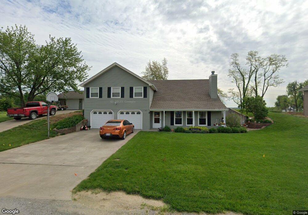
9 Baber Cir Camden Point, MO 64018
Estimated Value: $373,000 - $437,000
4
Beds
3
Baths
2,422
Sq Ft
$164/Sq Ft
Est. Value
About This Home
This home is located at 9 Baber Cir, Camden Point, MO 64018 and is currently estimated at $396,775, approximately $163 per square foot. 9 Baber Cir is a home located in Platte County with nearby schools including North Platte Elementary School, North Platte Intermediate School, and North Platte Junior High School.
Ownership History
Date
Name
Owned For
Owner Type
Purchase Details
Closed on
Dec 12, 2012
Sold by
Link Ronald V and Link Jessica C
Bought by
Percell Warren R
Current Estimated Value
Home Financials for this Owner
Home Financials are based on the most recent Mortgage that was taken out on this home.
Original Mortgage
$226,500
Outstanding Balance
$98,282
Interest Rate
3.41%
Mortgage Type
Future Advance Clause Open End Mortgage
Estimated Equity
$298,493
Create a Home Valuation Report for This Property
The Home Valuation Report is an in-depth analysis detailing your home's value as well as a comparison with similar homes in the area
Purchase History
| Date | Buyer | Sale Price | Title Company |
|---|---|---|---|
| Percell Warren R | -- | Stewart Title Co |
Source: Public Records
Mortgage History
| Date | Status | Borrower | Loan Amount |
|---|---|---|---|
| Open | Percell Warren R | $226,500 |
Source: Public Records
Tax History
| Year | Tax Paid | Tax Assessment Tax Assessment Total Assessment is a certain percentage of the fair market value that is determined by local assessors to be the total taxable value of land and additions on the property. | Land | Improvement |
|---|---|---|---|---|
| 2025 | $3,672 | $48,978 | $6,472 | $42,506 |
| 2024 | $3,518 | $48,978 | $6,472 | $42,506 |
| 2023 | $3,518 | $48,978 | $6,472 | $42,506 |
| 2022 | $2,825 | $42,775 | $6,472 | $36,303 |
| 2021 | $2,825 | $42,775 | $6,472 | $36,303 |
| 2020 | $2,825 | $37,955 | $3,800 | $34,155 |
| 2019 | $2,825 | $37,955 | $3,800 | $34,155 |
| 2018 | $2,842 | $37,955 | $3,800 | $34,155 |
| 2017 | $2,841 | $37,955 | $3,800 | $34,155 |
| 2016 | $2,813 | $37,955 | $3,800 | $34,155 |
| 2015 | $2,812 | $37,955 | $3,800 | $34,155 |
| 2013 | $2,745 | $37,955 | $0 | $0 |
Source: Public Records
Map
Nearby Homes
- 19710 Kansas City Blvd
- 19255 Lane Tree Dr
- U Highway
- 0 U Hwy Unit HMS2588353
- 17980 Lakewood Dr
- 0001 Edgerton Junction Rd
- 0000 Edgerton Junction Rd
- 21205 B Hwy Unit B
- 0 Gooseneck Bend Rd
- 0 Cockriel Rd
- 21195 Edgerton Junction Rd
- 21970 Lamar Rd
- 103 Johnson Cir
- 601 Main St
- 20860 County Road P
- 103 Sally Cir
- 314 Fairview Cir
- 5990 Z Hwy
- 107 Johnson Cir
- 109 Johnson Cir
Your Personal Tour Guide
Ask me questions while you tour the home.