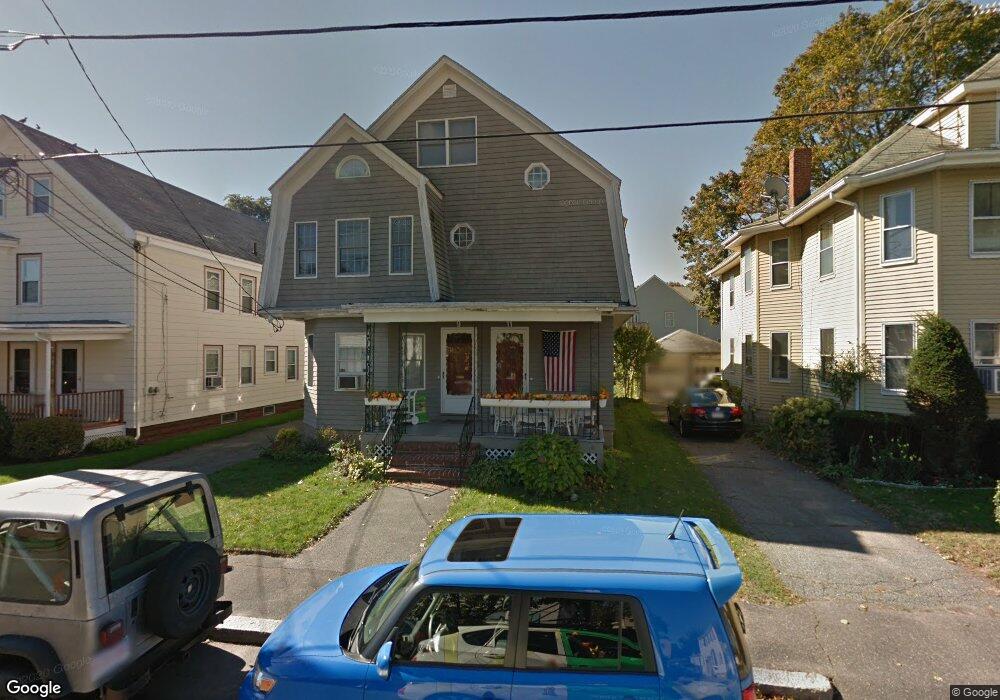
9 Barstow St Unit 11 Salem, MA 01970
North Salem NeighborhoodEstimated Value: $859,000 - $1,013,000
--
Bed
2
Baths
2,562
Sq Ft
$372/Sq Ft
Est. Value
About This Home
This home is located at 9 Barstow St Unit 11, Salem, MA 01970 and is currently estimated at $952,152, approximately $371 per square foot. 9 Barstow St Unit 11 is a home located in Essex County with nearby schools including Bates Elementary School, Saltonstall School, and Carlton Elementary School.
Ownership History
Date
Name
Owned For
Owner Type
Purchase Details
Closed on
Feb 12, 2016
Sold by
Rust Cheryl A
Bought by
Rust 3Rd Raymond A
Current Estimated Value
Home Financials for this Owner
Home Financials are based on the most recent Mortgage that was taken out on this home.
Original Mortgage
$334,125
Outstanding Balance
$266,962
Interest Rate
4.02%
Mortgage Type
VA
Estimated Equity
$685,190
Purchase Details
Closed on
Apr 28, 2006
Sold by
Gondella Richard Louis
Bought by
Rust Cheryl A
Home Financials for this Owner
Home Financials are based on the most recent Mortgage that was taken out on this home.
Original Mortgage
$315,000
Interest Rate
6.4%
Mortgage Type
Purchase Money Mortgage
Create a Home Valuation Report for This Property
The Home Valuation Report is an in-depth analysis detailing your home's value as well as a comparison with similar homes in the area
Home Values in the Area
Average Home Value in this Area
Purchase History
| Date | Buyer | Sale Price | Title Company |
|---|---|---|---|
| Rust 3Rd Raymond A | $450,000 | -- | |
| Rust Cheryl A | $465,000 | -- |
Source: Public Records
Mortgage History
| Date | Status | Borrower | Loan Amount |
|---|---|---|---|
| Open | Rust 3Rd Raymond A | $334,125 | |
| Previous Owner | Rust Cheryl A | $30,000 | |
| Previous Owner | Rust Cheryl A | $315,000 | |
| Previous Owner | Rust Cheryl A | $50,000 | |
| Previous Owner | Rust Cheryl A | $40,000 |
Source: Public Records
Tax History Compared to Growth
Tax History
| Year | Tax Paid | Tax Assessment Tax Assessment Total Assessment is a certain percentage of the fair market value that is determined by local assessors to be the total taxable value of land and additions on the property. | Land | Improvement |
|---|---|---|---|---|
| 2025 | $9,668 | $852,600 | $207,300 | $645,300 |
| 2024 | $9,232 | $794,500 | $197,000 | $597,500 |
| 2023 | $9,077 | $725,600 | $181,800 | $543,800 |
| 2022 | $9,090 | $686,000 | $175,800 | $510,200 |
| 2021 | $8,608 | $623,800 | $163,600 | $460,200 |
| 2020 | $8,341 | $577,200 | $154,500 | $422,700 |
| 2019 | $8,261 | $547,100 | $146,700 | $400,400 |
| 2018 | $7,615 | $495,100 | $139,400 | $355,700 |
| 2017 | $7,153 | $451,000 | $117,600 | $333,400 |
| 2016 | $6,981 | $445,500 | $112,100 | $333,400 |
| 2015 | $6,781 | $413,200 | $103,000 | $310,200 |
Source: Public Records
Map
Nearby Homes
- 3 S Mason St
- 112 North St
- 8 Upham St
- 78 Federal St
- 97 Mason St Unit 2
- 18 Franklin St Unit 303
- 145 Federal St Unit 3
- 304 Essex St Unit 1
- 35 Flint St Unit 209
- 35 Flint St Unit 106
- 47 Federal St
- 27 Appleton St
- 38 Chestnut St
- 15 Lynde St Unit 26
- 289 Essex St Unit 307
- 36 Irving St Unit B
- 11 Summer St
- 281 Essex St Unit 201
- 0 Lot 41 Map 10 Unit 73335079
- 0 Lot 61 Map 10 Unit 73335091