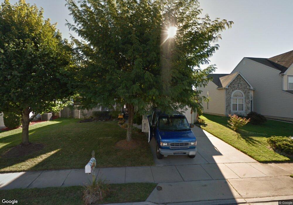
9 Barton Way Mount Laurel, NJ 08054
Estimated Value: $580,854 - $635,000
--
Bed
--
Bath
2,247
Sq Ft
$270/Sq Ft
Est. Value
About This Home
This home is located at 9 Barton Way, Mount Laurel, NJ 08054 and is currently estimated at $606,964, approximately $270 per square foot. 9 Barton Way is a home located in Burlington County with nearby schools including Countryside Elementary School, T.E. Harrington Middle School, and Mount Laurel Hartford School.
Ownership History
Date
Name
Owned For
Owner Type
Purchase Details
Closed on
Apr 22, 2013
Sold by
Mickel George and Mickel Christine
Bought by
Mickel George and Mickel Christine
Current Estimated Value
Purchase Details
Closed on
Feb 14, 2005
Sold by
Diaz Jose O and Diaz Leonor
Bought by
Mickel Yolanda M
Home Financials for this Owner
Home Financials are based on the most recent Mortgage that was taken out on this home.
Original Mortgage
$210,000
Interest Rate
5.14%
Mortgage Type
Fannie Mae Freddie Mac
Purchase Details
Closed on
Apr 29, 1999
Sold by
Greenberg Richard and Greenberg Mary
Bought by
Diaz Jose O and Diaz Leonor
Home Financials for this Owner
Home Financials are based on the most recent Mortgage that was taken out on this home.
Original Mortgage
$162,000
Interest Rate
6.92%
Create a Home Valuation Report for This Property
The Home Valuation Report is an in-depth analysis detailing your home's value as well as a comparison with similar homes in the area
Home Values in the Area
Average Home Value in this Area
Purchase History
| Date | Buyer | Sale Price | Title Company |
|---|---|---|---|
| Mickel George | -- | None Available | |
| Mickel Yolanda M | $350,000 | Integrity Title Agency Inc | |
| Diaz Jose O | $180,000 | Surety Title Corporation |
Source: Public Records
Mortgage History
| Date | Status | Borrower | Loan Amount |
|---|---|---|---|
| Closed | Mickel Yolanda M | $210,000 | |
| Previous Owner | Diaz Jose O | $162,000 |
Source: Public Records
Tax History Compared to Growth
Tax History
| Year | Tax Paid | Tax Assessment Tax Assessment Total Assessment is a certain percentage of the fair market value that is determined by local assessors to be the total taxable value of land and additions on the property. | Land | Improvement |
|---|---|---|---|---|
| 2025 | $9,698 | $307,200 | $98,500 | $208,700 |
| 2024 | $9,333 | $307,200 | $98,500 | $208,700 |
| 2023 | $9,333 | $307,200 | $98,500 | $208,700 |
| 2022 | $9,302 | $307,200 | $98,500 | $208,700 |
| 2021 | $9,127 | $307,200 | $98,500 | $208,700 |
| 2020 | $8,949 | $307,200 | $98,500 | $208,700 |
| 2019 | $8,857 | $307,200 | $98,500 | $208,700 |
| 2018 | $8,789 | $307,200 | $98,500 | $208,700 |
| 2017 | $8,562 | $307,200 | $98,500 | $208,700 |
| 2016 | $8,433 | $307,200 | $98,500 | $208,700 |
| 2015 | $8,334 | $307,200 | $98,500 | $208,700 |
| 2014 | $8,251 | $307,200 | $98,500 | $208,700 |
Source: Public Records
Map
Nearby Homes
- 53 Saw Mill Dr
- 907A Oliphant Ln Unit 907A
- 6 Leighton Dr
- 2 Watson Dr
- 12 B E Daisy Ln
- 205 Kirby Way Unit 205
- 13 Village Ct Unit 13
- 603 Kirby Way Unit 603
- 1201A Ginger Ct
- 1302 Ginger Dr
- 124 W Berwin Way
- 11 E Berwin Way
- 130B Birchfield Ct Unit 130B
- 123A Birchfield Ct Unit 123A
- 705A Wharton Rd
- 23 E Oleander Dr
- 70B Sumac Ct Unit 70B
- 60B Sumac Ct
- 74 Poppy Ct
- 6 E Azalea Ln