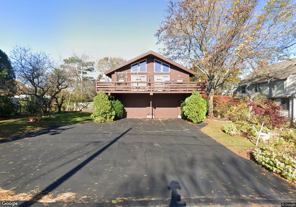
9 Beach Rd Gloucester, MA 01930
East Gloucester NeighborhoodEstimated Value: $1,230,000 - $1,414,000
4
Beds
2
Baths
2,350
Sq Ft
$562/Sq Ft
Est. Value
About This Home
This home is located at 9 Beach Rd, Gloucester, MA 01930 and is currently estimated at $1,321,256, approximately $562 per square foot. 9 Beach Rd is a home located in Essex County with nearby schools including East Gloucester Elementary School, Ralph B O'maley Middle School, and Gloucester High School.
Ownership History
Date
Name
Owned For
Owner Type
Purchase Details
Closed on
Oct 3, 2003
Sold by
Dexter Jeraldine A
Bought by
Bebrin William R
Current Estimated Value
Home Financials for this Owner
Home Financials are based on the most recent Mortgage that was taken out on this home.
Original Mortgage
$608,000
Outstanding Balance
$284,507
Interest Rate
6.25%
Mortgage Type
Purchase Money Mortgage
Estimated Equity
$1,036,749
Create a Home Valuation Report for This Property
The Home Valuation Report is an in-depth analysis detailing your home's value as well as a comparison with similar homes in the area
Home Values in the Area
Average Home Value in this Area
Purchase History
| Date | Buyer | Sale Price | Title Company |
|---|---|---|---|
| Bebrin William R | $760,000 | -- |
Source: Public Records
Mortgage History
| Date | Status | Borrower | Loan Amount |
|---|---|---|---|
| Open | Bebrin William R | $608,000 | |
| Previous Owner | Bebrin William R | $75,000 |
Source: Public Records
Tax History
| Year | Tax Paid | Tax Assessment Tax Assessment Total Assessment is a certain percentage of the fair market value that is determined by local assessors to be the total taxable value of land and additions on the property. | Land | Improvement |
|---|---|---|---|---|
| 2025 | $11,961 | $1,230,600 | $654,400 | $576,200 |
| 2024 | $11,617 | $1,193,900 | $623,000 | $570,900 |
| 2023 | $10,818 | $1,021,500 | $531,800 | $489,700 |
| 2022 | $10,273 | $875,800 | $462,500 | $413,300 |
| 2021 | $10,032 | $806,400 | $420,500 | $385,900 |
| 2020 | $9,677 | $784,800 | $420,500 | $364,300 |
| 2019 | $9,648 | $760,300 | $401,000 | $359,300 |
| 2018 | $9,270 | $716,900 | $391,200 | $325,700 |
| 2017 | $8,828 | $669,300 | $372,300 | $297,000 |
| 2016 | $8,604 | $632,200 | $356,100 | $276,100 |
| 2015 | $8,397 | $615,200 | $359,900 | $255,300 |
Source: Public Records
Map
Nearby Homes
- 70 Bass Ave
- 26 Marina Dr
- 3 Mondello Square
- 11 Wall St Unit R
- 36 Eastern Ave
- 78 Thatcher Rd Unit 6
- 25 Salt Island Rd
- 32 Witham St Unit B
- 197 E Main St Unit 1
- 21 Marble Rd
- 14R Spring St Unit 3
- 23 Mount Vernon St
- 60 Rocky Neck Ave Unit 202
- 10 Seaview Rd
- 73 Rocky Neck Ave Unit 2
- 50 Warner St
- 191 Main St Unit 3
- 191 Main St Unit 2A
- 1 Wonson St
- 113 Pleasant St
- 7 Beach Rd
- 11 Beach Rd
- 8 Atlantic Rd
- 14 Atlantic Rd Unit 5
- 14 Atlantic Rd Unit 4
- 14 Atlantic Rd Unit 3
- 14 Atlantic Rd Unit 2
- 14 Atlantic Rd Unit 1
- 14 Atlantic Rd
- 14 Atlantic Rd Unit 5
- 8 Beach Rd
- 5 Beach Rd
- 6 Atlantic Rd
- 1 Mallard Way
- 9 Atlantic Rd
- 9 Atlantic Rd Unit 2
- 2 Mallard Way
- 12 Beach Rd
- 3 Beach Rd
- 4 Atlantic Rd
Your Personal Tour Guide
Ask me questions while you tour the home.