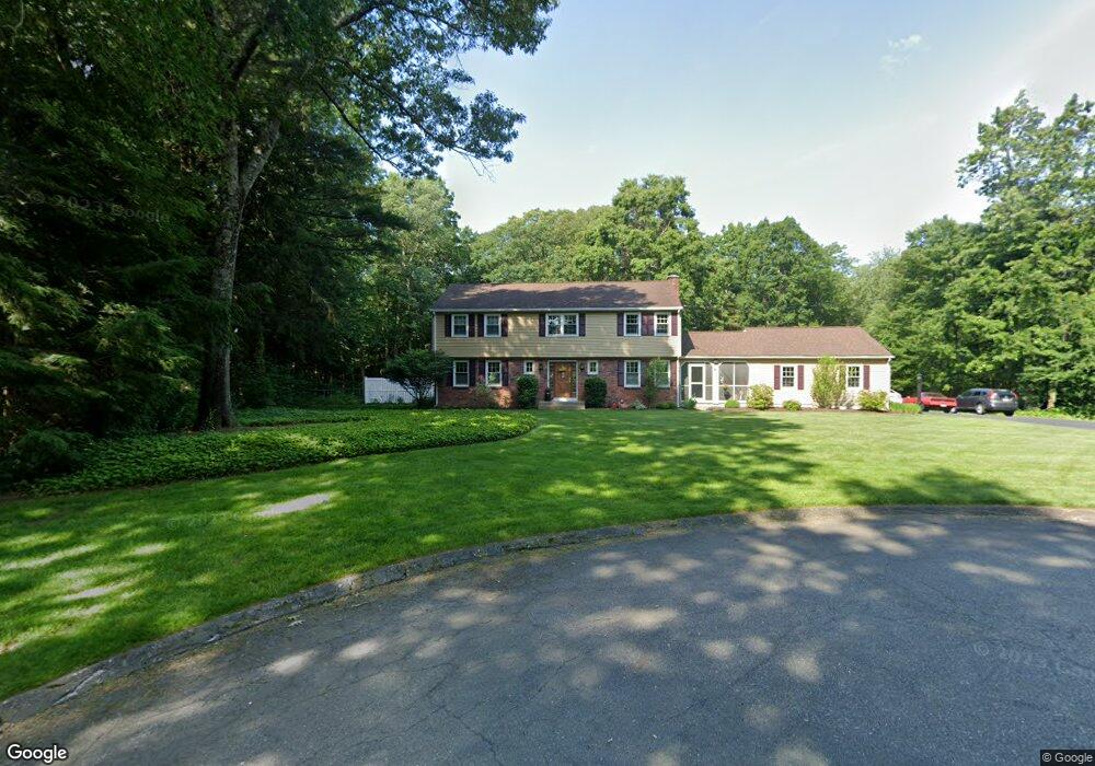
9 Blueberry Hill Rd Wilbraham, MA 01095
Estimated Value: $594,000 - $689,000
5
Beds
3
Baths
2,430
Sq Ft
$257/Sq Ft
Est. Value
About This Home
This home is located at 9 Blueberry Hill Rd, Wilbraham, MA 01095 and is currently estimated at $623,932, approximately $256 per square foot. 9 Blueberry Hill Rd is a home located in Hampden County with nearby schools including Minnechaug Regional High School and Wilbraham & Monson Academy.
Ownership History
Date
Name
Owned For
Owner Type
Purchase Details
Closed on
Oct 4, 2002
Sold by
Rene Richard E and Rene Suzanne M
Bought by
Menard George R and Igo Tammie S
Current Estimated Value
Home Financials for this Owner
Home Financials are based on the most recent Mortgage that was taken out on this home.
Original Mortgage
$245,000
Outstanding Balance
$103,540
Interest Rate
6.27%
Mortgage Type
Purchase Money Mortgage
Estimated Equity
$520,392
Purchase Details
Closed on
Nov 7, 1997
Sold by
Butterworth George A and Butterworth Nancy N
Bought by
Rene Richard E and Rene Suzanne M
Home Financials for this Owner
Home Financials are based on the most recent Mortgage that was taken out on this home.
Original Mortgage
$185,000
Interest Rate
7.19%
Mortgage Type
Purchase Money Mortgage
Create a Home Valuation Report for This Property
The Home Valuation Report is an in-depth analysis detailing your home's value as well as a comparison with similar homes in the area
Home Values in the Area
Average Home Value in this Area
Purchase History
| Date | Buyer | Sale Price | Title Company |
|---|---|---|---|
| Menard George R | $310,000 | -- | |
| Rene Richard E | $239,000 | -- |
Source: Public Records
Mortgage History
| Date | Status | Borrower | Loan Amount |
|---|---|---|---|
| Open | Rene Richard E | $245,000 | |
| Previous Owner | Rene Richard E | $185,000 | |
| Previous Owner | Rene Richard E | $144,000 |
Source: Public Records
Tax History Compared to Growth
Tax History
| Year | Tax Paid | Tax Assessment Tax Assessment Total Assessment is a certain percentage of the fair market value that is determined by local assessors to be the total taxable value of land and additions on the property. | Land | Improvement |
|---|---|---|---|---|
| 2025 | $9,237 | $516,600 | $135,000 | $381,600 |
| 2024 | $9,093 | $491,500 | $135,000 | $356,500 |
| 2023 | $8,301 | $443,900 | $135,000 | $308,900 |
| 2022 | $8,313 | $405,700 | $135,000 | $270,700 |
| 2021 | $7,735 | $336,900 | $135,700 | $201,200 |
| 2020 | $7,540 | $336,900 | $135,700 | $201,200 |
| 2019 | $7,347 | $337,000 | $135,700 | $201,300 |
| 2018 | $7,358 | $325,000 | $135,700 | $189,300 |
| 2017 | $7,150 | $325,000 | $135,700 | $189,300 |
| 2016 | $7,255 | $335,900 | $149,700 | $186,200 |
| 2015 | $7,014 | $335,900 | $149,700 | $186,200 |
Source: Public Records
Map
Nearby Homes
- 28 Decorie Dr
- 79 High Pine Cir
- 69 High Pine Cir
- 46 Washington Rd
- 54 High Pine Cir
- 35 Lake Dr
- 4 Hillcrest Dr
- 2 Bayberry Dr Unit 51
- 8 Patriot Ridge Ln
- 6 Teak Terrace Unit 24
- 99 Sandalwood Dr Unit site 00
- 103 Sandalwood Dr Unit site 00
- 57 Sandalwood Dr Unit site 61
- 111 Sandalwood Dr Unit site 00
- 2 Vista Rd
- 20 Old Orchard Rd
- 19 Linwood Dr
- 10 Forest Glade Dr
- 26 Sandalwood Dr
- 15 Sandalwood Dr Unit site 00
- 10 Blueberry Hill Rd
- 7 Blueberry Hill Rd
- 8 Blueberry Hill Rd
- 2 Marilyn Dr
- 5 Blueberry Hill Rd
- 6 Blueberry Hill Rd
- 4 Blueberry Hill Rd
- 3 Blueberry Hill Rd
- 10 Captain Rd
- 3 Marilyn Dr
- 5 Marilyn Dr
- 15 Captain Rd
- 11 Captain Rd
- 9 Captain Rd
- 7 Marilyn Dr
- 6 Marilyn Dr
- 23 Leemond St
- 33 Decorie Dr
- 21 Leemond St
- 25 Leemond St