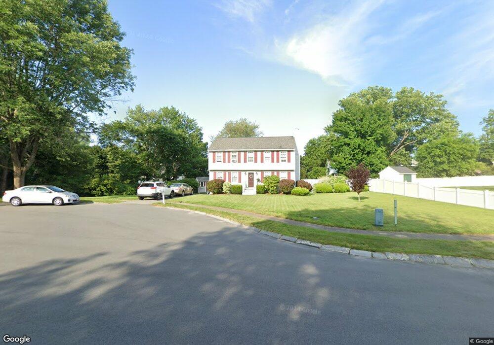
9 Bonin Dr Haverhill, MA 01832
Broad Hill NeighborhoodEstimated Value: $621,888 - $693,000
3
Beds
3
Baths
1,764
Sq Ft
$367/Sq Ft
Est. Value
About This Home
This home is located at 9 Bonin Dr, Haverhill, MA 01832 and is currently estimated at $646,722, approximately $366 per square foot. 9 Bonin Dr is a home located in Essex County with nearby schools including Tilton Elementary School and Silver Hill Elementary School.
Ownership History
Date
Name
Owned For
Owner Type
Purchase Details
Closed on
Feb 24, 1999
Sold by
Marggraf Jeffrey P and Brackett Virginia L
Bought by
Klemarczyk Stephen M and Klemarczyk Kimberly G
Current Estimated Value
Home Financials for this Owner
Home Financials are based on the most recent Mortgage that was taken out on this home.
Original Mortgage
$100,000
Outstanding Balance
$24,264
Interest Rate
6.78%
Mortgage Type
Purchase Money Mortgage
Estimated Equity
$622,458
Purchase Details
Closed on
Oct 5, 1994
Sold by
Ward Robert E and Ward Mary
Bought by
Marggraf Jeffrey and Brackett Virginia
Purchase Details
Closed on
Jul 26, 1990
Sold by
Ventura Gary M
Bought by
Ward Robert E
Create a Home Valuation Report for This Property
The Home Valuation Report is an in-depth analysis detailing your home's value as well as a comparison with similar homes in the area
Home Values in the Area
Average Home Value in this Area
Purchase History
| Date | Buyer | Sale Price | Title Company |
|---|---|---|---|
| Klemarczyk Stephen M | $178,500 | -- | |
| Marggraf Jeffrey | $155,000 | -- | |
| Ward Robert E | $168,000 | -- |
Source: Public Records
Mortgage History
| Date | Status | Borrower | Loan Amount |
|---|---|---|---|
| Open | Ward Robert E | $25,000 | |
| Closed | Ward Robert E | $10,000 | |
| Open | Ward Robert E | $100,000 |
Source: Public Records
Tax History Compared to Growth
Tax History
| Year | Tax Paid | Tax Assessment Tax Assessment Total Assessment is a certain percentage of the fair market value that is determined by local assessors to be the total taxable value of land and additions on the property. | Land | Improvement |
|---|---|---|---|---|
| 2025 | $5,903 | $551,200 | $221,600 | $329,600 |
| 2024 | $5,496 | $516,500 | $210,500 | $306,000 |
| 2023 | $5,262 | $471,900 | $192,000 | $279,900 |
| 2022 | $5,008 | $393,700 | $169,900 | $223,800 |
| 2021 | $4,953 | $368,500 | $162,500 | $206,000 |
| 2020 | $4,914 | $361,300 | $160,600 | $200,700 |
| 2019 | $4,757 | $341,000 | $140,300 | $200,700 |
| 2018 | $4,684 | $328,500 | $140,300 | $188,200 |
| 2017 | $4,530 | $302,200 | $125,600 | $176,600 |
| 2016 | $4,586 | $298,600 | $125,600 | $173,000 |
| 2015 | $4,584 | $298,600 | $125,600 | $173,000 |
Source: Public Records
Map
Nearby Homes
- 16 Standish Rd
- 5 Sherman Ave
- 2 N Broadway
- 291 Broadway Unit D
- 83 Standish Rd
- 99 Blaisdell St Unit C
- 97-99 Blaisdell St Unit 2
- 114 N Broadway
- 134 Warrenton Rd
- 19 Greenhill Farm Rd
- 110 Pilling St
- 39 Boston St Unit 39
- 43 Boston St Unit 43
- 40 Bellevue Ave Unit 42
- 54 Observatory Ave
- 70 Casablanca Ct Unit 70
- 226 Monument St
- 23 Lewis St
- 1 Proctor St
- 134 High St