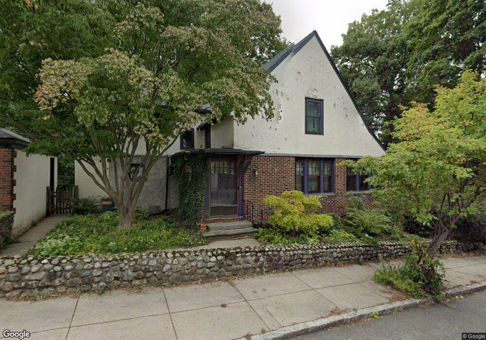
9 Bournedale Rd Jamaica Plain, MA 02130
Jamaica Plain NeighborhoodEstimated Value: $959,000 - $1,130,000
3
Beds
2
Baths
1,665
Sq Ft
$616/Sq Ft
Est. Value
About This Home
This home is located at 9 Bournedale Rd, Jamaica Plain, MA 02130 and is currently estimated at $1,026,456, approximately $616 per square foot. 9 Bournedale Rd is a home located in Suffolk County with nearby schools including Brooke Charter School Roslindale, The Croft School - Jamaica Plain, and St. Clare High School.
Ownership History
Date
Name
Owned For
Owner Type
Purchase Details
Closed on
May 22, 2001
Sold by
Mindell Shoshana R
Bought by
Gausch Karen B
Current Estimated Value
Purchase Details
Closed on
Mar 1, 1993
Sold by
Bell Arthur P and Bell Helen P
Bought by
Mindell Carl E and Mindell Pearl E
Home Financials for this Owner
Home Financials are based on the most recent Mortgage that was taken out on this home.
Original Mortgage
$58,000
Interest Rate
8.03%
Mortgage Type
Purchase Money Mortgage
Create a Home Valuation Report for This Property
The Home Valuation Report is an in-depth analysis detailing your home's value as well as a comparison with similar homes in the area
Home Values in the Area
Average Home Value in this Area
Purchase History
| Date | Buyer | Sale Price | Title Company |
|---|---|---|---|
| Gausch Karen B | $136,000 | -- | |
| Mindell Carl E | $149,000 | -- |
Source: Public Records
Mortgage History
| Date | Status | Borrower | Loan Amount |
|---|---|---|---|
| Previous Owner | Mindell Carl E | $58,000 |
Source: Public Records
Tax History
| Year | Tax Paid | Tax Assessment Tax Assessment Total Assessment is a certain percentage of the fair market value that is determined by local assessors to be the total taxable value of land and additions on the property. | Land | Improvement |
|---|---|---|---|---|
| 2025 | $11,631 | $1,004,400 | $351,600 | $652,800 |
| 2024 | $10,586 | $971,200 | $299,200 | $672,000 |
| 2023 | $9,745 | $907,400 | $279,500 | $627,900 |
| 2022 | $9,055 | $832,300 | $256,400 | $575,900 |
| 2021 | $8,621 | $808,000 | $248,900 | $559,100 |
| 2020 | $7,082 | $670,600 | $241,500 | $429,100 |
| 2019 | $6,729 | $638,400 | $207,500 | $430,900 |
| 2018 | $5,973 | $569,900 | $207,500 | $362,400 |
| 2017 | $5,919 | $558,900 | $207,500 | $351,400 |
| 2016 | $6,027 | $547,900 | $207,500 | $340,400 |
| 2015 | $6,117 | $505,100 | $196,900 | $308,200 |
| 2014 | $5,564 | $442,300 | $196,900 | $245,400 |
Source: Public Records
Map
Nearby Homes
- 35 Eldridge Rd Unit 209
- 6 Dellmore Rd Unit 2
- 348-350 Hyde Park Ave Unit 2
- 31 Rodman St Unit 2
- 40 Catherine St Unit B
- 40 Catherine St Unit 2
- 56 Patten St
- 375 Hyde Park Ave Unit 3
- 61 Fawndale Rd
- 19 Delford St
- 178 Hyde Park Ave Unit 3
- 3886-3888 Washington St
- 626 South St
- 34 Sammett Ave
- 602 Canterbury St Unit 14
- 602 Canterbury St Unit 6
- 602 Canterbury St Unit 10
- 602 Canterbury St Unit 13
- 602 Canterbury St Unit 5
- 602 Canterbury St Unit 9
- 44 Southbourne Rd
- 44 Southbourne Rd
- 44 Southbourne Rd Unit 1
- 42 Southbourne Rd
- 10 Bournedale Rd
- 40 Southbourne Rd
- 14 Bournedale Rd
- 19 Bournedale Rd
- 62 Southbourne Rd
- 38 Southbourne Rd
- 6 Bournedale Rd
- 5 Bournedale Rd
- 48 Southbourne Rd
- 36 Southbourne Rd
- 24 Bournedale Rd
- 31 Northbourne Rd
- 60 Southbourne Rd
- 64 Southbourne Rd
- 27 Northbourne Rd
- 23 Bournedale Rd
Your Personal Tour Guide
Ask me questions while you tour the home.