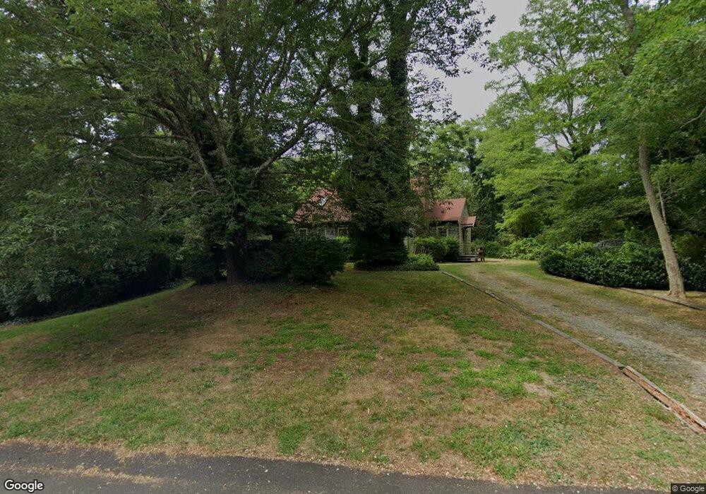
9 Brenda Ln Eastham, MA 02642
Estimated Value: $616,000 - $769,000
3
Beds
2
Baths
1,201
Sq Ft
$573/Sq Ft
Est. Value
About This Home
This home is located at 9 Brenda Ln, Eastham, MA 02642 and is currently estimated at $687,691, approximately $572 per square foot. 9 Brenda Ln is a home located in Barnstable County with nearby schools including Eastham Elementary School, Nauset Regional Middle School, and Nauset Regional High School.
Ownership History
Date
Name
Owned For
Owner Type
Purchase Details
Closed on
Sep 17, 2010
Sold by
Mahoney John J and Hassert-Mahoney Helga
Bought by
Mahoney Ft
Current Estimated Value
Purchase Details
Closed on
Sep 22, 1998
Sold by
Kelleher James E and Kelleher Lucille B
Bought by
Mahoney John J
Home Financials for this Owner
Home Financials are based on the most recent Mortgage that was taken out on this home.
Original Mortgage
$120,000
Interest Rate
6.9%
Mortgage Type
Purchase Money Mortgage
Create a Home Valuation Report for This Property
The Home Valuation Report is an in-depth analysis detailing your home's value as well as a comparison with similar homes in the area
Home Values in the Area
Average Home Value in this Area
Purchase History
| Date | Buyer | Sale Price | Title Company |
|---|---|---|---|
| Mahoney Ft | -- | -- | |
| Mahoney John J | $160,000 | -- |
Source: Public Records
Mortgage History
| Date | Status | Borrower | Loan Amount |
|---|---|---|---|
| Previous Owner | Mahoney John J | $114,978 | |
| Previous Owner | Mahoney John J | $120,000 | |
| Previous Owner | Mahoney John J | $108,750 | |
| Previous Owner | Mahoney John J | $114,000 |
Source: Public Records
Tax History Compared to Growth
Tax History
| Year | Tax Paid | Tax Assessment Tax Assessment Total Assessment is a certain percentage of the fair market value that is determined by local assessors to be the total taxable value of land and additions on the property. | Land | Improvement |
|---|---|---|---|---|
| 2025 | $4,574 | $593,300 | $276,900 | $316,400 |
| 2024 | $4,038 | $576,000 | $268,800 | $307,200 |
| 2023 | $3,764 | $519,900 | $248,900 | $271,000 |
| 2022 | $3,563 | $415,300 | $222,300 | $193,000 |
| 2021 | $3,465 | $377,400 | $202,000 | $175,400 |
| 2020 | $3,247 | $372,400 | $206,200 | $166,200 |
| 2019 | $2,984 | $361,700 | $200,200 | $161,500 |
| 2018 | $2,933 | $351,300 | $194,400 | $156,900 |
| 2017 | $2,736 | $346,300 | $190,600 | $155,700 |
| 2016 | $2,556 | $343,500 | $190,500 | $153,000 |
| 2015 | $2,395 | $337,300 | $186,800 | $150,500 |
Source: Public Records
Map
Nearby Homes
- 330 Hay Rd
- 1061 State Hwy Unit 4
- 993 Intonti Way
- 995 Intonti Way
- 30 Cove Rd
- 25 Twin Rocks Dr
- 785 State Hwy Unit 9
- 60 Smith Heights Way
- 20 Kittiwake Ln
- 180 Country Ln
- 20 White Pines Dr
- 1875 State Hwy
- 1975 State Hwy Unit 3
- 1975 State Hwy Unit 5
- 6 Snow Way
- 46 Freeman Ln
- 320 State Hwy
- 150 Old State Hwy Unit Compound
- 3 Bramblewood Ln
- 10 Cartway N
- 11 Brenda Ln
- 7 Brenda Ln
- 5 Brenda Ln
- 6 Brenda Ln
- 8 Brenda Ln
- 20 Misty Way
- 0 Brenda Ln Unit B 2034871
- 0 Brenda Ln Unit 10B 2011247
- 0 Brenda Ln Unit B 2034638
- 0 Brenda Ln Unit B 2023829
- 0 Brenda Ln Unit 2
- 30 Misty Way
- 13 Brenda Ln
- 10 Brenda Ln Unit B
- 10 Brenda Ln Unit A
- 10 Brenda Ln
- 10 Brenda Ln Unit 10 B
- 10 Brenda Ln Unit 10-A
- 200 Hay Rd
- 12 Brenda Ln