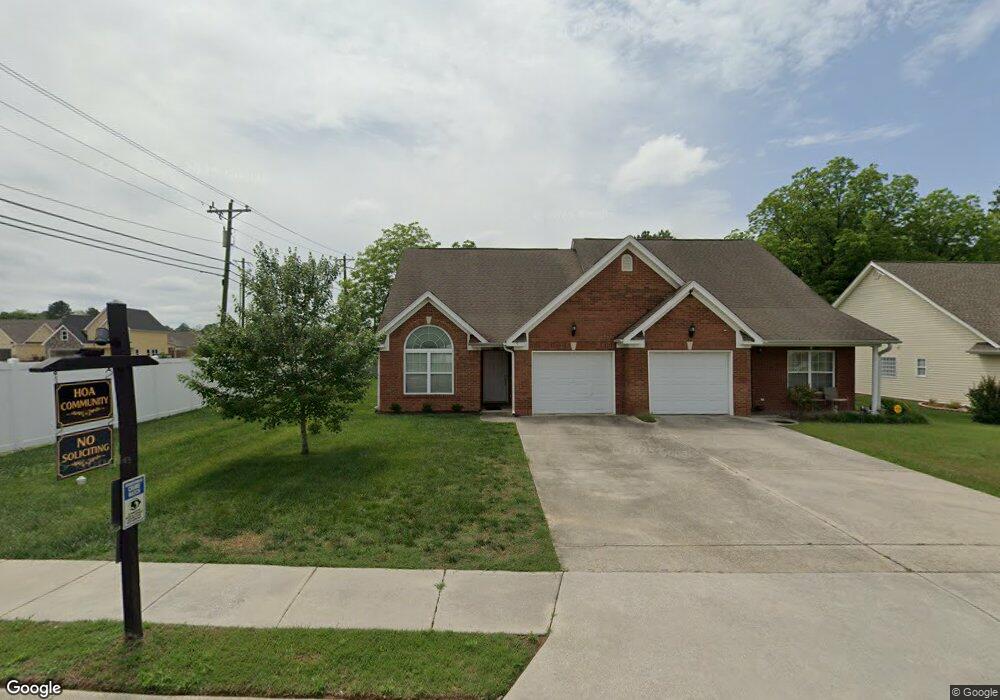
9 Briarstone Dr Rossville, GA 30741
Westside NeighborhoodEstimated Value: $248,151 - $266,000
2
Beds
2
Baths
1,156
Sq Ft
$221/Sq Ft
Est. Value
About This Home
This home is located at 9 Briarstone Dr, Rossville, GA 30741 and is currently estimated at $255,538, approximately $221 per square foot. 9 Briarstone Dr is a home located in Catoosa County with nearby schools including West Side Elementary School, Lakeview Middle School, and Lakeview-Fort Oglethorpe High School.
Ownership History
Date
Name
Owned For
Owner Type
Purchase Details
Closed on
Dec 26, 2013
Sold by
Hughes Jason D
Bought by
Hughes Jason D and Tidwell Susan K
Current Estimated Value
Purchase Details
Closed on
Mar 13, 2007
Sold by
Erth Llc
Bought by
Hughes Jason D
Home Financials for this Owner
Home Financials are based on the most recent Mortgage that was taken out on this home.
Original Mortgage
$104,850
Interest Rate
6.27%
Mortgage Type
New Conventional
Purchase Details
Closed on
Aug 23, 2001
Bought by
Erth Llc
Create a Home Valuation Report for This Property
The Home Valuation Report is an in-depth analysis detailing your home's value as well as a comparison with similar homes in the area
Home Values in the Area
Average Home Value in this Area
Purchase History
| Date | Buyer | Sale Price | Title Company |
|---|---|---|---|
| Hughes Jason D | -- | -- | |
| Hughes Jason D | $116,500 | -- | |
| Erth Llc | -- | -- |
Source: Public Records
Mortgage History
| Date | Status | Borrower | Loan Amount |
|---|---|---|---|
| Previous Owner | Hughes Jason D | $104,850 |
Source: Public Records
Tax History Compared to Growth
Tax History
| Year | Tax Paid | Tax Assessment Tax Assessment Total Assessment is a certain percentage of the fair market value that is determined by local assessors to be the total taxable value of land and additions on the property. | Land | Improvement |
|---|---|---|---|---|
| 2024 | $2,389 | $90,794 | $10,000 | $80,794 |
| 2023 | $1,967 | $70,019 | $10,000 | $60,019 |
| 2022 | $1,550 | $55,197 | $10,000 | $45,197 |
| 2021 | $1,470 | $55,197 | $10,000 | $45,197 |
| 2020 | $1,336 | $45,254 | $6,000 | $39,254 |
| 2019 | $1,350 | $45,254 | $6,000 | $39,254 |
| 2018 | $1,418 | $45,254 | $6,000 | $39,254 |
| 2017 | $1,379 | $44,016 | $6,000 | $38,016 |
Source: Public Records
Map
Nearby Homes
- 57 Country Cove Dr
- 288 Briarstone Dr
- 44 Sunset Cove Dr
- 85 Daybreak Dr
- 83 Daybreak Dr
- 27 May St
- 1703 Applebrook Dr
- 97 Morning Mist Dr
- 2204 Applebrook Dr
- 211 Idle Place Cir
- 14 Sunset Cove Dr
- 792 S MacK Smith Rd
- 164 Idle Place Cir
- 146 Idle Place Cir
- 283 Idle Place Cir
- 372 Idle Place Cir
- 89 Idle Place Cir
- 81 Idle Place Cir
- 396 Idle Place Cir
- 378 Idle Place Cir
- 17 Briarstone Dr
- 27 Briarstone Dr
- 33 Briarstone Dr
- 10 Briarstone Dr
- 10 Briarstone Dr
- 1161 Steele Rd
- 43 Briarstone Dr
- 28 Briarstone Dr
- 25 Country Cove Dr
- 36 Briarstone Dr
- 51 Briarstone Dr
- 35 Country Cove Dr
- 44 Briarstone Dr
- 59 Briarstone Dr
- 52 Briarstone Dr
- 43 Country Cove Dr
- 1245 Steele Rd
- 60 Briarstone Dr
- 4 Suntrust Dr
- 68 Briarstone Dr