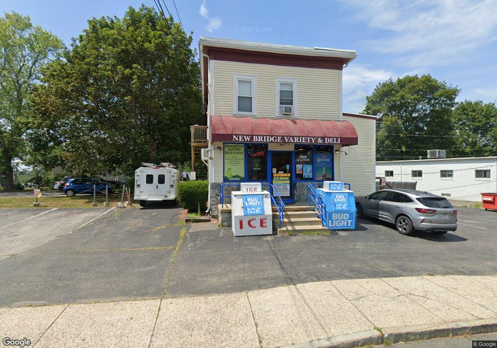
9 Bridge St Danvers, MA 01923
Estimated Value: $1,059,778
4
Beds
3
Baths
2,936
Sq Ft
$361/Sq Ft
Est. Value
About This Home
This home is located at 9 Bridge St, Danvers, MA 01923 and is currently estimated at $1,059,778, approximately $360 per square foot. 9 Bridge St is a home located in Essex County with nearby schools including Danvers High School, The Saints Academy, and Mrs Alexander's School.
Ownership History
Date
Name
Owned For
Owner Type
Purchase Details
Closed on
May 11, 2023
Sold by
9 Bridge Street Llc
Bought by
9 Bridge Rt and Piantidosi
Current Estimated Value
Home Financials for this Owner
Home Financials are based on the most recent Mortgage that was taken out on this home.
Original Mortgage
$760,000
Outstanding Balance
$736,944
Interest Rate
6.32%
Mortgage Type
Commercial
Estimated Equity
$322,834
Purchase Details
Closed on
Jul 1, 2021
Sold by
Lawrence Rt and Lawrence
Bought by
9 Bridge Street Llc
Home Financials for this Owner
Home Financials are based on the most recent Mortgage that was taken out on this home.
Original Mortgage
$720,000
Interest Rate
2.9%
Mortgage Type
Commercial
Purchase Details
Closed on
May 24, 2002
Sold by
Mccormick James E and Mccormick Diane E
Bought by
Lawrence Rt
Create a Home Valuation Report for This Property
The Home Valuation Report is an in-depth analysis detailing your home's value as well as a comparison with similar homes in the area
Home Values in the Area
Average Home Value in this Area
Purchase History
| Date | Buyer | Sale Price | Title Company |
|---|---|---|---|
| 9 Bridge Rt | $950,000 | None Available | |
| 9 Bridge Street Llc | $820,000 | None Available | |
| Lawrence Rt | $7,500 | -- | |
| Lawrence Rt | $7,500 | -- |
Source: Public Records
Mortgage History
| Date | Status | Borrower | Loan Amount |
|---|---|---|---|
| Open | 9 Bridge Rt | $760,000 | |
| Previous Owner | 9 Bridge Street Llc | $720,000 | |
| Previous Owner | Lawrence Rt | $258,000 | |
| Previous Owner | Lawrence Rt | $179,000 |
Source: Public Records
Tax History
| Year | Tax Paid | Tax Assessment Tax Assessment Total Assessment is a certain percentage of the fair market value that is determined by local assessors to be the total taxable value of land and additions on the property. | Land | Improvement |
|---|---|---|---|---|
| 2025 | $8,812 | $801,800 | $311,100 | $490,700 |
| 2024 | -- | $918,200 | $311,100 | $607,100 |
| 2023 | $0 | $692,900 | $275,800 | $417,100 |
| 2022 | $0 | $560,400 | $240,600 | $319,800 |
| 2021 | $0 | $500,800 | $218,300 | $282,500 |
| 2020 | $0 | $437,500 | $211,300 | $226,200 |
| 2019 | $0 | $430,400 | $204,200 | $226,200 |
| 2018 | $0 | $410,700 | $198,400 | $212,300 |
| 2017 | $0 | $396,600 | $184,300 | $212,300 |
| 2016 | -- | $388,400 | $176,100 | $212,300 |
| 2015 | -- | $360,400 | $152,600 | $207,800 |
Source: Public Records
Map
Nearby Homes
- 59 Riverview Ave
- 13 Giles Ave Unit 2
- 44 Foster St
- 6 Mcdewell Ave Unit 4
- 4 Duck Pond Rd Unit 225
- 76 Water St
- 147 High St
- 125 Livingstone Ave
- 123 Livingstone Ave
- 6 Pilgrim Heights
- 50 Balch St Unit 300
- 50 Balch St Unit 205
- 50 Balch St Unit 511
- 50 Balch St Unit 209
- 50 Balch St Unit 315
- 50 Balch St Unit 103
- 6 Grant St
- 61 Ellsworth Ave
- 108 Abington Rd Unit 108
- 14 Chase St
- 9 Bridge St Unit 9B
- 1 Bradstreet Ave
- 7 Bridge St
- 7R Bridge St
- 7 Bridge St
- 7 Bridge St
- 10 Bridge St Unit 2
- 10 Bridge St Unit 1
- 10 Bridge St Unit 3
- 10 Bridge St Unit 6
- 10 Bridge St Unit 5
- 10 Bridge St Unit 4
- 10 Bridge St
- 12 Bridge St
- 3 Bradstreet Ave
- 13 Bridge St
- 14 Bridge St
- 217 Bridge St
- 217 Bridge St Unit 1
- 2 Riverview Ave
Your Personal Tour Guide
Ask me questions while you tour the home.