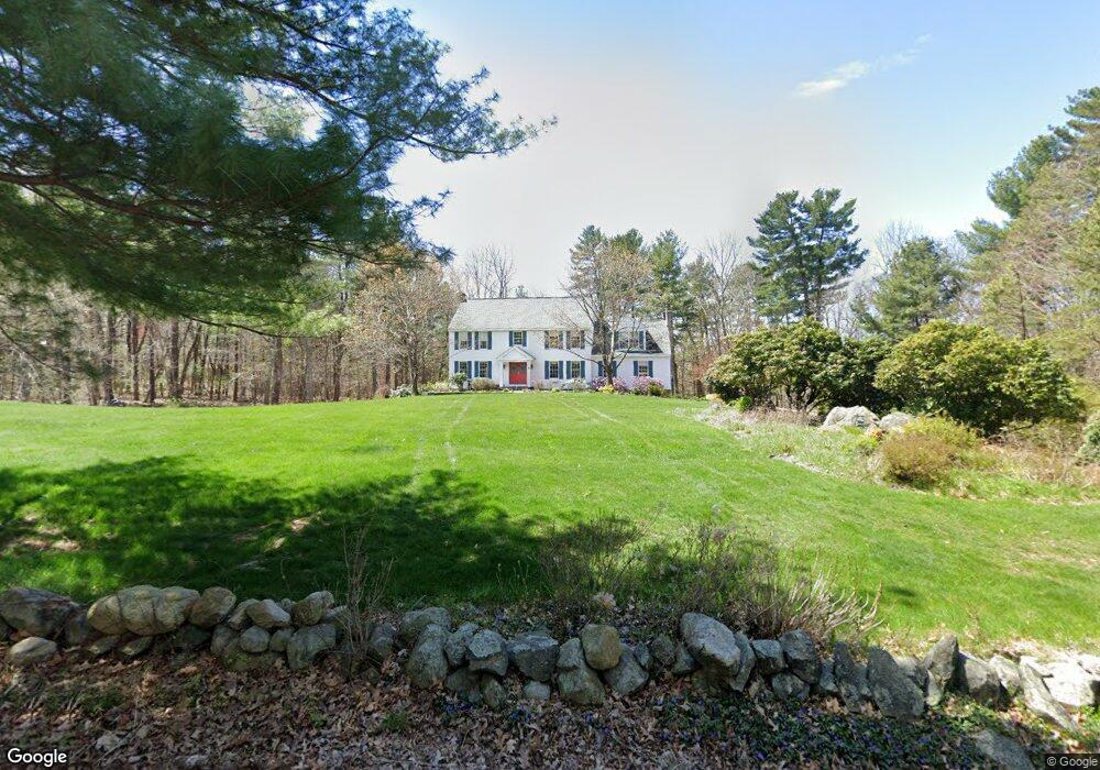
9 Brimstone Ln Sudbury, MA 01776
Estimated Value: $1,198,000 - $1,438,000
4
Beds
3
Baths
3,428
Sq Ft
$395/Sq Ft
Est. Value
About This Home
This home is located at 9 Brimstone Ln, Sudbury, MA 01776 and is currently estimated at $1,352,605, approximately $394 per square foot. 9 Brimstone Ln is a home located in Middlesex County with nearby schools including Peter Noyes Elementary School, Ephraim Curtis Middle School, and Lincoln-Sudbury Regional High School.
Ownership History
Date
Name
Owned For
Owner Type
Purchase Details
Closed on
May 16, 1989
Sold by
G D Rt
Bought by
Patrick Allan J
Current Estimated Value
Create a Home Valuation Report for This Property
The Home Valuation Report is an in-depth analysis detailing your home's value as well as a comparison with similar homes in the area
Home Values in the Area
Average Home Value in this Area
Purchase History
| Date | Buyer | Sale Price | Title Company |
|---|---|---|---|
| Patrick Allan J | $500,000 | -- |
Source: Public Records
Mortgage History
| Date | Status | Borrower | Loan Amount |
|---|---|---|---|
| Open | Patrick Allan J | $307,500 | |
| Closed | Patrick Allan J | $100,000 | |
| Closed | Patrick Allan J | $320,000 |
Source: Public Records
Tax History Compared to Growth
Tax History
| Year | Tax Paid | Tax Assessment Tax Assessment Total Assessment is a certain percentage of the fair market value that is determined by local assessors to be the total taxable value of land and additions on the property. | Land | Improvement |
|---|---|---|---|---|
| 2025 | $19,580 | $1,337,400 | $413,600 | $923,800 |
| 2024 | $18,863 | $1,291,100 | $402,100 | $889,000 |
| 2023 | $17,615 | $1,117,000 | $373,800 | $743,200 |
| 2022 | $16,987 | $941,100 | $344,600 | $596,500 |
| 2021 | $15,881 | $843,400 | $344,600 | $498,800 |
| 2020 | $15,561 | $843,400 | $344,600 | $498,800 |
| 2019 | $14,570 | $813,500 | $344,600 | $468,900 |
| 2018 | $14,152 | $789,300 | $361,600 | $427,700 |
| 2017 | $13,857 | $781,100 | $357,500 | $423,600 |
| 2016 | $13,453 | $755,800 | $344,600 | $411,200 |
| 2015 | $13,258 | $753,300 | $350,300 | $403,000 |
| 2014 | $13,259 | $735,400 | $340,600 | $394,800 |
Source: Public Records
Map
Nearby Homes
- 15 Brimstone Ln
- 6 Bigelow Dr
- 2 Brimstone Ln
- 6 Brimstone Ln
- 6 Brimstone Ln Unit Lane
- 14 Bigelow Dr
- 850 Boston Post Rd
- 25 Brimstone Ln
- 26 Brimstone Ln
- 22 Bigelow Dr
- 33 Brimstone Ln
- 33 Brimstone Ln Unit 1
- 882 Boston Post Rd
- 34 Brimstone Ln
- 821 Boston Post Rd
- 821 Boston Post Rd
- 821 Boston Post Rd
- 821 Boston Post Rd Unit Lots A,B,C
- 821 Boston Post Rd Unit Lots 1-3
- 821 Boston Post Rd