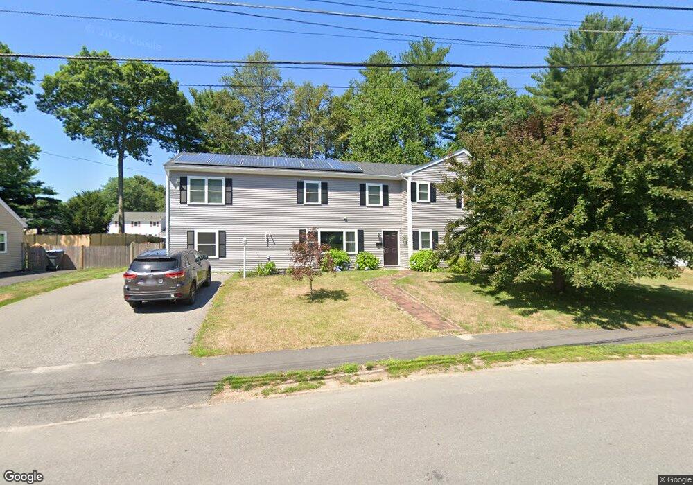
9 Brookdale Rd Natick, MA 01760
Estimated Value: $754,000 - $1,200,000
3
Beds
2
Baths
1,474
Sq Ft
$722/Sq Ft
Est. Value
About This Home
This home is located at 9 Brookdale Rd, Natick, MA 01760 and is currently estimated at $1,063,733, approximately $721 per square foot. 9 Brookdale Rd is a home located in Middlesex County with nearby schools including Natick High School, J F Kennedy Middle School, and Brown Elementary School.
Ownership History
Date
Name
Owned For
Owner Type
Purchase Details
Closed on
May 26, 2010
Sold by
Mazzola Dean A and Mazzola Gabrielle C
Bought by
Brenneman Matthew J and Brenneman Jennifer L
Current Estimated Value
Home Financials for this Owner
Home Financials are based on the most recent Mortgage that was taken out on this home.
Original Mortgage
$362,123
Interest Rate
5.5%
Mortgage Type
FHA
Purchase Details
Closed on
Apr 1, 1987
Sold by
Russo Louis J
Bought by
Mazzola Dean
Create a Home Valuation Report for This Property
The Home Valuation Report is an in-depth analysis detailing your home's value as well as a comparison with similar homes in the area
Home Values in the Area
Average Home Value in this Area
Purchase History
| Date | Buyer | Sale Price | Title Company |
|---|---|---|---|
| Brenneman Matthew J | $367,000 | -- | |
| Mazzola Dean | $159,000 | -- |
Source: Public Records
Mortgage History
| Date | Status | Borrower | Loan Amount |
|---|---|---|---|
| Open | Mazzola Dean | $355,495 | |
| Closed | Brenneman Matthew J | $362,123 | |
| Previous Owner | Mazzola Dean | $77,600 | |
| Previous Owner | Mazzola Dean | $94,000 |
Source: Public Records
Tax History
| Year | Tax Paid | Tax Assessment Tax Assessment Total Assessment is a certain percentage of the fair market value that is determined by local assessors to be the total taxable value of land and additions on the property. | Land | Improvement |
|---|---|---|---|---|
| 2025 | $11,183 | $935,000 | $437,000 | $498,000 |
| 2024 | $10,802 | $881,100 | $411,300 | $469,800 |
| 2023 | $10,480 | $829,100 | $394,800 | $434,300 |
| 2022 | $10,202 | $764,800 | $357,900 | $406,900 |
| 2021 | $6,636 | $487,600 | $337,400 | $150,200 |
| 2020 | $6,428 | $472,300 | $322,100 | $150,200 |
| 2019 | $6,003 | $472,300 | $322,100 | $150,200 |
| 2018 | $5,816 | $445,700 | $306,800 | $138,900 |
| 2017 | $5,396 | $400,000 | $263,500 | $136,500 |
| 2016 | $5,125 | $377,700 | $242,500 | $135,200 |
| 2015 | $5,064 | $366,400 | $242,500 | $123,900 |
Source: Public Records
Map
Nearby Homes
- 132 Howe St Unit B
- 56 Morency St Unit D
- 16 Grant Street Extension
- 54 Pilgrim Rd
- 47 Bishop Dr
- 260 Grant St
- 96 Mansfield St
- 15 Willis St Unit 4
- 157 Mill St
- 4 Village Rock Ln Unit 9
- 21 Village Rock Ln Unit 4
- 9 Village Hill Ln Unit 15
- 5 Village Rock Ln Unit 24
- 50 Village Brook Ln Unit 4
- 57 Village Brook Ln Unit 5
- 23 Village Rock Ln Unit 22
- 44 Village Hill Ln
- 29 Village Rock Ln Unit 6
- 52 Village Brook Ln Unit 14
- 26 Fairway Cir Unit 26
- 11 Brookdale Rd
- 7 Brookdale Rd
- 7 Brookdale Rd Unit 7
- 14 Madonna St
- 16 Madonna St
- 13 Brookdale Rd
- 12 Madonna St
- 1 Hemlock Dr
- 5 Brookdale Rd
- 6 Brookdale Rd
- LOT 3 Waterview Estates
- LOT 67 Chalcom Cir
- LOT 3 Commonwealth Rd
- 18 Madonna St
- 15 Brookdale Rd
- 15 Madonna St
- 3 Brookdale Rd
- 11 Madonna St
- 10 Madonna St
- 2 Elwin Rd
Your Personal Tour Guide
Ask me questions while you tour the home.