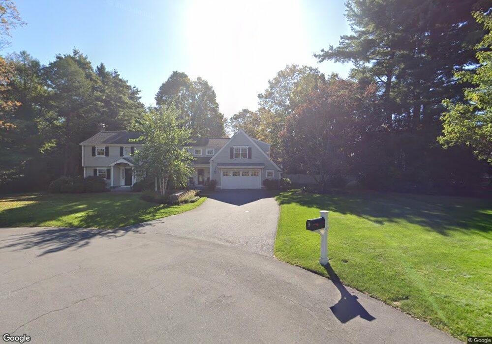
9 Brown Rd Lexington, MA 02420
Munroe Hill NeighborhoodEstimated Value: $2,153,104 - $2,474,000
4
Beds
3
Baths
3,468
Sq Ft
$670/Sq Ft
Est. Value
About This Home
This home is located at 9 Brown Rd, Lexington, MA 02420 and is currently estimated at $2,322,026, approximately $669 per square foot. 9 Brown Rd is a home located in Middlesex County with nearby schools including Fiske Elementary School, William Diamond Middle School, and Lexington High School.
Ownership History
Date
Name
Owned For
Owner Type
Purchase Details
Closed on
Mar 29, 1990
Sold by
Bertolini Anthony
Bought by
Dinapoli Mark L
Current Estimated Value
Create a Home Valuation Report for This Property
The Home Valuation Report is an in-depth analysis detailing your home's value as well as a comparison with similar homes in the area
Home Values in the Area
Average Home Value in this Area
Purchase History
| Date | Buyer | Sale Price | Title Company |
|---|---|---|---|
| Dinapoli Mark L | $220,000 | -- |
Source: Public Records
Mortgage History
| Date | Status | Borrower | Loan Amount |
|---|---|---|---|
| Open | Dinapoli Mark L | $350,000 | |
| Closed | Dinapoli Mark L | $175,000 | |
| Closed | Dinapoli Mark L | $150,000 | |
| Closed | Dinapoli Mark L | $150,000 |
Source: Public Records
Tax History
| Year | Tax Paid | Tax Assessment Tax Assessment Total Assessment is a certain percentage of the fair market value that is determined by local assessors to be the total taxable value of land and additions on the property. | Land | Improvement |
|---|---|---|---|---|
| 2025 | $23,164 | $1,894,000 | $801,000 | $1,093,000 |
| 2024 | $22,712 | $1,854,000 | $763,000 | $1,091,000 |
| 2023 | $22,347 | $1,719,000 | $694,000 | $1,025,000 |
| 2022 | $20,907 | $1,515,000 | $631,000 | $884,000 |
| 2021 | $5,339 | $1,401,000 | $601,000 | $800,000 |
| 2020 | $19,445 | $1,384,000 | $601,000 | $783,000 |
| 2019 | $4,575 | $1,321,000 | $572,000 | $749,000 |
| 2018 | $18,318 | $1,281,000 | $545,000 | $736,000 |
| 2017 | $15,925 | $1,099,000 | $519,000 | $580,000 |
| 2016 | $15,272 | $1,046,000 | $495,000 | $551,000 |
| 2015 | $14,964 | $1,007,000 | $450,000 | $557,000 |
| 2014 | $9,942 | $641,000 | $409,000 | $232,000 |
Source: Public Records
Map
Nearby Homes
Your Personal Tour Guide
Ask me questions while you tour the home.