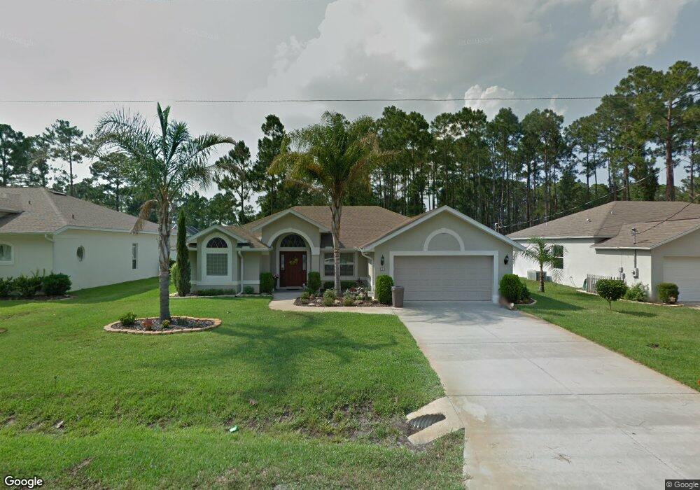
9 Burning Sands Ln Palm Coast, FL 32137
Estimated Value: $359,000 - $393,000
3
Beds
2
Baths
1,923
Sq Ft
$194/Sq Ft
Est. Value
About This Home
This home is located at 9 Burning Sands Ln, Palm Coast, FL 32137 and is currently estimated at $373,868, approximately $194 per square foot. 9 Burning Sands Ln is a home located in Flagler County with nearby schools including Belle Terre Elementary School, Indian Trails Middle School, and Matanzas High School.
Ownership History
Date
Name
Owned For
Owner Type
Purchase Details
Closed on
Nov 10, 2020
Sold by
Harris Jacqueline
Bought by
Harris Michael J and Harris Alexandra M
Current Estimated Value
Purchase Details
Closed on
Dec 19, 2019
Sold by
Harris Jacqueline
Bought by
Harris Jacqueline and Harris Michael J
Purchase Details
Closed on
Feb 20, 2018
Sold by
Harris Jacqueline
Bought by
Harris Michael J and Harris Alexandra M
Purchase Details
Closed on
Aug 12, 2002
Sold by
Rawls James D and Rawls Bettie Ann
Bought by
Harris Jacqueline
Create a Home Valuation Report for This Property
The Home Valuation Report is an in-depth analysis detailing your home's value as well as a comparison with similar homes in the area
Home Values in the Area
Average Home Value in this Area
Purchase History
| Date | Buyer | Sale Price | Title Company |
|---|---|---|---|
| Harris Michael J | -- | Accommodation | |
| Harris Jacqueline | -- | Attorney | |
| Harris Michael J | -- | Attorney | |
| Harris Jacqueline | $15,000 | -- |
Source: Public Records
Tax History Compared to Growth
Tax History
| Year | Tax Paid | Tax Assessment Tax Assessment Total Assessment is a certain percentage of the fair market value that is determined by local assessors to be the total taxable value of land and additions on the property. | Land | Improvement |
|---|---|---|---|---|
| 2024 | $1,958 | $158,011 | -- | -- |
| 2023 | $1,958 | $153,409 | $0 | $0 |
| 2022 | $2,012 | $148,941 | $0 | $0 |
| 2021 | $1,979 | $144,603 | $0 | $0 |
| 2020 | $1,972 | $142,606 | $0 | $0 |
| 2019 | $1,933 | $139,400 | $0 | $0 |
| 2018 | $1,919 | $136,801 | $0 | $0 |
| 2017 | $1,868 | $133,987 | $0 | $0 |
| 2016 | $1,820 | $131,231 | $0 | $0 |
| 2015 | $1,821 | $130,319 | $0 | $0 |
| 2014 | $1,827 | $129,285 | $0 | $0 |
Source: Public Records
Map
Nearby Homes
- 8 Burning Sands Ln
- 7 Burning View Ln
- 1 Burning Sands Ln
- 23 Burning View Ln
- 39 Bird of Paradise Dr
- 32 Burning Sands Ln
- 32 Barrister Ln
- 8 Bunker View Place
- 20 Burning Wick Place
- 5 Bird of Paradise Place
- 20 Barkley Ln
- 6 Barrister Ln
- 22 Bunker View Dr
- 8 Lakeside Place W
- 45 Barkwood Ln
- 25 Bassett Ln
- 6 Bainbridge Ln
- 24 Lakeside Place W
- 29 Bassett Ln
- 62 Barkley Ln
- 7 Burning Sands Ln
- 11 Burning Sands Ln
- 10 Burning View Ln
- 13 Burning Sands Ln
- 5 Burning Sands Ln
- 10 Burning Sands Ln
- 16 Burning View Ln
- 6 Burning View Ln
- 3 Burning Sands Ln
- 14 Burning Sands Ln
- 7 Burning Ember Ln
- 4 Burning Sands Ln
- 5 Burning Ember Ln
- 9 Burning View Ln
- 9 Burning Ember Ln
- 13 Burning View Ln
- 17 Burning Sands Ln
- 4 Burning View Ln
- 11 Burning Ember Ln
- 20 Burning View Ln