Estimated Value: $1,095,876 - $1,593,000
4
Beds
3
Baths
3,147
Sq Ft
$417/Sq Ft
Est. Value
About This Home
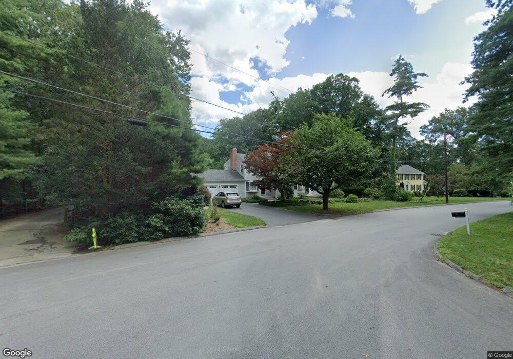
This home is located at 9 Captain Browns Ln, Acton, MA 01720 and is currently estimated at $1,311,969, approximately $416 per square foot. 9 Captain Browns Ln is a home located in Middlesex County with nearby schools including Acton-Boxborough Regional High School, Maynard Knowledge Beginnings, and The Imago School.
Ownership History
Date
Name
Owned For
Owner Type
Purchase Details
Closed on
Dec 1, 2021
Sold by
Armiento Craig A and Armiento Barbara A
Bought by
2021 Armiento Ft
Current Estimated Value
Purchase Details
Closed on
Jun 29, 1998
Sold by
Moon Thomas H and Moon Gail A
Bought by
Armiento Craig A and Armiento Barbara A
Home Financials for this Owner
Home Financials are based on the most recent Mortgage that was taken out on this home.
Original Mortgage
$70,000
Interest Rate
7.09%
Mortgage Type
Purchase Money Mortgage
Purchase Details
Closed on
Apr 21, 1992
Sold by
Campbell Edward F and Campbell Elizabeth
Bought by
Moon Thomas H and Moon Gail A
Home Financials for this Owner
Home Financials are based on the most recent Mortgage that was taken out on this home.
Original Mortgage
$174,000
Interest Rate
8.75%
Mortgage Type
Purchase Money Mortgage
Create a Home Valuation Report for This Property
The Home Valuation Report is an in-depth analysis detailing your home's value as well as a comparison with similar homes in the area
Home Values in the Area
Average Home Value in this Area
Purchase History
| Date | Buyer | Sale Price | Title Company |
|---|---|---|---|
| 2021 Armiento Ft | -- | None Available | |
| Armiento Craig A | $457,000 | -- | |
| Moon Thomas H | $290,000 | -- |
Source: Public Records
Mortgage History
| Date | Status | Borrower | Loan Amount |
|---|---|---|---|
| Previous Owner | Moon Thomas H | $70,000 | |
| Previous Owner | Moon Thomas H | $40,000 | |
| Previous Owner | Moon Thomas H | $174,000 |
Source: Public Records
Tax History
| Year | Tax Paid | Tax Assessment Tax Assessment Total Assessment is a certain percentage of the fair market value that is determined by local assessors to be the total taxable value of land and additions on the property. | Land | Improvement |
|---|---|---|---|---|
| 2025 | $16,287 | $949,700 | $368,200 | $581,500 |
| 2024 | $15,483 | $928,800 | $368,200 | $560,600 |
| 2023 | $15,102 | $860,000 | $334,600 | $525,400 |
| 2022 | $14,272 | $733,800 | $290,800 | $443,000 |
| 2021 | $13,936 | $688,900 | $269,400 | $419,500 |
| 2020 | $13,143 | $683,100 | $269,400 | $413,700 |
| 2019 | $12,683 | $654,800 | $269,400 | $385,400 |
| 2018 | $12,665 | $653,500 | $269,400 | $384,100 |
| 2017 | $12,336 | $647,200 | $269,400 | $377,800 |
| 2016 | $12,084 | $628,400 | $269,400 | $359,000 |
| 2015 | $11,592 | $608,500 | $269,400 | $339,100 |
| 2014 | $11,192 | $575,400 | $269,400 | $306,000 |
Source: Public Records
Map
Nearby Homes
- 20 Joseph Reed Ln
- 79 Charter Rd
- 235 Arlington St
- 5 Perkins Ln
- 7 Kelley Rd
- 18 Hayward Rd
- 631 Massachusetts Ave Unit 631
- 184 Main St Unit 3
- 11 Braebrook
- 92 Willow St Unit 3
- 92 Willow St Unit 2
- 25 Nylander Way
- 90 Willow St Unit 1
- 46 Taylor Rd
- 96 Newtown Rd
- 129 Main St Unit 129
- 131 Main St
- 60 Nashoba Rd
- 4 Littlefield Rd
- 6 Beacon Ct
- 7 Captain Browns Ln
- 2 Captain Forbush Ln
- 11 Captain Browns Ln
- 465 Massachusetts Ave
- 6 Captain Browns Ln
- 10 Captain Browns Ln
- 467 Massachusetts Ave
- 5 Captain Browns Ln
- 4 Captain Forbush Ln
- 3 Captain Forbush Ln
- 4 Captain Browns Ln
- 11 Deacon Hunt Dr
- 12 Captain Browns Ln
- 469 Massachusetts Ave
- 463 Massachusetts Ave
- 3 Captain Browns Ln
- 9 Deacon Hunt Dr
- 6 Captain Forbush Ln
- 13 Deacon Hunt Dr
- 461 Massachusetts Ave
Your Personal Tour Guide
Ask me questions while you tour the home.