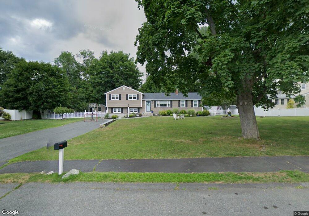
9 Carlson Cir Natick, MA 01760
Estimated Value: $867,165 - $1,042,000
4
Beds
3
Baths
2,000
Sq Ft
$468/Sq Ft
Est. Value
About This Home
This home is located at 9 Carlson Cir, Natick, MA 01760 and is currently estimated at $936,041, approximately $468 per square foot. 9 Carlson Cir is a home located in Middlesex County with nearby schools including Natick High School, J F Kennedy Middle School, and Johnson Elementary School.
Ownership History
Date
Name
Owned For
Owner Type
Purchase Details
Closed on
Apr 6, 2023
Sold by
Howard James W and Howard Diane L
Bought by
Howard Ft
Current Estimated Value
Purchase Details
Closed on
Oct 31, 2007
Sold by
Conway Francis D and Conway Justine E
Bought by
Howard Diane L and Howard James W
Home Financials for this Owner
Home Financials are based on the most recent Mortgage that was taken out on this home.
Original Mortgage
$394,500
Interest Rate
6.43%
Mortgage Type
Purchase Money Mortgage
Purchase Details
Closed on
Feb 3, 2004
Sold by
Kaplan Allen D and Kaplan Susan E
Bought by
Conway Francis D and Conway Justine E
Home Financials for this Owner
Home Financials are based on the most recent Mortgage that was taken out on this home.
Original Mortgage
$197,000
Interest Rate
5.82%
Mortgage Type
Purchase Money Mortgage
Create a Home Valuation Report for This Property
The Home Valuation Report is an in-depth analysis detailing your home's value as well as a comparison with similar homes in the area
Home Values in the Area
Average Home Value in this Area
Purchase History
| Date | Buyer | Sale Price | Title Company |
|---|---|---|---|
| Howard Ft | -- | None Available | |
| Howard Diane L | $494,500 | -- | |
| Conway Francis D | $435,000 | -- |
Source: Public Records
Mortgage History
| Date | Status | Borrower | Loan Amount |
|---|---|---|---|
| Previous Owner | Howard Diane L | $394,500 | |
| Previous Owner | Conway Francis D | $197,000 |
Source: Public Records
Tax History
| Year | Tax Paid | Tax Assessment Tax Assessment Total Assessment is a certain percentage of the fair market value that is determined by local assessors to be the total taxable value of land and additions on the property. | Land | Improvement |
|---|---|---|---|---|
| 2025 | $9,134 | $763,700 | $438,600 | $325,100 |
| 2024 | $8,817 | $719,200 | $412,800 | $306,400 |
| 2023 | $8,622 | $682,100 | $396,100 | $286,000 |
| 2022 | $8,338 | $625,000 | $359,000 | $266,000 |
| 2021 | $7,981 | $586,400 | $338,500 | $247,900 |
| 2020 | $7,771 | $571,000 | $323,100 | $247,900 |
| 2019 | $7,257 | $571,000 | $323,100 | $247,900 |
| 2018 | $7,103 | $544,300 | $307,700 | $236,600 |
| 2017 | $6,703 | $496,900 | $264,600 | $232,300 |
| 2016 | $6,429 | $473,800 | $243,600 | $230,200 |
| 2015 | $6,107 | $441,900 | $243,600 | $198,300 |
Source: Public Records
Map
Nearby Homes
- 28 Sylvester Rd
- 79 Speen St
- 1 Fern St
- 5 Lanes End
- 46 Silver Hill Ln Unit 1
- 3 Silver Hill Ln Unit 6
- 1 Post Oak Ln Unit 19
- 26 Wellesley Ave Unit B
- 34 Walden Dr Unit 5
- 30 Walden Dr Unit 7
- 8 Walden Dr Unit 13
- 52 Village Brook Ln Unit 14
- 57 Village Brook Ln Unit 5
- 8 Village Way Unit 11
- 15 Edwards Rd
- 16 West St
- 15 Village Way Unit 8
- 27 Stillman St
- 62 Oakland St
- 44 Village Hill Ln
Your Personal Tour Guide
Ask me questions while you tour the home.