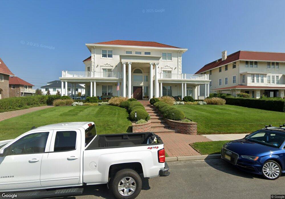
9 Cedar Ave Allenhurst, NJ 07711
Estimated Value: $5,726,000 - $7,368,638
5
Beds
4
Baths
5,319
Sq Ft
$1,262/Sq Ft
Est. Value
About This Home
This home is located at 9 Cedar Ave, Allenhurst, NJ 07711 and is currently estimated at $6,711,546, approximately $1,261 per square foot. 9 Cedar Ave is a home located in Monmouth County with nearby schools including Hope Academy Charter School, St. Mary of the Assumption School, and Bnot Shirah of Deal.
Ownership History
Date
Name
Owned For
Owner Type
Purchase Details
Closed on
Nov 18, 2010
Sold by
Azizo Barbara and Haber Selim
Bought by
Azizo Barbara and Haber Selim
Current Estimated Value
Purchase Details
Closed on
May 18, 2010
Sold by
Borough Of Red Bank
Bought by
Red Bank Affordable Housing Corporation
Purchase Details
Closed on
Jun 9, 2008
Sold by
Azizo Barbara and Azizo Maurice
Bought by
Azizo Barbara and Haber Selim
Purchase Details
Closed on
Oct 13, 1994
Sold by
Ocean Fedl Savings
Bought by
Azizo Maurice
Create a Home Valuation Report for This Property
The Home Valuation Report is an in-depth analysis detailing your home's value as well as a comparison with similar homes in the area
Home Values in the Area
Average Home Value in this Area
Purchase History
| Date | Buyer | Sale Price | Title Company |
|---|---|---|---|
| Azizo Barbara | -- | None Available | |
| Red Bank Affordable Housing Corporation | -- | Old Republic National Title | |
| Azizo Barbara | -- | None Available | |
| Azizo Maurice | $400,000 | -- |
Source: Public Records
Tax History
| Year | Tax Paid | Tax Assessment Tax Assessment Total Assessment is a certain percentage of the fair market value that is determined by local assessors to be the total taxable value of land and additions on the property. | Land | Improvement |
|---|---|---|---|---|
| 2025 | $32,521 | $5,847,500 | $3,959,900 | $1,887,600 |
| 2024 | $28,364 | $5,521,400 | $3,647,000 | $1,874,400 |
Source: Public Records
Map
Nearby Homes
- 48 Neptune Ave
- 127 Cedar Ave
- 57 Hathaway Ave
- 222 Cedar Ave
- 112 Euclid Ave
- 205 Edgemont Dr Unit 1
- 205 Edgemont Dr Unit 2
- 205 Edgemont Dr Unit 3
- 205 Edgemont Dr Unit BUILDING
- 315 Allen Ave
- 57 Darlington Rd
- 304 Deal Lake Dr Unit 35
- 18 Lady Bess Dr
- 400 Deal Lake Dr Unit 3J
- 400 Deal Lake Dr Unit 6G
- 400 Deal Lake Dr Unit 2L
- 400 Deal Lake Dr Unit 8F
- 400 Deal Lake Dr Unit 7H & 7G
- 400 Deal Lake Dr Unit 6E
- 400 Deal Lake Dr Unit 4B
Your Personal Tour Guide
Ask me questions while you tour the home.