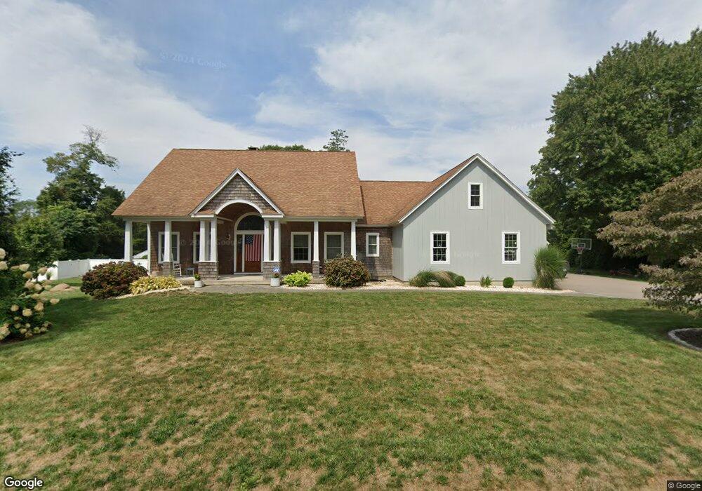
9 Channelside Dr Old Saybrook, CT 06475
Estimated Value: $655,000 - $804,041
3
Beds
3
Baths
2,046
Sq Ft
$367/Sq Ft
Est. Value
About This Home
This home is located at 9 Channelside Dr, Old Saybrook, CT 06475 and is currently estimated at $750,510, approximately $366 per square foot. 9 Channelside Dr is a home with nearby schools including Kathleen E. Goodwin School, Old Saybrook Middle School, and Old Saybrook Senior High School.
Ownership History
Date
Name
Owned For
Owner Type
Purchase Details
Closed on
Apr 11, 2008
Sold by
Colebank Allen
Bought by
Smedick Nicholas and Czako Heather
Current Estimated Value
Home Financials for this Owner
Home Financials are based on the most recent Mortgage that was taken out on this home.
Original Mortgage
$162,000
Interest Rate
6.3%
Create a Home Valuation Report for This Property
The Home Valuation Report is an in-depth analysis detailing your home's value as well as a comparison with similar homes in the area
Home Values in the Area
Average Home Value in this Area
Purchase History
| Date | Buyer | Sale Price | Title Company |
|---|---|---|---|
| Smedick Nicholas | $180,000 | -- |
Source: Public Records
Mortgage History
| Date | Status | Borrower | Loan Amount |
|---|---|---|---|
| Open | Smedick Nicholas | $417,000 | |
| Closed | Smedick Nicholas | $417,000 | |
| Closed | Smedick Nicholas | $162,000 | |
| Closed | Smedick Nicholas | $101,458 |
Source: Public Records
Tax History Compared to Growth
Tax History
| Year | Tax Paid | Tax Assessment Tax Assessment Total Assessment is a certain percentage of the fair market value that is determined by local assessors to be the total taxable value of land and additions on the property. | Land | Improvement |
|---|---|---|---|---|
| 2025 | $7,504 | $484,100 | $114,300 | $369,800 |
| 2024 | $7,203 | $473,900 | $114,300 | $359,600 |
| 2023 | $6,440 | $314,900 | $81,400 | $233,500 |
| 2022 | $6,323 | $314,900 | $81,400 | $233,500 |
| 2021 | $6,312 | $314,800 | $81,300 | $233,500 |
| 2020 | $6,312 | $314,800 | $81,300 | $233,500 |
| 2019 | $6,217 | $314,800 | $81,300 | $233,500 |
| 2018 | $4,910 | $250,500 | $69,200 | $181,300 |
| 2017 | $5,747 | $292,300 | $111,000 | $181,300 |
| 2016 | $5,630 | $292,300 | $111,000 | $181,300 |
| 2015 | $5,498 | $292,300 | $111,000 | $181,300 |
| 2014 | $5,408 | $292,300 | $111,000 | $181,300 |
Source: Public Records
Map
Nearby Homes
- 5 Sunrise Ave
- 12 Rocky Point Rd
- 175 Ferry Rd Unit 3
- 227 Essex Rd
- 40 A Ayers Point Rd
- 96 Ayers Point Rd
- 11 Trolley Crossing
- 62-14,15,16 Middlesex Turnpike
- 11 Neck Rd
- 1 Huntley Rd
- 1 & 3 Neck Rd
- 8 Lieutenant River Ln
- 0 Middlesex Turnpike
- 41 Watrous Point Rd
- 24 Lyme St
- 60 Lyme St
- 34 Lyme St
- 13 Hemlock Dr
- 9 Turnstone Rd
- 160 Saybrook Rd
- 12 Sunrise Ave
- 10 Sunrise Ave
- 11 Channeiside
- 11 Channelside Dr
- 7 Channelside Dr
- 8 Channelside Dr
- 14 Sunrise Ave
- 0 Bethel Heights #1
- 16 Sunrise Ave
- 10 Channelside Dr
- 12 Channelside Dr
- 89 Essex Rd
- 15 Channelside Dr
- 28 Sunrise Ave
- 9 Sunrise Ave
- 18 Sunrise Ave
- 17 Channelside Dr
- 11 Sunrise Ave
- 110 Essex Rd Unit 1