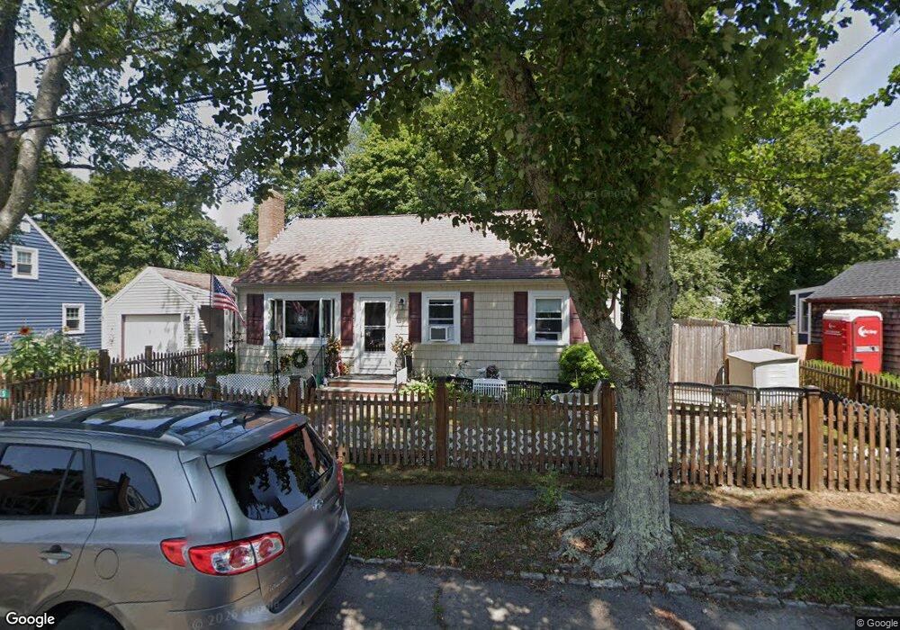
9 Chipman Rd Beverly, MA 01915
North Beverly NeighborhoodEstimated Value: $586,000 - $774,000
3
Beds
1
Bath
1,462
Sq Ft
$464/Sq Ft
Est. Value
About This Home
This home is located at 9 Chipman Rd, Beverly, MA 01915 and is currently estimated at $678,670, approximately $464 per square foot. 9 Chipman Rd is a home located in Essex County with nearby schools including Beverly High School, North Shore Christian School, and Waldorf School at Moraine Farm.
Ownership History
Date
Name
Owned For
Owner Type
Purchase Details
Closed on
May 24, 2021
Sold by
Tries Kenneth L and Tries Patrice M
Bought by
9 Chipman Road Ret and Tries
Current Estimated Value
Purchase Details
Closed on
Oct 10, 2000
Sold by
Ford Arthur M and Ford Dorothy
Bought by
Tries Kenneth L and Tries Patrice M
Home Financials for this Owner
Home Financials are based on the most recent Mortgage that was taken out on this home.
Original Mortgage
$140,000
Interest Rate
7.96%
Mortgage Type
Purchase Money Mortgage
Create a Home Valuation Report for This Property
The Home Valuation Report is an in-depth analysis detailing your home's value as well as a comparison with similar homes in the area
Home Values in the Area
Average Home Value in this Area
Purchase History
| Date | Buyer | Sale Price | Title Company |
|---|---|---|---|
| 9 Chipman Road Ret | -- | None Available | |
| Tries Kenneth L | $140,000 | -- |
Source: Public Records
Mortgage History
| Date | Status | Borrower | Loan Amount |
|---|---|---|---|
| Previous Owner | Tries Kenneth L | $125,000 | |
| Previous Owner | Tries Kenneth L | $140,000 |
Source: Public Records
Tax History
| Year | Tax Paid | Tax Assessment Tax Assessment Total Assessment is a certain percentage of the fair market value that is determined by local assessors to be the total taxable value of land and additions on the property. | Land | Improvement |
|---|---|---|---|---|
| 2025 | $6,467 | $588,400 | $366,600 | $221,800 |
| 2024 | $6,185 | $550,800 | $329,000 | $221,800 |
| 2023 | $5,757 | $511,300 | $289,500 | $221,800 |
| 2022 | $5,788 | $475,600 | $253,800 | $221,800 |
| 2021 | $5,495 | $432,700 | $223,700 | $209,000 |
| 2020 | $5,359 | $417,700 | $208,700 | $209,000 |
| 2019 | $4,970 | $394,000 | $191,800 | $202,200 |
| 2018 | $4,882 | $359,000 | $174,800 | $184,200 |
| 2017 | $4,781 | $334,800 | $150,400 | $184,400 |
| 2016 | $4,547 | $316,000 | $131,600 | $184,400 |
| 2015 | $4,459 | $316,000 | $131,600 | $184,400 |
Source: Public Records
Map
Nearby Homes
- 29 Conant St
- 61 Ellsworth Ave
- 3 Lakeside Ave
- 18 Dunham Rd
- 98 Northridge Rd Unit 98
- 4 Duck Pond Rd Unit 225
- 50 Balch St Unit 300
- 50 Balch St Unit 200
- 50 Balch St Unit 205
- 50 Balch St Unit 308
- 50 Balch St Unit 511
- 50 Balch St Unit 209
- 50 Balch St Unit 409
- 50 Balch St Unit 316
- 50 Balch St Unit 315
- 50 Balch St Unit 103
- 50 Balch St Unit 412
- 50 Balch St Unit 112
- 19 Berrywood Ln
- 12 Stewart Ln
- 7 Chipman Rd
- 11 Chipman Rd
- 5 Chipman Rd
- 10 Chipman Rd
- 8 Chipman Rd
- 13 Chipman Rd
- 12 Chipman Rd
- 3 Chipman Rd
- 26 Chipman Rd
- 20 Conant St
- 20-22 Conant St
- 24 Conant St
- 24 Chipman Rd
- 14 Chipman Rd
- 30 Conant St Unit 3E
- 30 Conant St Unit 3D
- 30 Conant St Unit 3C
- 30 Conant St Unit 3B
- 30 Conant St Unit 3A
- 30 Conant St Unit 2G
Your Personal Tour Guide
Ask me questions while you tour the home.