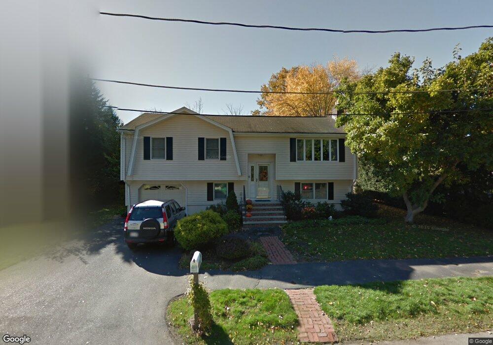
9 Countryside Ln Reading, MA 01867
Estimated Value: $851,000 - $1,005,000
3
Beds
2
Baths
2,029
Sq Ft
$468/Sq Ft
Est. Value
About This Home
This home is located at 9 Countryside Ln, Reading, MA 01867 and is currently estimated at $948,613, approximately $467 per square foot. 9 Countryside Ln is a home located in Middlesex County with nearby schools including Joshua Eaton Elementary School, Walter S. Parker Middle School, and Reading Memorial High School.
Ownership History
Date
Name
Owned For
Owner Type
Purchase Details
Closed on
Jun 13, 2024
Sold by
Curran Florence T
Bought by
Florence T Curran Ret and Curran
Current Estimated Value
Purchase Details
Closed on
Jul 2, 1973
Bought by
Curran James T and Curran Florence T
Create a Home Valuation Report for This Property
The Home Valuation Report is an in-depth analysis detailing your home's value as well as a comparison with similar homes in the area
Home Values in the Area
Average Home Value in this Area
Purchase History
| Date | Buyer | Sale Price | Title Company |
|---|---|---|---|
| Florence T Curran Ret | -- | None Available | |
| Florence T Curran Ret | -- | None Available | |
| Curran James T | -- | -- |
Source: Public Records
Tax History Compared to Growth
Tax History
| Year | Tax Paid | Tax Assessment Tax Assessment Total Assessment is a certain percentage of the fair market value that is determined by local assessors to be the total taxable value of land and additions on the property. | Land | Improvement |
|---|---|---|---|---|
| 2025 | $9,351 | $821,000 | $482,300 | $338,700 |
| 2024 | $9,247 | $789,000 | $463,400 | $325,600 |
| 2023 | $8,963 | $711,900 | $417,800 | $294,100 |
| 2022 | $8,634 | $647,700 | $379,800 | $267,900 |
| 2021 | $8,699 | $629,900 | $363,900 | $266,000 |
| 2020 | $4,976 | $599,700 | $346,300 | $253,400 |
| 2019 | $8,132 | $571,500 | $329,900 | $241,600 |
| 2018 | $7,480 | $539,300 | $311,100 | $228,200 |
| 2017 | $4,667 | $509,100 | $293,500 | $215,600 |
| 2016 | $6,795 | $468,600 | $293,900 | $174,700 |
| 2015 | $6,372 | $433,500 | $271,600 | $161,900 |
| 2014 | $6,176 | $419,000 | $262,400 | $156,600 |
Source: Public Records
Map
Nearby Homes
- 175 West St
- 57 Wescroft Rd
- 133 Pine Ridge Rd
- 75 Border Rd
- 266 West St
- 89 Walnut St
- 246 Walnut St
- 16 Munroe Ave
- 101 King St Unit 101
- 16 Glen Rd
- 35 Park Ave
- 18 Talbot Ln Unit 18
- 237 Main St Unit A4
- 5 Washington St Unit B2
- 16 Taylor Dr Unit 1010
- 16 Taylor Dr Unit 1009
- 13 Elaine Rd
- 62 Abigail Way Unit 2007
- 62 Abigail Way Unit 3004
- 75 Johnson Woods Dr Unit 75