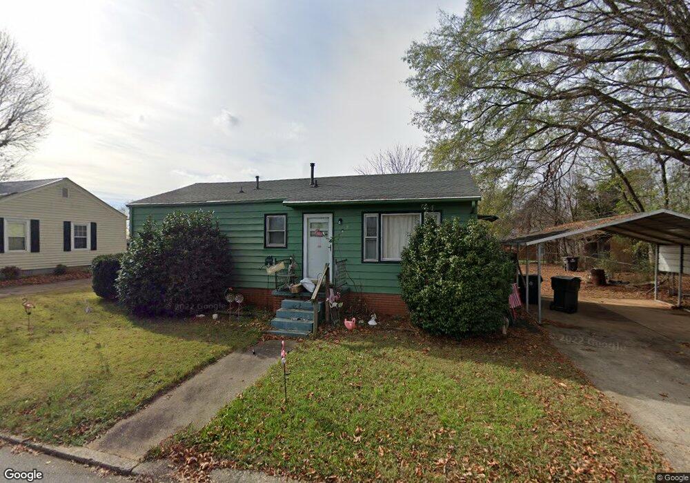
9 Crutchfield Ave Lexington, NC 27292
Estimated Value: $107,748 - $163,000
2
Beds
1
Bath
912
Sq Ft
$142/Sq Ft
Est. Value
About This Home
This home is located at 9 Crutchfield Ave, Lexington, NC 27292 and is currently estimated at $129,187, approximately $141 per square foot. 9 Crutchfield Ave is a home located in Davidson County with nearby schools including South Lexington School, Lexington Middle School, and Lexington Senior High School.
Ownership History
Date
Name
Owned For
Owner Type
Purchase Details
Closed on
Sep 7, 2007
Sold by
Moody Ricky Dale
Bought by
Moyle Geremy S
Current Estimated Value
Home Financials for this Owner
Home Financials are based on the most recent Mortgage that was taken out on this home.
Original Mortgage
$46,800
Outstanding Balance
$29,752
Interest Rate
6.65%
Mortgage Type
Purchase Money Mortgage
Estimated Equity
$99,435
Purchase Details
Closed on
Oct 14, 2002
Bought by
Moody Ricky Dale
Create a Home Valuation Report for This Property
The Home Valuation Report is an in-depth analysis detailing your home's value as well as a comparison with similar homes in the area
Home Values in the Area
Average Home Value in this Area
Purchase History
| Date | Buyer | Sale Price | Title Company |
|---|---|---|---|
| Moyle Geremy S | $52,000 | None Available | |
| Moody Ricky Dale | -- | -- |
Source: Public Records
Mortgage History
| Date | Status | Borrower | Loan Amount |
|---|---|---|---|
| Open | Moyle Geremy S | $46,800 |
Source: Public Records
Tax History Compared to Growth
Tax History
| Year | Tax Paid | Tax Assessment Tax Assessment Total Assessment is a certain percentage of the fair market value that is determined by local assessors to be the total taxable value of land and additions on the property. | Land | Improvement |
|---|---|---|---|---|
| 2025 | $751 | $57,780 | $0 | $0 |
| 2024 | $751 | $57,780 | $0 | $0 |
| 2023 | $751 | $57,780 | $0 | $0 |
| 2022 | $751 | $57,780 | $0 | $0 |
| 2021 | $751 | $57,780 | $0 | $0 |
| 2020 | $562 | $43,550 | $0 | $0 |
| 2019 | $571 | $43,550 | $0 | $0 |
| 2018 | $571 | $43,550 | $0 | $0 |
| 2017 | $571 | $43,550 | $0 | $0 |
| 2016 | $571 | $43,550 | $0 | $0 |
| 2015 | $549 | $43,550 | $0 | $0 |
| 2014 | $668 | $52,990 | $0 | $0 |
Source: Public Records
Map
Nearby Homes
- 306 Pope St
- 26 Harrington Ave
- 386 Harper Mill Cir
- 503 Quail Ln
- 507 Quail Ln
- 337 Owens Ridge Way
- 330 Owens Ridge Way
- 10 E 12th Ave
- 326 Owens Ridge Way
- 333 Owens Ridge Way
- 329 Owens Ridge Way
- 325 Owens Ridge Way
- 341 Owens Ridge Way
- 401 Owens Ridge Way
- 410 Irma Ave
- 405 Owens Ridge Way
- 409 Owens Ridge Way
- 510 Quail Ln
- TAYLOR Plan at Owens Ridge
- HAYDEN Plan at Owens Ridge
- 11 Crutchfield Ave
- 14 Stamey Ave
- 12 Stamey Ave
- 101 Peacock Ave
- 1700 S Main St
- 11 Stamey Ave
- 38 Snider Ave
- 105 Snider Ave
- 220 Aberdeen Dr
- 218 Aberdeen Dr
- 104 Peacock Ave
- 105 Peacock Ave
- 222 Aberdeen Dr
- 214 Aberdeen Dr
- 3 Snider Ave
- 107 Peacock Ave
- 107 Snider Ave
- 108 Peacock Ave
- 225 Aberdeen Dr
- 109 Peacock Ave