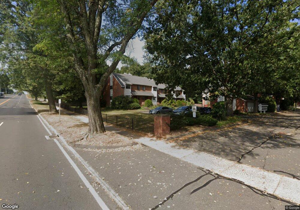
9 Danforth Ln West Hartford, CT 06110
Estimated Value: $288,000 - $321,000
2
Beds
2
Baths
1,278
Sq Ft
$242/Sq Ft
Est. Value
About This Home
This home is located at 9 Danforth Ln, West Hartford, CT 06110 and is currently estimated at $309,308, approximately $242 per square foot. 9 Danforth Ln is a home located in Hartford County with nearby schools including Webster Hill School, Sedgwick Middle School, and Conard High School.
Ownership History
Date
Name
Owned For
Owner Type
Purchase Details
Closed on
Dec 15, 2023
Sold by
Mercier Paula L
Bought by
Sojourn Mortgage Llc
Current Estimated Value
Purchase Details
Closed on
Feb 28, 2021
Sold by
Sojourn Mtg Co Llc and Mercier
Bought by
Mercier Paul A
Purchase Details
Closed on
May 31, 2018
Sold by
Mercier Paula L
Bought by
Mercier Paula L
Purchase Details
Closed on
Sep 21, 2017
Sold by
Shaughnessy John
Bought by
Mercier Paula L
Home Financials for this Owner
Home Financials are based on the most recent Mortgage that was taken out on this home.
Original Mortgage
$148,000
Interest Rate
3.9%
Mortgage Type
New Conventional
Purchase Details
Closed on
Aug 22, 2017
Sold by
Shaughnessy Marcia
Bought by
Shaughnessy John
Home Financials for this Owner
Home Financials are based on the most recent Mortgage that was taken out on this home.
Original Mortgage
$148,000
Interest Rate
3.9%
Mortgage Type
New Conventional
Purchase Details
Closed on
Jul 8, 2013
Sold by
Boerum Gerald and Boerum Angelina
Bought by
Shaughnessy Marcia and Shaughnessy John
Purchase Details
Closed on
Aug 27, 2012
Sold by
Mandelbaum Andrea
Bought by
Boerum Gerald and Boerum Angelina
Home Financials for this Owner
Home Financials are based on the most recent Mortgage that was taken out on this home.
Original Mortgage
$123,200
Interest Rate
3.61%
Mortgage Type
New Conventional
Purchase Details
Closed on
Mar 29, 2007
Sold by
Davis Ryan A and Davis Tara M
Bought by
Mandel-Baum Andrea
Purchase Details
Closed on
Jan 5, 2005
Sold by
Curry Dorisann B
Bought by
Davis Ryan A and Davis Tara M
Purchase Details
Closed on
Jun 2, 1993
Sold by
Guthrie Eleanor
Bought by
Curry Dorisann
Purchase Details
Closed on
Aug 23, 1991
Sold by
Carlo Anthony
Bought by
Guthrie Eleanor
Create a Home Valuation Report for This Property
The Home Valuation Report is an in-depth analysis detailing your home's value as well as a comparison with similar homes in the area
Home Values in the Area
Average Home Value in this Area
Purchase History
| Date | Buyer | Sale Price | Title Company |
|---|---|---|---|
| Sojourn Mortgage Llc | -- | None Available | |
| Sojourn Mortgage Llc | -- | None Available | |
| Mercier Paul A | -- | None Available | |
| Mercier Paul A | -- | None Available | |
| Mercier Paula L | -- | -- | |
| Mercier Paula L | -- | -- | |
| Mercier Paula L | $185,000 | -- | |
| Mercier Paula L | $185,000 | -- | |
| Shaughnessy John | -- | -- | |
| Shaughnessy John | -- | -- | |
| Shaughnessy Marcia | $170,000 | -- | |
| Shaughnessy Marcia | $170,000 | -- | |
| Boerum Gerald | $154,000 | -- | |
| Boerum Gerald | $154,000 | -- | |
| Mandel-Baum Andrea | $195,000 | -- | |
| Mandel-Baum Andrea | $195,000 | -- | |
| Davis Ryan A | $163,000 | -- | |
| Davis Ryan A | $163,000 | -- | |
| Curry Dorisann | $107,000 | -- | |
| Curry Dorisann | $107,000 | -- | |
| Guthrie Eleanor | $116,400 | -- |
Source: Public Records
Mortgage History
| Date | Status | Borrower | Loan Amount |
|---|---|---|---|
| Previous Owner | Mercier Paula L | $148,000 | |
| Previous Owner | Boerum Gerald | $123,200 |
Source: Public Records
Tax History Compared to Growth
Tax History
| Year | Tax Paid | Tax Assessment Tax Assessment Total Assessment is a certain percentage of the fair market value that is determined by local assessors to be the total taxable value of land and additions on the property. | Land | Improvement |
|---|---|---|---|---|
| 2025 | $5,802 | $129,570 | $0 | $129,570 |
| 2024 | $5,487 | $129,570 | $0 | $129,570 |
| 2023 | $5,302 | $129,570 | $0 | $129,570 |
| 2022 | $5,271 | $129,570 | $0 | $129,570 |
| 2021 | $5,051 | $119,070 | $0 | $119,070 |
| 2020 | $5,006 | $119,770 | $0 | $119,770 |
| 2019 | $5,006 | $119,770 | $0 | $119,770 |
| 2018 | $4,911 | $119,770 | $0 | $119,770 |
| 2017 | $4,915 | $119,770 | $0 | $119,770 |
| 2016 | $4,417 | $111,790 | $0 | $111,790 |
| 2015 | $4,283 | $111,790 | $0 | $111,790 |
| 2014 | $4,178 | $111,790 | $0 | $111,790 |
Source: Public Records
Map
Nearby Homes
- 39 Cortland St
- 18 Federal St
- 49 Somerset St
- 61 Colonial St
- 1145 New Britain Ave
- 422 S Main St
- 90 Park Place Cir Unit 90
- 49 Park Place Cir Unit 49
- 107 Westgate St
- 479 S Main St
- 123 Grove St
- 148 Colonial St
- 108 Newington Rd
- 121 Cambridge St
- 24 Thorne Rd Unit 24
- 204 Trout Brook Dr
- 17 Parkview Rd
- 1 Valley Crest Dr
- 96 Bentwood Rd
- 741 Quaker Ln S
- 8 Kingsley Ct
- 6 Kingsley Ct
- 4 Kingsley Ct
- 9 Kingsley Ct
- 7 Kingsley Ct
- 5 Kingsley Ct
- 8 Danforth Ln
- 6 Danforth Ln
- 4 Danforth Ln
- 7 Danforth Ln
- 37 Danforth Ln
- 35 Danforth Ln
- 33 Danforth Ln
- 35 Danforth Ln Unit 35
- 7 Kingsley Ct Unit 7
- 9 Kingsley Ct Unit 9
- 7 Danforth Ln Unit 7
- 6 Kingsley Ct Unit 6
- 9 Danforth Ln Unit 9
- 37 Danforth Ln Unit 37