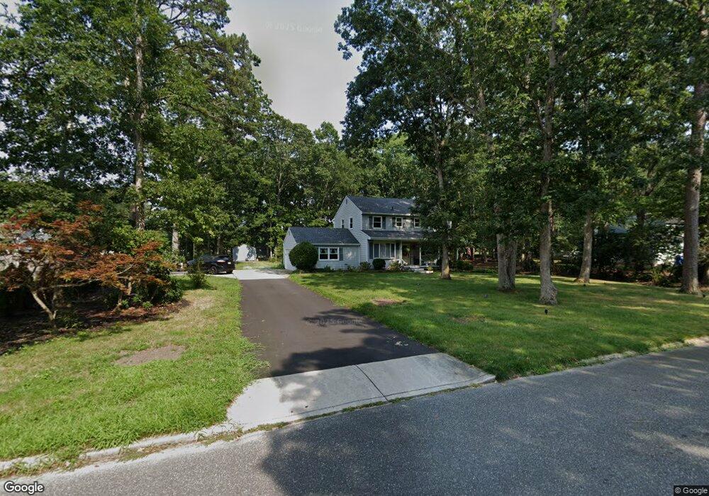
9 Dawn Rd Woodbine, NJ 08270
Estimated Value: $300,000 - $511,000
--
Bed
--
Bath
2,176
Sq Ft
$187/Sq Ft
Est. Value
About This Home
This home is located at 9 Dawn Rd, Woodbine, NJ 08270 and is currently estimated at $407,192, approximately $187 per square foot. 9 Dawn Rd is a home located in Cape May County with nearby schools including Upper Township Primary School, Upper Township Elementary School, and Upper Township Middle School.
Ownership History
Date
Name
Owned For
Owner Type
Purchase Details
Closed on
Oct 31, 2023
Sold by
Bunting Robert R
Bought by
Clark Alexandra and Clark Gregory J
Current Estimated Value
Home Financials for this Owner
Home Financials are based on the most recent Mortgage that was taken out on this home.
Original Mortgage
$311,355
Outstanding Balance
$305,593
Interest Rate
7.19%
Mortgage Type
FHA
Estimated Equity
$101,599
Purchase Details
Closed on
Jan 21, 2011
Sold by
Muller Dianne M and Bunting Dianne M
Bought by
Bunting Robert R
Home Financials for this Owner
Home Financials are based on the most recent Mortgage that was taken out on this home.
Original Mortgage
$175,568
Interest Rate
4.76%
Mortgage Type
New Conventional
Create a Home Valuation Report for This Property
The Home Valuation Report is an in-depth analysis detailing your home's value as well as a comparison with similar homes in the area
Home Values in the Area
Average Home Value in this Area
Purchase History
| Date | Buyer | Sale Price | Title Company |
|---|---|---|---|
| Clark Alexandra | $340,000 | Freedom Title | |
| Clark Alexandra | $340,000 | Freedom Title | |
| Bunting Robert R | $120,000 | None Available |
Source: Public Records
Mortgage History
| Date | Status | Borrower | Loan Amount |
|---|---|---|---|
| Open | Clark Alexandra | $311,355 | |
| Closed | Clark Alexandra | $311,355 | |
| Previous Owner | Bunting Robert R | $175,568 |
Source: Public Records
Tax History Compared to Growth
Tax History
| Year | Tax Paid | Tax Assessment Tax Assessment Total Assessment is a certain percentage of the fair market value that is determined by local assessors to be the total taxable value of land and additions on the property. | Land | Improvement |
|---|---|---|---|---|
| 2025 | $5,977 | $253,800 | $92,500 | $161,300 |
| 2024 | $5,977 | $253,800 | $92,500 | $161,300 |
| 2023 | $5,443 | $253,800 | $92,500 | $161,300 |
| 2022 | $5,268 | $253,800 | $92,500 | $161,300 |
| 2021 | $3,760 | $253,800 | $92,500 | $161,300 |
| 2020 | $4,884 | $253,800 | $92,500 | $161,300 |
| 2019 | $4,768 | $253,800 | $92,500 | $161,300 |
| 2018 | $4,641 | $253,800 | $92,500 | $161,300 |
| 2017 | $4,580 | $253,800 | $92,500 | $161,300 |
| 2016 | $4,204 | $230,300 | $92,500 | $137,800 |
| 2015 | $4,323 | $230,300 | $92,500 | $137,800 |
| 2014 | $4,870 | $318,900 | $164,900 | $154,000 |
Source: Public Records
Map
Nearby Homes
- 1520 Route 50
- 781 Route 50
- 3 Farm Rd
- 240 Dennisville-Petersburg Rd
- 9 Deerfield Trail
- 1981 Tuckahoe Rd
- 17 Deerfield Trail
- 50 School House Ln
- 78 Tyler Rd
- 27 Cedar Ave
- 10 New Jersey 50
- 115 Rte 50
- 6 Ash St
- 301 Heine Ave
- 127 Route 50
- 11 Laurel Ridge Rd
- 000 New Jersey 49
- 13 Mooring Cir
- 86 Route 50
- 81 Flounder