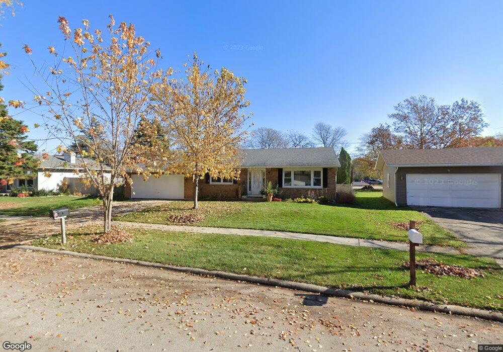
9 Devonshire Cir Elgin, IL 60123
Century Oaks West NeighborhoodEstimated Value: $317,036 - $386,000
4
Beds
--
Bath
1,862
Sq Ft
$194/Sq Ft
Est. Value
About This Home
This home is located at 9 Devonshire Cir, Elgin, IL 60123 and is currently estimated at $361,259, approximately $194 per square foot. 9 Devonshire Cir is a home located in Kane County with nearby schools including Century Oaks Elementary School, Kimball Middle School, and Larkin High School.
Ownership History
Date
Name
Owned For
Owner Type
Purchase Details
Closed on
Jul 22, 2003
Sold by
Leon Alfonzo and Leon Huvertina
Bought by
Leon Alfonzo and Leon Huvertina
Current Estimated Value
Purchase Details
Closed on
Jun 18, 1997
Sold by
Mcconnell Dan G and Mcconnell Dianne E
Bought by
Leon Alfonso and Leon Juan M
Home Financials for this Owner
Home Financials are based on the most recent Mortgage that was taken out on this home.
Original Mortgage
$124,642
Outstanding Balance
$17,422
Interest Rate
7.71%
Mortgage Type
FHA
Estimated Equity
$343,837
Create a Home Valuation Report for This Property
The Home Valuation Report is an in-depth analysis detailing your home's value as well as a comparison with similar homes in the area
Home Values in the Area
Average Home Value in this Area
Purchase History
| Date | Buyer | Sale Price | Title Company |
|---|---|---|---|
| Leon Alfonzo | -- | City Wide Title | |
| Leon Alfonso | $84,000 | First American Title Ins Co |
Source: Public Records
Mortgage History
| Date | Status | Borrower | Loan Amount |
|---|---|---|---|
| Open | Leon Alfonso | $124,642 |
Source: Public Records
Tax History
| Year | Tax Paid | Tax Assessment Tax Assessment Total Assessment is a certain percentage of the fair market value that is determined by local assessors to be the total taxable value of land and additions on the property. | Land | Improvement |
|---|---|---|---|---|
| 2024 | $6,358 | $91,262 | $22,824 | $68,438 |
| 2023 | $5,963 | $82,114 | $20,536 | $61,578 |
| 2022 | $4,399 | $62,333 | $20,536 | $41,797 |
| 2021 | $4,510 | $58,855 | $19,390 | $39,465 |
| 2020 | $4,458 | $57,532 | $18,954 | $38,578 |
| 2019 | $4,291 | $54,615 | $17,993 | $36,622 |
| 2018 | $4,428 | $53,534 | $17,637 | $35,897 |
| 2017 | $4,233 | $50,079 | $16,499 | $33,580 |
| 2016 | $5,241 | $52,082 | $19,528 | $32,554 |
| 2015 | -- | $48,802 | $18,298 | $30,504 |
| 2014 | -- | $47,455 | $17,793 | $29,662 |
| 2013 | -- | $48,908 | $18,338 | $30,570 |
Source: Public Records
Map
Nearby Homes
- 1348 Sheffield Dr
- 14 Devonshire Cir Unit 1
- 1583 Sheffield Dr Unit 85
- 1212 Century Oaks Dr
- 43 Creekside Cir Unit A
- 1932 Banks Dr
- 1009 Meadow Ln
- 938 Hillcrest Rd
- 1865 Kevin Ave Unit 5
- 801 N Mclean Blvd Unit 320
- 801 N Mclean Blvd Unit 118
- 801 N Mclean Blvd Unit 124
- 801 N Mclean Blvd Unit 222
- 2176 Jordan Ln
- 1167 Florimond Dr
- 1104 Florimond Dr
- 36W628 Oak Hill Dr
- 36W474 Hickory Hollow Dr
- 10 Chateau Dr
- 1419 Harlan Ave
- 7 Devonshire Cir
- 11 Devonshire Cir
- 13 Devonshire Cir
- 5 Devonshire Cir
- 6 Devonshire Cir
- 10 Devonshire Cir
- 3 Devonshire Cir
- 12 Devonshire Cir
- 15 Devonshire Cir
- 4 Devonshire Cir
- 1369 Sheffield Dr
- 17 Devonshire Cir
- 1359 Sheffield Dr
- 1387 Sheffield Dr
- 1379 Sheffield Dr
- 16 Devonshire Cir
- 1393 Sheffield Dr
- 1403 Sheffield Dr
- 1353 Sheffield Dr
- 19 Devonshire Cir
Your Personal Tour Guide
Ask me questions while you tour the home.