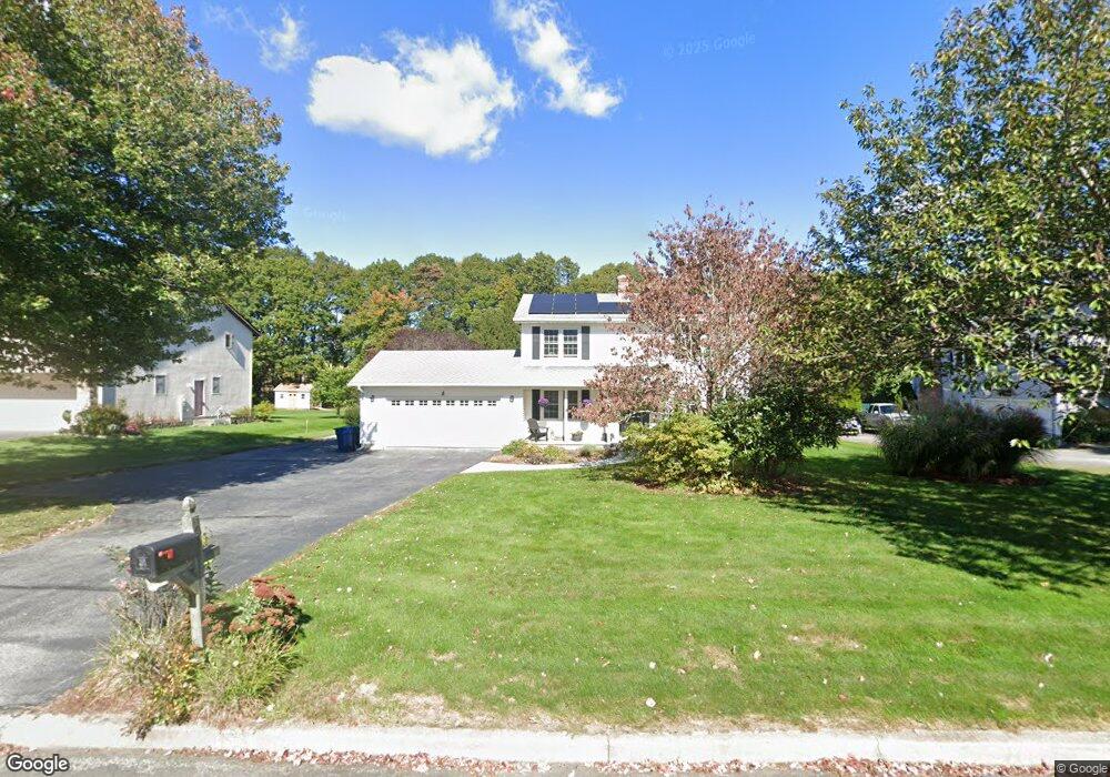
9 Devonshire Dr Waterford, CT 06385
Estimated Value: $441,431 - $473,000
3
Beds
3
Baths
1,536
Sq Ft
$299/Sq Ft
Est. Value
About This Home
This home is located at 9 Devonshire Dr, Waterford, CT 06385 and is currently estimated at $459,858, approximately $299 per square foot. 9 Devonshire Dr is a home located in New London County with nearby schools including Clark Lane Middle School, Waterford High School, and New London High School Multi-Magnet Campus.
Ownership History
Date
Name
Owned For
Owner Type
Purchase Details
Closed on
Jul 10, 2019
Sold by
Hosmer Sean C
Bought by
Hosmer Kasey M
Current Estimated Value
Purchase Details
Closed on
Jun 19, 1998
Sold by
Lubchansky Steven and Lubchansky Pamela Jo
Bought by
Hosmer Sean C
Create a Home Valuation Report for This Property
The Home Valuation Report is an in-depth analysis detailing your home's value as well as a comparison with similar homes in the area
Home Values in the Area
Average Home Value in this Area
Purchase History
| Date | Buyer | Sale Price | Title Company |
|---|---|---|---|
| Hosmer Kasey M | -- | -- | |
| Hosmer Sean C | $165,000 | -- |
Source: Public Records
Mortgage History
| Date | Status | Borrower | Loan Amount |
|---|---|---|---|
| Previous Owner | Hosmer Sean C | $236,000 | |
| Previous Owner | Hosmer Sean C | $279,000 | |
| Previous Owner | Hosmer Sean C | $212,000 |
Source: Public Records
Tax History
| Year | Tax Paid | Tax Assessment Tax Assessment Total Assessment is a certain percentage of the fair market value that is determined by local assessors to be the total taxable value of land and additions on the property. | Land | Improvement |
|---|---|---|---|---|
| 2025 | $5,211 | $223,060 | $85,360 | $137,700 |
| 2024 | $4,974 | $223,060 | $85,360 | $137,700 |
| 2023 | $4,729 | $223,060 | $85,360 | $137,700 |
| 2022 | $5,145 | $186,670 | $68,130 | $118,540 |
| 2021 | $5,160 | $186,670 | $68,130 | $118,540 |
| 2020 | $5,202 | $186,670 | $68,130 | $118,540 |
| 2019 | $5,223 | $186,670 | $68,130 | $118,540 |
| 2018 | $5,118 | $186,670 | $68,130 | $118,540 |
| 2017 | $4,638 | $171,570 | $55,740 | $115,830 |
| 2016 | $4,595 | $171,570 | $55,740 | $115,830 |
| 2015 | $4,432 | $171,570 | $55,740 | $115,830 |
| 2014 | $4,432 | $171,570 | $55,740 | $115,830 |
Source: Public Records
Map
Nearby Homes
- 22 Woodlawn Ave
- 140 Waterford Pkwy S
- 213 Boston Post Rd
- 59 Vivian St
- 19 Olive St
- 310 Boston Post Rd Unit 76
- 310 Boston Post Rd Unit 152
- 42 Roseleah Dr
- 26 Beechwood Dr
- 54 Rope Ferry Rd Unit C55
- 54 Rope Ferry Rd Unit I154
- 54 Rope Ferry Rd Unit C45
- 54 Rope Ferry Rd Unit C42
- 54 Rope Ferry Rd Unit I151
- 12 Beechwood Dr
- 16 Longview Ave
- 49 Cross Rd
- 385 Broad St
- 35 Pine St
- 24 Pine St
- 11 Devonshire Dr
- 7 Devonshire Dr
- 13 Devonshire Dr
- 5 Devonshire Dr
- 15 Devonshire Dr
- 8 Devonshire Dr
- 6 Devonshire Dr
- 3 Devonshire Dr
- 45 Fog Plain Rd
- 17 Devonshire Dr
- 4 Devonshire Dr
- 43 Fog Plain Rd
- 10 Devonshire Dr
- 55R Fog Plain Rd
- 12 Devonshire Dr
- 53 Fog Plain Rd
- 14 Devonshire Dr
- 19 Devonshire Dr
- 16 Devonshire Dr
- 55 Fog Plain Rd
Your Personal Tour Guide
Ask me questions while you tour the home.