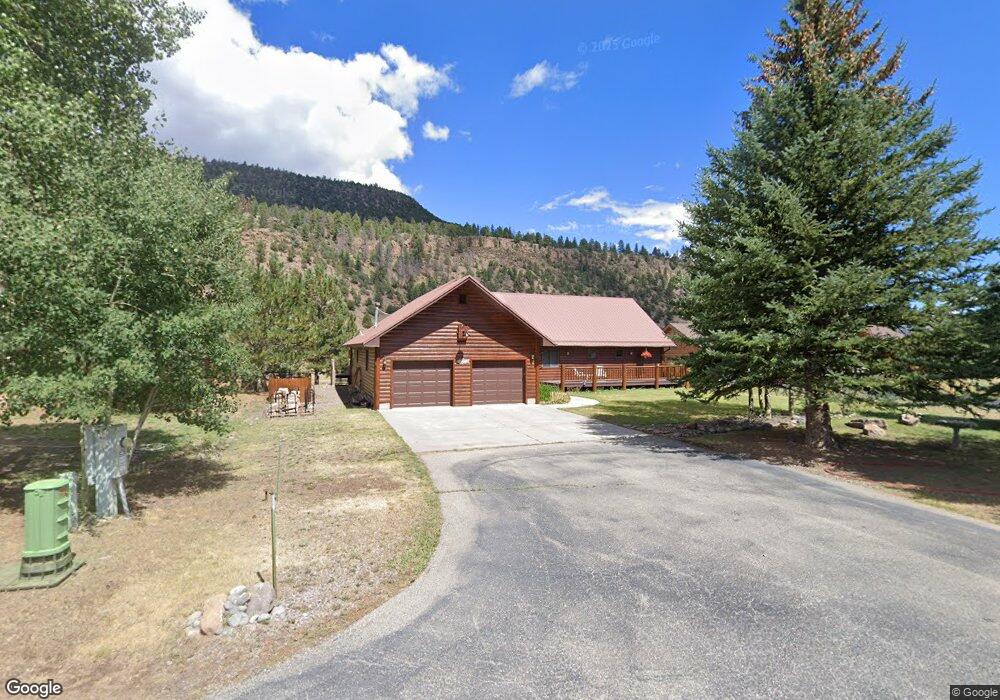
9 Doe Cir South Fork, CO 81154
Estimated Value: $793,098 - $1,072,000
3
Beds
3
Baths
2,454
Sq Ft
$361/Sq Ft
Est. Value
About This Home
This home is located at 9 Doe Cir, South Fork, CO 81154 and is currently estimated at $885,525, approximately $360 per square foot. 9 Doe Cir is a home located in Rio Grande County with nearby schools including Del Norte K-8 School and Del Norte High School.
Ownership History
Date
Name
Owned For
Owner Type
Purchase Details
Closed on
Jan 30, 2018
Sold by
Carroll Mike S and Carroll Judy N
Bought by
Barrett Lin Morgan
Current Estimated Value
Home Financials for this Owner
Home Financials are based on the most recent Mortgage that was taken out on this home.
Original Mortgage
$190,000
Outstanding Balance
$160,710
Interest Rate
3.94%
Mortgage Type
New Conventional
Estimated Equity
$724,815
Purchase Details
Closed on
Aug 21, 2008
Sold by
Mans C James and Mans Frances K
Bought by
Carroll Mike S and Carroll Judy N
Home Financials for this Owner
Home Financials are based on the most recent Mortgage that was taken out on this home.
Original Mortgage
$41,838
Interest Rate
6.42%
Mortgage Type
Purchase Money Mortgage
Create a Home Valuation Report for This Property
The Home Valuation Report is an in-depth analysis detailing your home's value as well as a comparison with similar homes in the area
Purchase History
| Date | Buyer | Sale Price | Title Company |
|---|---|---|---|
| Barrett Lin Morgan | $525,000 | South Fork Title | |
| Carroll Mike S | $470,000 | None Available |
Source: Public Records
Mortgage History
| Date | Status | Borrower | Loan Amount |
|---|---|---|---|
| Open | Barrett Lin Morgan | $190,000 | |
| Previous Owner | Carroll Mike S | $41,838 |
Source: Public Records
Tax History
| Year | Tax Paid | Tax Assessment Tax Assessment Total Assessment is a certain percentage of the fair market value that is determined by local assessors to be the total taxable value of land and additions on the property. | Land | Improvement |
|---|---|---|---|---|
| 2024 | $3,166 | $41,654 | $9,510 | $32,144 |
| 2023 | $2,701 | $41,654 | $9,510 | $32,144 |
| 2022 | $1,875 | $28,830 | $5,694 | $23,136 |
| 2021 | $1,898 | $29,659 | $5,858 | $23,801 |
| 2020 | $2,057 | $32,013 | $5,858 | $26,155 |
| 2019 | $2,060 | $32,013 | $5,858 | $26,155 |
| 2018 | $2,028 | $31,347 | $0 | $0 |
| 2017 | $2,045 | $31,347 | $0 | $0 |
| 2016 | $1,611 | $31,882 | $0 | $0 |
| 2015 | $1,645 | $31,882 | $0 | $0 |
| 2014 | $1,645 | $32,464 | $0 | $0 |
| 2013 | $1,307 | $32,464 | $0 | $0 |
Source: Public Records
Map
Nearby Homes
- 526 Vista Del Rio Dr
- TBD Colorado 149
- 120 East St
- 59 Spruce Dr W
- 0 Ellingwood Dr Unit 829439
- TBD Little Bear Circle Lot 55
- TBD Little Bear Circle Lot 54
- 0253 Aspen Cir
- TBD Little Bear Circle Lot 41
- 580 Blanca Vista Dr
- 530 Blanca Vista Dr
- 24 E Ciffside Dr
- 548 Blanca Vista Dr
- 136 Hopi Ct
- 65 Timberline Trail
- 222 Bristle Cone Dr
- 26 Upper Reserve Dr
- 11 Blanca Vista Dr
- 7 Blanca Vista Dr
- 254 Timberline Trail
Your Personal Tour Guide
Ask me questions while you tour the home.