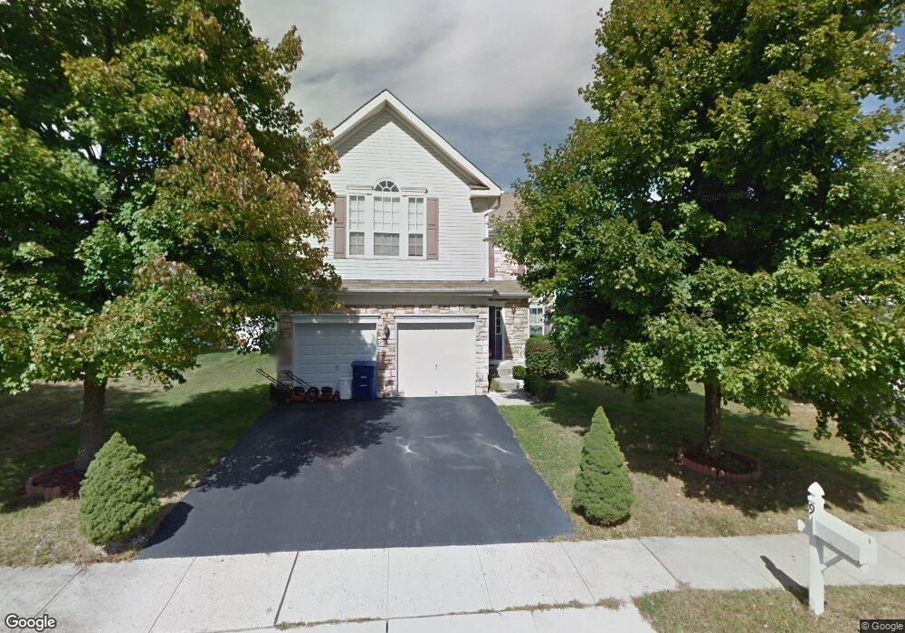
9 Durham Dr Columbus, NJ 08022
Estimated Value: $626,000 - $670,000
Studio
--
Bath
2,646
Sq Ft
$243/Sq Ft
Est. Value
About This Home
This home is located at 9 Durham Dr, Columbus, NJ 08022 and is currently estimated at $644,062, approximately $243 per square foot. 9 Durham Dr is a home located in Burlington County with nearby schools including John Hydock Elementary School, Mansfield Township Elementary School, and Northern Burlington County Regional Middle School.
Ownership History
Date
Name
Owned For
Owner Type
Purchase Details
Closed on
Mar 20, 2006
Sold by
Smith Ellis D and Smith Annette M
Bought by
Anderson Ronald Charles and Anderson Kathina G
Current Estimated Value
Home Financials for this Owner
Home Financials are based on the most recent Mortgage that was taken out on this home.
Original Mortgage
$78,800
Outstanding Balance
$44,928
Interest Rate
6.32%
Mortgage Type
Stand Alone Second
Estimated Equity
$599,134
Create a Home Valuation Report for This Property
The Home Valuation Report is an in-depth analysis detailing your home's value as well as a comparison with similar homes in the area
Home Values in the Area
Average Home Value in this Area
Purchase History
| Date | Buyer | Sale Price | Title Company |
|---|---|---|---|
| Anderson Ronald Charles | $396,400 | Fidelity Natl Title Ins Co |
Source: Public Records
Mortgage History
| Date | Status | Borrower | Loan Amount |
|---|---|---|---|
| Open | Anderson Ronald Charles | $78,800 | |
| Previous Owner | Anderson Ronald Charles | $315,500 |
Source: Public Records
Tax History Compared to Growth
Tax History
| Year | Tax Paid | Tax Assessment Tax Assessment Total Assessment is a certain percentage of the fair market value that is determined by local assessors to be the total taxable value of land and additions on the property. | Land | Improvement |
|---|---|---|---|---|
| 2025 | $8,116 | $250,100 | $66,700 | $183,400 |
| 2024 | $8,173 | $250,100 | $66,700 | $183,400 |
| 2023 | $8,173 | $250,100 | $66,700 | $183,400 |
| 2022 | $8,256 | $250,100 | $66,700 | $183,400 |
| 2021 | $8,428 | $250,100 | $66,700 | $183,400 |
| 2020 | $8,338 | $250,100 | $66,700 | $183,400 |
| 2019 | $8,133 | $250,100 | $66,700 | $183,400 |
| 2018 | $7,798 | $250,100 | $66,700 | $183,400 |
| 2017 | $7,793 | $250,100 | $66,700 | $183,400 |
| 2016 | $7,798 | $250,100 | $66,700 | $183,400 |
| 2015 | $7,718 | $250,100 | $66,700 | $183,400 |
| 2014 | $7,398 | $250,100 | $66,700 | $183,400 |
Source: Public Records
Map
Nearby Homes
- 43 Barbary Ln
- 5 Pheasant Ct
- 3 Jasper Dr
- 25 Ellington Dr
- 36 White Pine Rd
- 27058 Mount Pleasant Rd
- 0 Bordentown Georgetown Rd
- 199 Bordentown Georgetown Rd
- 220-240 White Pine Rd
- 17 Belmont Cir
- 478 Island Rd
- 145 White Pine Rd
- 2717 Monmouth Rd
- 2707 Monmouth Rd
- 707 Route 68
- 183 Bordentown Georgetown Rd
- 58 Sykesville Rd
- 618 Chesterfield Arneytown Rd
- 259 Sykesville Rd
- 350 New York Ave