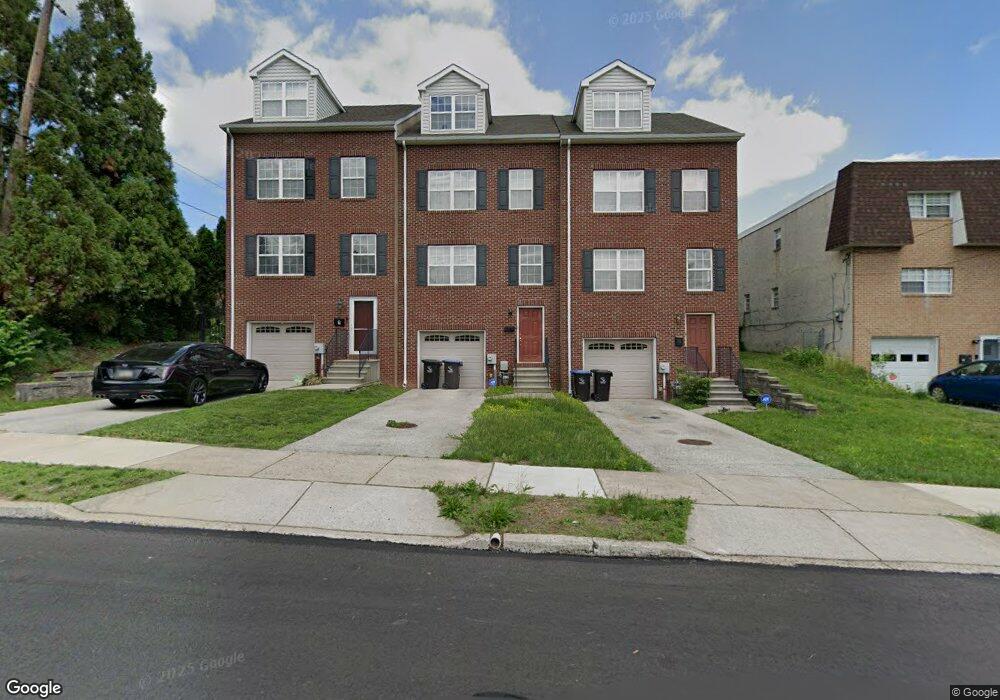
9 E Roberts St Norristown, PA 19401
Estimated Value: $358,000 - $453,000
3
Beds
3
Baths
2,200
Sq Ft
$190/Sq Ft
Est. Value
About This Home
This home is located at 9 E Roberts St, Norristown, PA 19401 and is currently estimated at $418,228, approximately $190 per square foot. 9 E Roberts St is a home located in Montgomery County with nearby schools including Hancock Elementary School, Charles Blockson Middle School, and East Norriton Middle School.
Ownership History
Date
Name
Owned For
Owner Type
Purchase Details
Closed on
Oct 22, 2009
Sold by
Stein Kimberley and Stein David S
Bought by
Lara Mark and Lara Deborah
Current Estimated Value
Home Financials for this Owner
Home Financials are based on the most recent Mortgage that was taken out on this home.
Original Mortgage
$289,136
Outstanding Balance
$188,608
Interest Rate
5.06%
Mortgage Type
VA
Estimated Equity
$229,620
Purchase Details
Closed on
Oct 31, 2006
Sold by
9 East Roberts Llc and Mcclain Scott A
Bought by
Stein David S and Stein Kimberly
Home Financials for this Owner
Home Financials are based on the most recent Mortgage that was taken out on this home.
Original Mortgage
$214,720
Interest Rate
6.33%
Purchase Details
Closed on
Dec 1, 2004
Sold by
Not Provided
Bought by
Not Provided
Purchase Details
Closed on
Nov 11, 2004
Sold by
Not Provided
Bought by
Not Provided
Purchase Details
Closed on
Nov 27, 1996
Sold by
Young Percy L and Young Mae F
Bought by
Young Percy L
Create a Home Valuation Report for This Property
The Home Valuation Report is an in-depth analysis detailing your home's value as well as a comparison with similar homes in the area
Home Values in the Area
Average Home Value in this Area
Purchase History
| Date | Buyer | Sale Price | Title Company |
|---|---|---|---|
| Lara Mark | $279,900 | None Available | |
| Stein David S | $268,400 | None Available | |
| Not Provided | $50,000 | -- | |
| Not Provided | $50,000 | -- | |
| Young Percy L | -- | -- |
Source: Public Records
Mortgage History
| Date | Status | Borrower | Loan Amount |
|---|---|---|---|
| Open | Lara Mark | $289,136 | |
| Previous Owner | Stein David S | $214,720 |
Source: Public Records
Tax History Compared to Growth
Tax History
| Year | Tax Paid | Tax Assessment Tax Assessment Total Assessment is a certain percentage of the fair market value that is determined by local assessors to be the total taxable value of land and additions on the property. | Land | Improvement |
|---|---|---|---|---|
| 2025 | $8,724 | $142,130 | -- | -- |
| 2024 | $8,724 | $142,130 | -- | -- |
| 2023 | $8,645 | $142,130 | $0 | $0 |
| 2022 | $8,459 | $142,130 | $0 | $0 |
| 2021 | $8,418 | $142,130 | $0 | $0 |
| 2020 | $8,030 | $142,130 | $0 | $0 |
| 2019 | $7,884 | $142,130 | $0 | $0 |
| 2018 | $5,001 | $142,130 | $0 | $0 |
| 2017 | $7,240 | $142,130 | $0 | $0 |
| 2016 | $7,185 | $142,130 | $0 | $0 |
| 2015 | $6,882 | $142,130 | $0 | $0 |
| 2014 | $6,882 | $142,130 | $0 | $0 |
Source: Public Records
Map
Nearby Homes
- 1642 Locust St
- 1615 Dekalb St
- 4 W Johnson Hwy
- 253 Chapel Ct Unit 84A
- 249 Chapel Ct Dr Unit 82C
- 247 Chapel Ct Unit 81C
- 29 E Freedley St
- 1515 Dekalb St Unit 116
- 268 Harmony Ct Unit 76C
- 270 Harmony Ct Unit 77B
- 236 Chapel Ct Unit 32E
- 1854 Arbor Place Dr Unit 50W
- 28 W Freedley St
- 1846 Arbor Place Dr Unit 46S
- 1801 Arch St Unit 24W
- 1838 Arbor Place Dr Unit 42S
- 1803 Arch St
- 1840 Arbor Place Dr Unit 43E
- 1805 Arch St Unit 22E
- 1848 Arbor Place Dr Unit 47E
- 11 E Roberts St
- 7 E Roberts St
- 13 E Roberts St
- 15 E Roberts St
- 1710 Powell St
- 1700 Powell St
- 1712 Powell St
- 1708 Powell St
- 1711 Willow St Unit 10
- 1714 Powell St
- 1716 Powell St
- 1659 Willow St
- 1652 Powell St
- 1713 Willow St
- 1718 Powell St
- 1657 Willow St
- 1650 Powell St
- 1715 Willow St
- 1655 Willow St
- 1648 Powell St