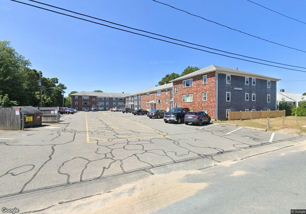
9 Edwards Ave Unit 11 Dennis Port, MA 02639
Dennis Port NeighborhoodEstimated Value: $253,000 - $301,000
2
Beds
1
Bath
887
Sq Ft
$310/Sq Ft
Est. Value
About This Home
This home is located at 9 Edwards Ave Unit 11, Dennis Port, MA 02639 and is currently estimated at $274,962, approximately $309 per square foot. 9 Edwards Ave Unit 11 is a home located in Barnstable County with nearby schools including Dennis-Yarmouth Regional High School and St. Pius X. School.
Ownership History
Date
Name
Owned For
Owner Type
Purchase Details
Closed on
Jan 6, 2020
Sold by
Kelley William D
Bought by
Burke Glenroy S
Current Estimated Value
Home Financials for this Owner
Home Financials are based on the most recent Mortgage that was taken out on this home.
Original Mortgage
$83,000
Outstanding Balance
$73,647
Interest Rate
3.6%
Mortgage Type
New Conventional
Estimated Equity
$210,904
Purchase Details
Closed on
Dec 6, 2004
Sold by
Sullivan Jane F
Bought by
Kelley William D
Create a Home Valuation Report for This Property
The Home Valuation Report is an in-depth analysis detailing your home's value as well as a comparison with similar homes in the area
Home Values in the Area
Average Home Value in this Area
Purchase History
| Date | Buyer | Sale Price | Title Company |
|---|---|---|---|
| Burke Glenroy S | $143,000 | None Available | |
| Kelley William D | $136,500 | -- |
Source: Public Records
Mortgage History
| Date | Status | Borrower | Loan Amount |
|---|---|---|---|
| Open | Burke Glenroy S | $83,000 |
Source: Public Records
Tax History Compared to Growth
Tax History
| Year | Tax Paid | Tax Assessment Tax Assessment Total Assessment is a certain percentage of the fair market value that is determined by local assessors to be the total taxable value of land and additions on the property. | Land | Improvement |
|---|---|---|---|---|
| 2025 | $1,122 | $259,200 | $0 | $259,200 |
| 2024 | $981 | $223,500 | $0 | $223,500 |
| 2023 | $856 | $183,200 | $0 | $183,200 |
| 2022 | $837 | $149,400 | $0 | $149,400 |
| 2021 | $852 | $141,300 | $0 | $141,300 |
| 2020 | $809 | $132,600 | $0 | $132,600 |
| 2019 | $787 | $127,600 | $0 | $127,600 |
| 2018 | $692 | $109,200 | $0 | $109,200 |
| 2017 | $568 | $92,400 | $0 | $92,400 |
| 2016 | $523 | $80,100 | $0 | $80,100 |
| 2015 | $513 | $80,100 | $0 | $80,100 |
| 2014 | $509 | $80,100 | $0 | $80,100 |
Source: Public Records
Map
Nearby Homes
- 9 Edwards Ave Unit B1
- 16 Edwards Ave
- 10 South St Unit 2-1
- 157 Depot St Unit 3
- 73 Division St
- 26 Manning Rd
- 12 Cross St
- 22 Manning Rd
- 13 Garden Ln
- 13 Garden Ln
- 1 Redwing Place Unit 1 & 3
- 91 Depot St Unit 10
- 47 Telegraph Rd Unit 1
- 141 Division St
- 141 Division St
- 435 Main St Unit 1
- 248 Sea St
- 56 Center St Unit 1-5
- 9 Country Ln
- 45 Route 28
- 9 Edwards Ave Unit B4
- 9 Edwards Ave Unit B5
- 9 Edwards Ave Unit 9A
- 9 Edwards Ave Unit E1
- 9 Edwards Ave Unit D2
- 9 Edwards Ave Unit 11
- 9 Edwards Ave Unit 11
- 9 Edwards Ave Unit 11
- 9 Edwards Ave Unit 11
- 9 Edwards Ave Unit 11
- 9 Edwards Ave Unit 11
- 9 Edwards Ave Unit 11
- 9 Edwards Ave Unit 11
- 9 Edwards Ave Unit 11
- 9 Edwards Ave Unit 11
- 9 Edwards Ave Unit 11
- 9 Edwards Ave Unit 11
- 9 Edwards Ave Unit 11
- 9 Edwards Ave Unit 11
- 9 Edwards Ave Unit 11