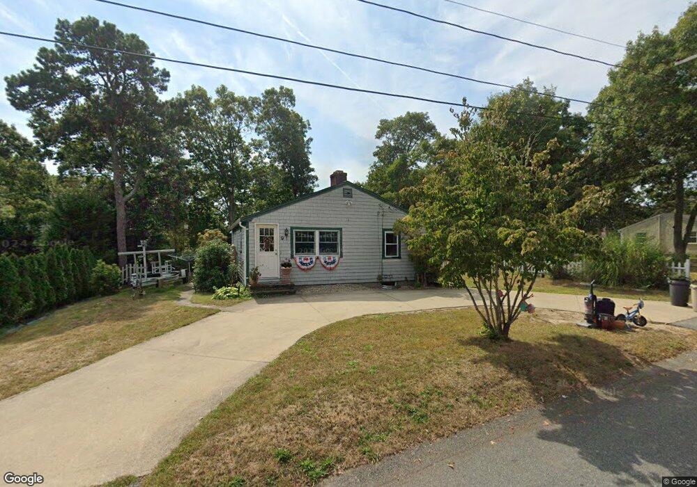
9 Ellsworth Dr East Falmouth, MA 02536
East Falmouth NeighborhoodEstimated Value: $377,000 - $594,000
3
Beds
1
Bath
1,201
Sq Ft
$430/Sq Ft
Est. Value
About This Home
This home is located at 9 Ellsworth Dr, East Falmouth, MA 02536 and is currently estimated at $516,545, approximately $430 per square foot. 9 Ellsworth Dr is a home located in Barnstable County with nearby schools including East Falmouth Elementary School, Morse Pond School, and Lawrence School.
Ownership History
Date
Name
Owned For
Owner Type
Purchase Details
Closed on
Dec 13, 2016
Sold by
Kinsella Michael R and Kinsella Debra W
Bought by
Kinsella Michael R
Current Estimated Value
Purchase Details
Closed on
Nov 13, 2000
Sold by
Kinsella Patrick J
Bought by
Kinsella Michael R and Kinsella Debra W
Home Financials for this Owner
Home Financials are based on the most recent Mortgage that was taken out on this home.
Original Mortgage
$37,000
Interest Rate
7.81%
Mortgage Type
Purchase Money Mortgage
Purchase Details
Closed on
Jun 22, 1995
Sold by
Tobias John and Tobias Joyce
Bought by
Kinsella Patrick J
Home Financials for this Owner
Home Financials are based on the most recent Mortgage that was taken out on this home.
Original Mortgage
$35,000
Interest Rate
7.82%
Mortgage Type
Purchase Money Mortgage
Create a Home Valuation Report for This Property
The Home Valuation Report is an in-depth analysis detailing your home's value as well as a comparison with similar homes in the area
Home Values in the Area
Average Home Value in this Area
Purchase History
| Date | Buyer | Sale Price | Title Company |
|---|---|---|---|
| Kinsella Michael R | -- | -- | |
| Kinsella Michael R | -- | -- | |
| Kinsella Michael R | $97,000 | -- | |
| Kinsella Michael R | $97,000 | -- | |
| Kinsella Patrick J | $72,000 | -- | |
| Kinsella Patrick J | $72,000 | -- |
Source: Public Records
Mortgage History
| Date | Status | Borrower | Loan Amount |
|---|---|---|---|
| Previous Owner | Kinsella Patrick J | $37,000 | |
| Previous Owner | Kinsella Patrick J | $35,000 |
Source: Public Records
Tax History Compared to Growth
Tax History
| Year | Tax Paid | Tax Assessment Tax Assessment Total Assessment is a certain percentage of the fair market value that is determined by local assessors to be the total taxable value of land and additions on the property. | Land | Improvement |
|---|---|---|---|---|
| 2025 | $2,400 | $408,800 | $157,500 | $251,300 |
| 2024 | $2,339 | $372,500 | $143,200 | $229,300 |
| 2023 | $2,342 | $338,500 | $143,200 | $195,300 |
| 2022 | $2,226 | $276,500 | $110,000 | $166,500 |
| 2021 | $2,162 | $254,400 | $105,200 | $149,200 |
| 2020 | $1,944 | $226,300 | $95,600 | $130,700 |
| 2019 | $1,870 | $218,400 | $95,600 | $122,800 |
| 2018 | $1,826 | $212,300 | $95,600 | $116,700 |
| 2017 | $1,777 | $208,300 | $95,600 | $112,700 |
| 2016 | $1,743 | $208,300 | $95,600 | $112,700 |
| 2015 | $1,706 | $208,300 | $95,600 | $112,700 |
| 2014 | $1,623 | $199,200 | $100,600 | $98,600 |
Source: Public Records
Map
Nearby Homes
- 15 Ovington Dr
- 285 Edgewater Dr W
- 231 Edgewater Dr W
- 0 Tobey Ln
- 381 Seacoast Shores Blvd
- 53 Eel River Rd
- 23 N Bournes Pond Rd
- 23 N Bournes Pond Rd
- 42 Hanson Cir
- 11 Pershing Dr
- 15 Pershing Dr
- 7 Yale Dr
- 23 Meadowood Ln
- 52 Bacon Farm Rd
- 27 Emerald Ln
- 30 Weatherglass Ln
- 21 Captain Davis Ln
- 0 Elsies Way Unit 22505181
- 0 Elsies Way Unit 73443603
- 14 Old Meeting House Rd
- 13 Ellsworth Dr
- 3 Ellsworth Dr
- 16 Ovington Dr
- 8 Ovington Dr
- 10 Ellsworth Dr
- 17 Ellsworth Dr
- 14 Ellsworth Dr
- 4 Ellsworth Dr
- 20 Ovington Dr
- 272 Edgewater Dr W
- 19 Ellsworth Dr
- 18 Ellsworth Dr
- 0 Ovington Dr Unit 70750063
- 0 Ovington Dr Unit 72187308
- 0 Ovington Dr Unit 71479177
- 0 Ovington Dr Unit 70447272
- 0 Ovington Dr Unit 20610236
- 0 Ovington Dr Unit 20403781
- 0 Ovington Dr Unit 6023450
- 0 Ovington Dr Unit 20401600