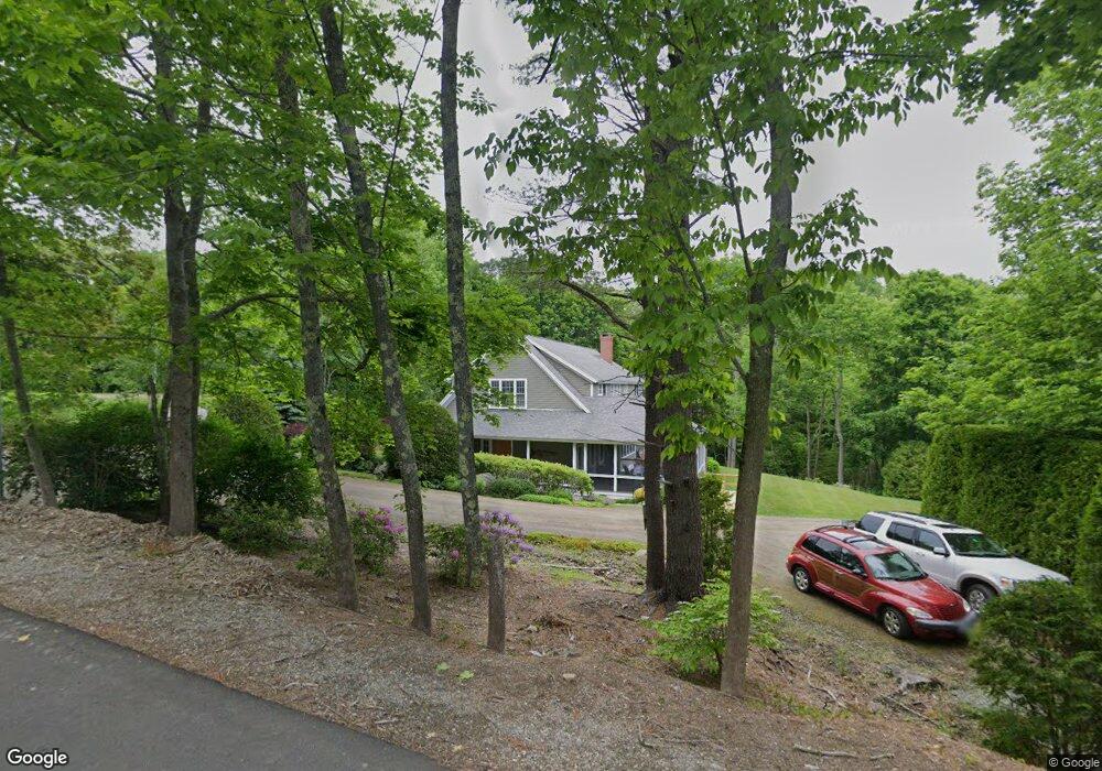
9 Elm St Rockport, ME 04856
Estimated Value: $1,519,000 - $2,115,532
--
Bed
1
Bath
2,861
Sq Ft
$664/Sq Ft
Est. Value
About This Home
This home is located at 9 Elm St, Rockport, ME 04856 and is currently estimated at $1,899,177, approximately $663 per square foot. 9 Elm St is a home located in Knox County with nearby schools including Camden-Rockport Elementary School, Camden-Rockport Middle School, and Camden Hills Regional High School.
Ownership History
Date
Name
Owned For
Owner Type
Purchase Details
Closed on
Sep 24, 2025
Sold by
James C Murray Iii T C and James Murray
Bought by
11 Elm Street Llc
Current Estimated Value
Purchase Details
Closed on
Feb 5, 2008
Sold by
Dorsey S Murray T S and Dorsey Murray
Bought by
Dorsey S Murray Qprt S and Dorsey Murray
Create a Home Valuation Report for This Property
The Home Valuation Report is an in-depth analysis detailing your home's value as well as a comparison with similar homes in the area
Home Values in the Area
Average Home Value in this Area
Purchase History
| Date | Buyer | Sale Price | Title Company |
|---|---|---|---|
| 11 Elm Street Llc | -- | -- | |
| Dorsey S Murray Qprt S | -- | -- | |
| Dorsey S Murray Qprt S | -- | -- | |
| Qprt Dorsey S Murray | -- | -- |
Source: Public Records
Tax History Compared to Growth
Tax History
| Year | Tax Paid | Tax Assessment Tax Assessment Total Assessment is a certain percentage of the fair market value that is determined by local assessors to be the total taxable value of land and additions on the property. | Land | Improvement |
|---|---|---|---|---|
| 2024 | $22,911 | $1,607,800 | $768,900 | $838,900 |
| 2023 | $20,339 | $1,607,800 | $768,900 | $838,900 |
| 2022 | $17,477 | $1,131,200 | $609,800 | $521,400 |
| 2021 | $16,411 | $962,500 | $558,600 | $403,900 |
| 2020 | $16,180 | $962,500 | $558,600 | $403,900 |
| 2019 | $16,411 | $962,500 | $558,600 | $403,900 |
| 2018 | $15,477 | $962,500 | $558,600 | $403,900 |
| 2017 | $14,197 | $962,500 | $558,600 | $403,900 |
| 2016 | $14,062 | $962,500 | $558,600 | $403,900 |
| 2015 | $13,523 | $962,500 | $558,600 | $403,900 |
| 2014 | $13,510 | $1,040,000 | $588,200 | $451,800 |
| 2013 | $13,198 | $1,040,000 | $588,200 | $451,800 |
Source: Public Records
Map
Nearby Homes
- 1 Ship St
- 11 Spruce St
- 198 Beauchamp Point Rd
- 21 Main St
- 10 Summer St Unit 7
- 10 Summer St Unit 1
- 54 Beech Hill Rd
- 00 Roc Crest Dr
- 116 Mistic Ave
- 21 Conway Rd
- Lot #19 Greenfield Dr
- Lot #23 Greenfield Dr
- 3 Sea Light Ln
- 34 Curtis Ave
- 93 Elm St
- 319 West St
- 76 Park St
- 84 Elm St
- 99 Chestnut St
- 73 (1) Elm St