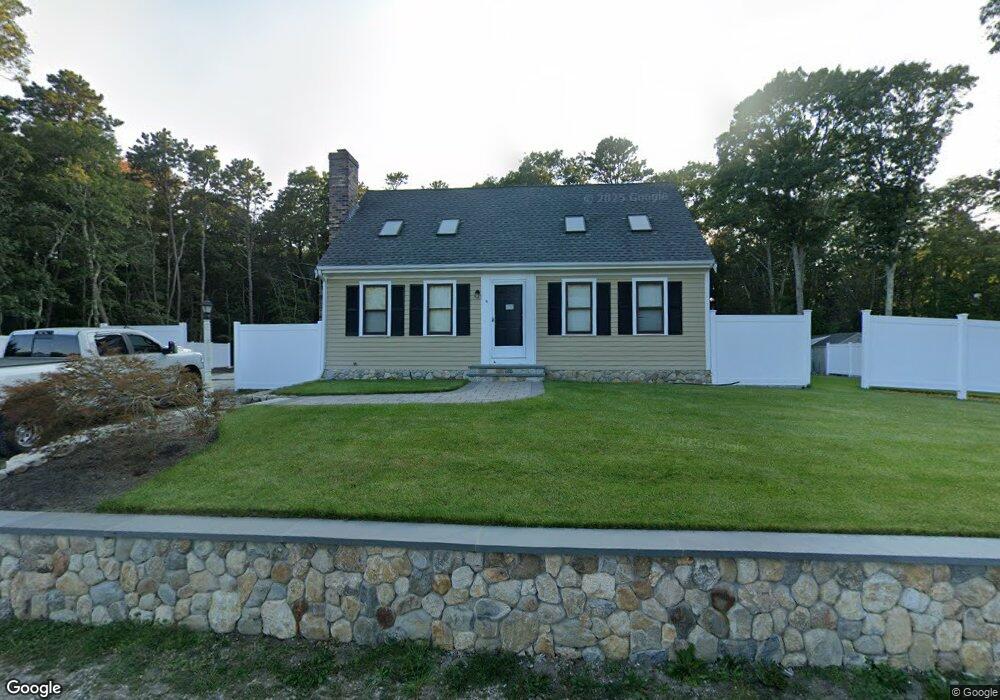
9 Evsun Dr Centerville, MA 02632
Centerville NeighborhoodEstimated Value: $627,063 - $698,000
3
Beds
2
Baths
1,501
Sq Ft
$433/Sq Ft
Est. Value
About This Home
This home is located at 9 Evsun Dr, Centerville, MA 02632 and is currently estimated at $649,766, approximately $432 per square foot. 9 Evsun Dr is a home located in Barnstable County with nearby schools including Centerville Elementary School, Barnstable United Elementary School, and Barnstable Intermediate School.
Ownership History
Date
Name
Owned For
Owner Type
Purchase Details
Closed on
Dec 13, 2002
Sold by
Lonergan Denis and Lonegran Linda
Bought by
Lima Rildo E
Current Estimated Value
Home Financials for this Owner
Home Financials are based on the most recent Mortgage that was taken out on this home.
Original Mortgage
$237,500
Outstanding Balance
$101,504
Interest Rate
6.17%
Mortgage Type
Purchase Money Mortgage
Estimated Equity
$548,262
Purchase Details
Closed on
Jun 20, 2002
Sold by
Warren Charles F and Warren Marie E
Bought by
Lonergan Denis
Home Financials for this Owner
Home Financials are based on the most recent Mortgage that was taken out on this home.
Original Mortgage
$135,000
Interest Rate
6.81%
Mortgage Type
Purchase Money Mortgage
Create a Home Valuation Report for This Property
The Home Valuation Report is an in-depth analysis detailing your home's value as well as a comparison with similar homes in the area
Home Values in the Area
Average Home Value in this Area
Purchase History
| Date | Buyer | Sale Price | Title Company |
|---|---|---|---|
| Lima Rildo E | $250,000 | -- | |
| Lonergan Denis | $180,000 | -- |
Source: Public Records
Mortgage History
| Date | Status | Borrower | Loan Amount |
|---|---|---|---|
| Open | Lonergan Denis | $237,500 | |
| Previous Owner | Lonergan Denis | $135,000 | |
| Previous Owner | Lonergan Denis | $36,800 |
Source: Public Records
Tax History
| Year | Tax Paid | Tax Assessment Tax Assessment Total Assessment is a certain percentage of the fair market value that is determined by local assessors to be the total taxable value of land and additions on the property. | Land | Improvement |
|---|---|---|---|---|
| 2025 | $4,239 | $524,000 | $154,900 | $369,100 |
| 2024 | $3,959 | $506,900 | $154,900 | $352,000 |
| 2023 | $3,804 | $456,100 | $140,800 | $315,300 |
| 2022 | $3,599 | $373,300 | $104,300 | $269,000 |
| 2021 | $3,570 | $340,300 | $104,300 | $236,000 |
| 2020 | $3,664 | $334,300 | $104,300 | $230,000 |
| 2019 | $3,550 | $314,700 | $104,300 | $210,400 |
| 2018 | $3,033 | $270,300 | $109,800 | $160,500 |
| 2017 | $2,829 | $262,900 | $109,800 | $153,100 |
| 2016 | $2,877 | $263,900 | $110,800 | $153,100 |
| 2015 | $2,786 | $256,800 | $108,000 | $148,800 |
Source: Public Records
Map
Nearby Homes
- 51 Larch Ln
- 200 Lumbert Mill Rd
- 53 Meadow Farm Rd
- 52 Meadow Farm Rd
- 103 Pine Tree Dr
- 315 Prince Hinckley Rd
- 296 Buckskin Path
- 351 Swift Ave
- 19 Marrick Ct
- 7 Ebenezer
- 82 Yacht Club Rd
- 12 S Cedar Rd
- 156 S Main St
- 818 S Main St
- 369 Bumps River Rd
- 40 Sachem Dr
- 89 Swift Ave
- 900 Old Stage Rd
- 87 Foxglove Rd
- 117 Parsley Ln
- 10 Evsun Dr
- 2130 Falmouth Rd
- 24 Evsun Dr
- 2156 Falmouth Rd
- 2126 Falmouth Rd
- 2156 Falmouth Rd
- 2167 Falmouth Rd
- 2170 Falmouth Rd
- 640 Skunknet Rd
- 634 Skunknet Rd
- 662 Skunknet Rd
- 628 Skunknet Rd
- 610 Skunknet Rd
- 68 Evsun Dr
- 618 Skunknet Rd
- 645 Skunknet Rd
- 608 Skunknet Rd
- 240 5 Corners Rd
- 240 Five Corners Rd
- 635 Skunknet Rd
Your Personal Tour Guide
Ask me questions while you tour the home.