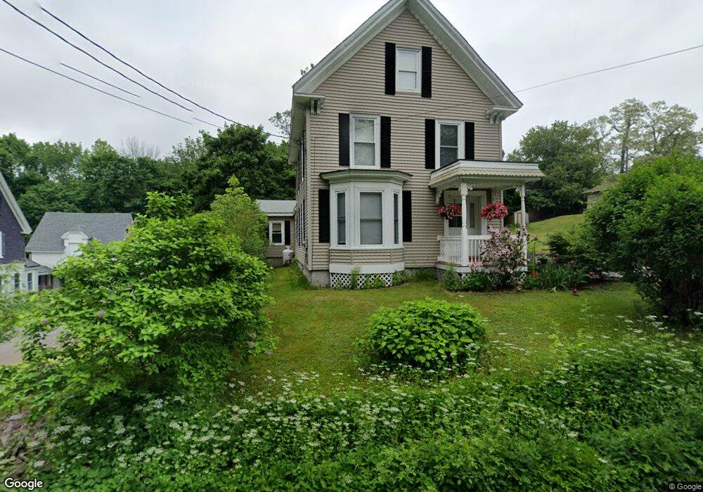
9 Ferry Rd Orrington, ME 04474
Estimated Value: $266,845 - $392,000
--
Bed
--
Bath
--
Sq Ft
0.25
Acres
About This Home
This home is located at 9 Ferry Rd, Orrington, ME 04474 and is currently estimated at $334,961. 9 Ferry Rd is a home located in Penobscot County with nearby schools including Center Drive School and Calvary Chapel Christian School.
Ownership History
Date
Name
Owned For
Owner Type
Purchase Details
Closed on
Aug 21, 2020
Sold by
Smith Debra E
Bought by
Tompkins Merrill L
Current Estimated Value
Home Financials for this Owner
Home Financials are based on the most recent Mortgage that was taken out on this home.
Original Mortgage
$88,201
Outstanding Balance
$78,240
Interest Rate
3%
Mortgage Type
FHA
Estimated Equity
$256,721
Create a Home Valuation Report for This Property
The Home Valuation Report is an in-depth analysis detailing your home's value as well as a comparison with similar homes in the area
Home Values in the Area
Average Home Value in this Area
Purchase History
| Date | Buyer | Sale Price | Title Company |
|---|---|---|---|
| Tompkins Merrill L | -- | None Available |
Source: Public Records
Mortgage History
| Date | Status | Borrower | Loan Amount |
|---|---|---|---|
| Open | Tompkins Merrill L | $88,201 |
Source: Public Records
Tax History Compared to Growth
Tax History
| Year | Tax Paid | Tax Assessment Tax Assessment Total Assessment is a certain percentage of the fair market value that is determined by local assessors to be the total taxable value of land and additions on the property. | Land | Improvement |
|---|---|---|---|---|
| 2024 | $2,329 | $213,700 | $30,900 | $182,800 |
| 2023 | $2,221 | $201,900 | $28,800 | $173,100 |
| 2022 | $2,343 | $183,800 | $32,600 | $151,200 |
| 2021 | $2,469 | $164,600 | $32,600 | $132,000 |
| 2020 | $2,447 | $153,900 | $32,600 | $121,300 |
| 2019 | $2,447 | $153,900 | $32,600 | $121,300 |
| 2018 | $2,139 | $153,900 | $32,600 | $121,300 |
| 2017 | $2,139 | $153,900 | $32,600 | $121,300 |
| 2016 | $1,848 | $128,800 | $17,100 | $111,700 |
| 2015 | $1,848 | $128,800 | $17,100 | $111,700 |
| 2014 | $1,711 | $119,200 | $17,100 | $102,100 |
| 2013 | $1,603 | $119,200 | $17,100 | $102,100 |
Source: Public Records
Map
Nearby Homes
- 59 Summer St
- 25 Summer St
- 7 Summer St
- 12 Rowell Rd
- 173 Center Dr
- 245 Center Dr
- 1 Honey Hill Ln
- 180 Main Rd N
- 290 Center Dr
- 10 Independence Ave
- 0 Constitution
- 1002 River Rd
- 23 Carver Rd
- 41 Stoneybrook Rd
- 34 Stoneybrook Rd
- 304 Main Rd N
- 314 Main Rd N
- 420 Main Rd S
- 128 Mayo Rd Unit K
- 197 Arctic Station Rd