
Seller's Agent in 2025
Louise Knight
eXp Realty
(978) 771-6680
2 in this area
65 Total Sales
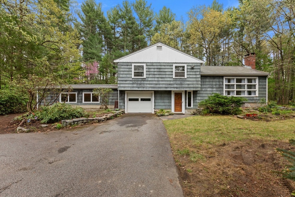
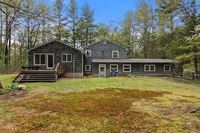
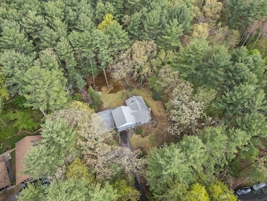
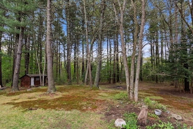
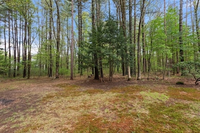
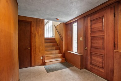
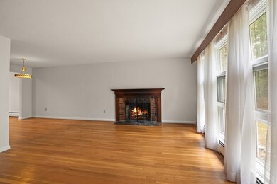
First time on the market! This tri-level home is nestled on a quiet cul-de-sac in a desirable Acton location near the Concord line. Set on a rare 1.29-acre wooded lot, it offers privacy and space in a beautiful neighborhood. The fireplaced living room flows into the dining area and spacious kitchen, with access to the deck—perfect for enjoying the natural surroundings. Upstairs are three bedrooms and a full bath. The lower level features a large family room, office, and a fourth bedroom, offering flexible living space. A workshop and ample storage can be found in the basement. The one-car garage adds winter convenience. Priced with updates in mind—bring your vision and make it yours! Close to everything-Concord center, shopping and restaurants, the Bruce Freeman rail trail, Nara Park, and the commuter rail! Showings begin Friday May 16th.
| Date | Type | Sale Price | Title Company |
|---|---|---|---|
| Quit Claim Deed | $730,000 | None Available | |
| Quit Claim Deed | $730,000 | None Available | |
| Deed | -- | -- | |
| Deed | -- | -- | |
| Deed | -- | -- | |
| Deed | -- | -- | |
| Deed | -- | -- | |
| Deed | -- | -- |
| Date | Status | Loan Amount | Loan Type |
|---|---|---|---|
| Open | $430,000 | Purchase Money Mortgage | |
| Closed | $430,000 | Purchase Money Mortgage | |
| Previous Owner | $45,000 | No Value Available |
| Date | Event | Price | List to Sale | Price per Sq Ft |
|---|---|---|---|---|
| 06/13/2025 06/13/25 | Sold | $730,000 | +16.8% | $272 / Sq Ft |
| 05/21/2025 05/21/25 | Pending | -- | -- | -- |
| 05/13/2025 05/13/25 | For Sale | $625,000 | -- | $233 / Sq Ft |
| Year | Tax Paid | Tax Assessment Tax Assessment Total Assessment is a certain percentage of the fair market value that is determined by local assessors to be the total taxable value of land and additions on the property. | Land | Improvement |
|---|---|---|---|---|
| 2025 | $12,760 | $744,000 | $369,700 | $374,300 |
| 2024 | $12,624 | $757,300 | $369,700 | $387,600 |
| 2023 | $11,906 | $678,000 | $336,000 | $342,000 |
| 2022 | $11,186 | $575,100 | $292,200 | $282,900 |
| 2021 | $11,072 | $547,300 | $270,300 | $277,000 |
| 2020 | $10,530 | $547,300 | $270,300 | $277,000 |
| 2019 | $10,477 | $540,900 | $270,300 | $270,600 |
| 2018 | $9,638 | $497,300 | $270,300 | $227,000 |
| 2017 | $9,402 | $493,300 | $270,300 | $223,000 |
| 2016 | $9,071 | $471,700 | $270,300 | $201,400 |
| 2015 | $8,742 | $458,900 | $270,300 | $188,600 |
| 2014 | $8,653 | $444,900 | $270,300 | $174,600 |
Seller's Agent in 2025
Louise Knight
eXp Realty
(978) 771-6680
2 in this area
65 Total Sales
Buyer's Agent in 2025
Shannon Boeckelman
Compass
(530) 318-3958
1 in this area
28 Total Sales
Source: MLS Property Information Network (MLS PIN)
MLS Number: 73373526
APN: ACTO-000005F-000038
Disclaimer: Certain information contained herein is derived from information provided by parties other than Homes.com. All information provided is deemed reliable, but is not guaranteed to be accurate and should be independently verified.
![]() The property listing data and information, or the Images, set forth herein were provided to MLS Property Information Network, Inc. from third party sources, including sellers, lessors and public records, and were compiled by MLS Property Information Network, Inc. The property listing data and information, and the Images, are for the personal, non-commercial use of consumers having a good faith interest in purchasing or leasing listed properties of the type displayed to them and may not be used for any purpose other than to identify prospective properties which such consumers may have a good faith interest in purchasing or leasing. MLS Property Information Network, Inc. and its subscribers disclaim any and all representations and warranties as to the accuracy of the property listing data and information, or as to the accuracy of any of the Images, set forth herein.
The property listing data and information, or the Images, set forth herein were provided to MLS Property Information Network, Inc. from third party sources, including sellers, lessors and public records, and were compiled by MLS Property Information Network, Inc. The property listing data and information, and the Images, are for the personal, non-commercial use of consumers having a good faith interest in purchasing or leasing listed properties of the type displayed to them and may not be used for any purpose other than to identify prospective properties which such consumers may have a good faith interest in purchasing or leasing. MLS Property Information Network, Inc. and its subscribers disclaim any and all representations and warranties as to the accuracy of the property listing data and information, or as to the accuracy of any of the Images, set forth herein.
Ask me questions while you tour the home.