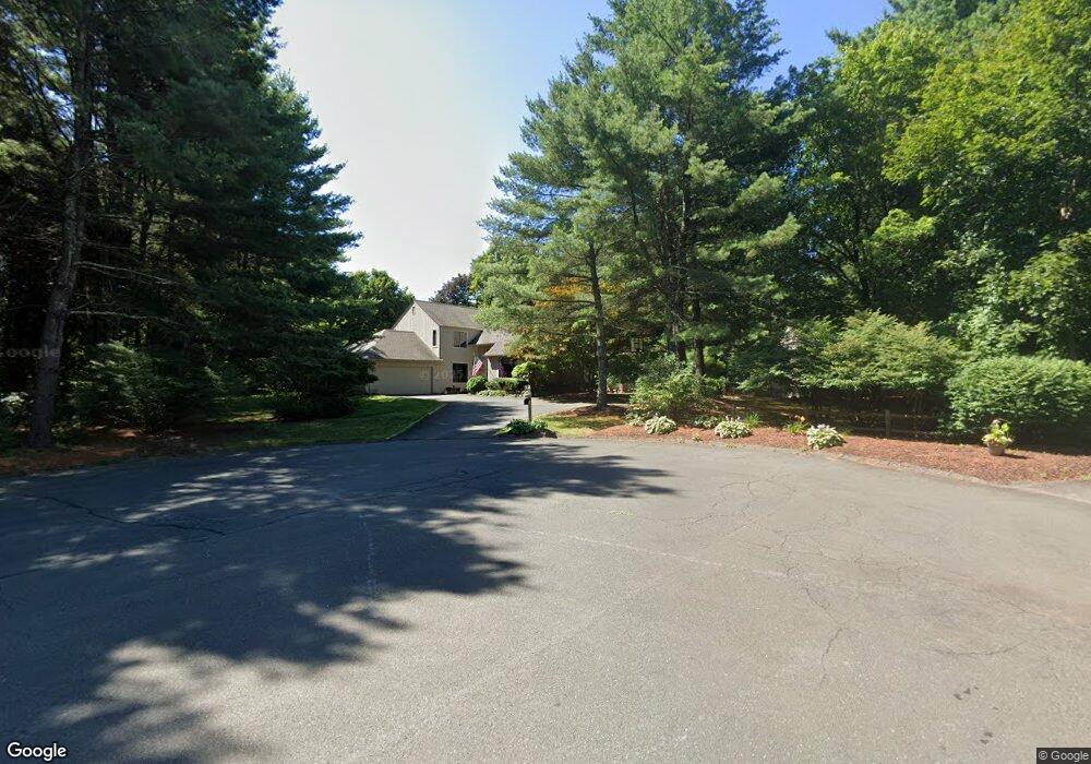
9 Gates Ln Simsbury, CT 06070
Estimated Value: $556,000 - $592,000
3
Beds
3
Baths
1,998
Sq Ft
$287/Sq Ft
Est. Value
About This Home
This home is located at 9 Gates Ln, Simsbury, CT 06070 and is currently estimated at $572,782, approximately $286 per square foot. 9 Gates Ln is a home located in Hartford County with nearby schools including Squadron Line School, Henry James Memorial School, and Simsbury High School.
Ownership History
Date
Name
Owned For
Owner Type
Purchase Details
Closed on
Oct 13, 2006
Sold by
Naughton Matthew R and Naughton Ellen M
Bought by
Cartus Financial Corp
Current Estimated Value
Home Financials for this Owner
Home Financials are based on the most recent Mortgage that was taken out on this home.
Original Mortgage
$189,150
Interest Rate
6.47%
Purchase Details
Closed on
Jul 31, 1997
Sold by
Tubach Paul and Tubach Marian
Bought by
Naughton Matthew and Naughton Ellen
Home Financials for this Owner
Home Financials are based on the most recent Mortgage that was taken out on this home.
Original Mortgage
$170,000
Interest Rate
7%
Mortgage Type
Unknown
Create a Home Valuation Report for This Property
The Home Valuation Report is an in-depth analysis detailing your home's value as well as a comparison with similar homes in the area
Home Values in the Area
Average Home Value in this Area
Purchase History
| Date | Buyer | Sale Price | Title Company |
|---|---|---|---|
| Cartus Financial Corp | $382,500 | -- | |
| Naughton Matthew | $222,000 | -- |
Source: Public Records
Mortgage History
| Date | Status | Borrower | Loan Amount |
|---|---|---|---|
| Open | Naughton Matthew | $160,624 | |
| Closed | Naughton Matthew | $170,000 | |
| Closed | Naughton Matthew | $189,150 | |
| Previous Owner | Naughton Matthew | $170,000 |
Source: Public Records
Tax History Compared to Growth
Tax History
| Year | Tax Paid | Tax Assessment Tax Assessment Total Assessment is a certain percentage of the fair market value that is determined by local assessors to be the total taxable value of land and additions on the property. | Land | Improvement |
|---|---|---|---|---|
| 2025 | $9,440 | $276,360 | $77,980 | $198,380 |
| 2024 | $9,206 | $276,360 | $77,980 | $198,380 |
| 2023 | $8,794 | $276,360 | $77,980 | $198,380 |
| 2022 | $8,873 | $229,700 | $84,680 | $145,020 |
| 2021 | $8,873 | $229,700 | $84,680 | $145,020 |
| 2020 | $8,520 | $229,700 | $84,680 | $145,020 |
| 2019 | $8,572 | $229,700 | $84,680 | $145,020 |
| 2018 | $8,634 | $229,700 | $84,680 | $145,020 |
| 2017 | $8,188 | $211,250 | $84,670 | $126,580 |
| 2016 | $7,842 | $211,250 | $84,670 | $126,580 |
| 2015 | $7,842 | $211,250 | $84,670 | $126,580 |
| 2014 | $7,846 | $211,250 | $84,670 | $126,580 |
Source: Public Records
Map
Nearby Homes
- 247 Old Farms Rd
- 5 Anja Dr
- 324 Firetown Rd
- 19 Elaine Dr
- 65 Chriswell Dr
- 12 Gretel Ln
- 16 Berkshire Way
- 21 Berkshire Way
- 7R Stonewall Dr
- 113 Old Farms Rd
- 26 Winterset Ln
- 30 Holcomb Ridge
- 7 Knollwood Cir
- 45 Hoskins Rd
- 141 Firetown Rd
- 27 Brettonwood Dr Unit 27
- 14 Gordon St
- 14 Brettonwood Dr
- 35 Beldenwood Rd
- 51 Canton Rd
- 426 Firetown Rd
- 10 Gates Ln
- 80 Holcomb St
- 84 Holcomb St
- 430 Firetown Rd
- 15 Gates Ln
- 11 Gates Ln
- 12 Gates Ln
- 88 Holcomb St
- 1 Cardinal Rd
- 74 Holcomb St
- 13 Whitcomb Dr
- 0 County Road 4
- 0 County Road 4 Unit RECIR926845
- 0 County Road 4 Unit RECIR925313
- 0 County Road 4 Unit 2178214
- 0 County Road 4 Unit 4301135
- 0 County Road 4 Unit 7457228
- 0 County Road 4 Unit 554688
- 0 County Road 4 Unit 439620