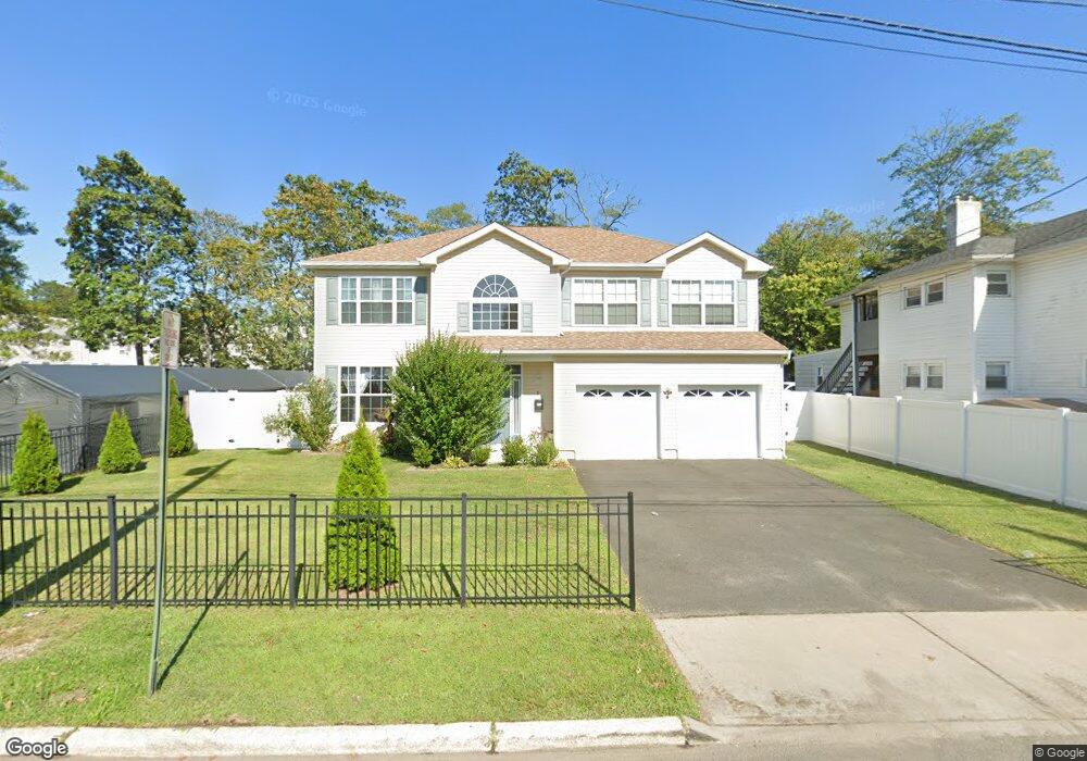
9 George St Neptune, NJ 07753
Estimated Value: $550,000 - $866,000
4
Beds
3
Baths
2,361
Sq Ft
$296/Sq Ft
Est. Value
About This Home
This home is located at 9 George St, Neptune, NJ 07753 and is currently estimated at $699,624, approximately $296 per square foot. 9 George St is a home with nearby schools including Neptune High School and Our Lady of Mount Carmel School.
Ownership History
Date
Name
Owned For
Owner Type
Purchase Details
Closed on
Apr 7, 2017
Sold by
Saba Properties Llc and Bazzani Scott W
Bought by
Baptiste Pierre W and Maude Nadine Baptiste
Current Estimated Value
Home Financials for this Owner
Home Financials are based on the most recent Mortgage that was taken out on this home.
Original Mortgage
$261,000
Outstanding Balance
$217,191
Interest Rate
4.21%
Mortgage Type
New Conventional
Estimated Equity
$482,433
Purchase Details
Closed on
Mar 4, 2016
Sold by
Ybeg Property Management Company and Ybeg Property Management Llc
Bought by
Saba Properties Llc
Home Financials for this Owner
Home Financials are based on the most recent Mortgage that was taken out on this home.
Interest Rate
3.64%
Create a Home Valuation Report for This Property
The Home Valuation Report is an in-depth analysis detailing your home's value as well as a comparison with similar homes in the area
Home Values in the Area
Average Home Value in this Area
Purchase History
| Date | Buyer | Sale Price | Title Company |
|---|---|---|---|
| Baptiste Pierre W | $290,000 | None Available | |
| Saba Properties Llc | $35,000 | -- |
Source: Public Records
Mortgage History
| Date | Status | Borrower | Loan Amount |
|---|---|---|---|
| Open | Baptiste Pierre W | $261,000 | |
| Previous Owner | Saba Properties Llc | -- |
Source: Public Records
Tax History Compared to Growth
Tax History
| Year | Tax Paid | Tax Assessment Tax Assessment Total Assessment is a certain percentage of the fair market value that is determined by local assessors to be the total taxable value of land and additions on the property. | Land | Improvement |
|---|---|---|---|---|
| 2025 | $9,800 | $616,800 | $235,800 | $381,000 |
| 2024 | $9,184 | $559,700 | $188,700 | $371,000 |
| 2023 | $9,184 | $508,500 | $146,200 | $362,300 |
| 2022 | $7,683 | $446,700 | $101,700 | $345,000 |
| 2021 | $6,643 | $363,600 | $87,700 | $275,900 |
| 2020 | $6,920 | $326,700 | $65,200 | $261,500 |
| 2019 | $6,643 | $309,700 | $64,500 | $245,200 |
| 2018 | $6,681 | $307,900 | $64,500 | $243,400 |
| 2017 | $1,457 | $64,500 | $64,500 | $0 |
| 2016 | $1,461 | $64,500 | $64,500 | $0 |
| 2015 | $1,436 | $64,500 | $64,500 | $0 |
| 2014 | $1,376 | $50,800 | $50,800 | $0 |
Source: Public Records
Map
Nearby Homes
- 1528 Monroe Ave
- 601 New Jersey 35
- 113 Leonard Ave
- 126 Leonard Ave
- 1902 Stratford Ave
- 1704 Summerfield Ave
- 1702 Summerfield Ave
- 1711 Stratford Ave
- 1807 Milton Ave
- 1316 Monroe Ave
- 405 Myrtle Ave
- 401 Ridge Ave
- 1604 Bangs Ave
- 1712 Brockton Ave
- 0 Bangs Ave
- 1961 W Lake Ave
- 119 Ridge Ave
- 1405 Mattison Ave
- 270 Fisher Ave
- 141 Elizabeth Ave
- 11 George St
- 5 George St
- 1514 Monroe Ave Unit 23b
- 1514 Monroe Ave
- 1829 Bangs Ave
- 1925 Bangs Ave
- 22 George St
- 1927 Bangs Ave
- 1600 Monroe Ave
- 1510 Monroe Ave
- 1602 Monroe Ave
- 1827 Bangs Ave Unit 17A
- 1827 Bangs Ave Unit 11B
- 1827 Bangs Ave Unit 11B
- 1935 Bangs Ave
- 1508 Monroe Ave Unit AVE 1/2
- 100 Oxonia Ave
- 1517 Monroe Ave
- 1604 Monroe Ave
- 1937 Bangs Ave