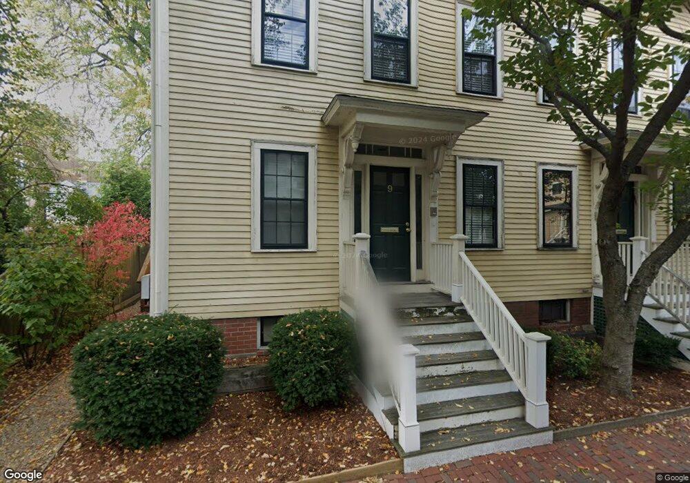
9 Gerry St Unit A Cambridge, MA 02138
West Cambridge NeighborhoodEstimated Value: $790,000 - $1,045,000
2
Beds
2
Baths
600
Sq Ft
$1,474/Sq Ft
Est. Value
About This Home
This home is located at 9 Gerry St Unit A, Cambridge, MA 02138 and is currently estimated at $884,324, approximately $1,473 per square foot. 9 Gerry St Unit A is a home located in Middlesex County with nearby schools including St Peter School, Buckingham Browne & Nichols School, and Saint Paul's Choir School.
Ownership History
Date
Name
Owned For
Owner Type
Purchase Details
Closed on
Dec 28, 2010
Sold by
Gordon Kevin
Bought by
Gordon Kevin and Leonard Diana
Current Estimated Value
Purchase Details
Closed on
Sep 19, 2008
Sold by
Bray Robert H
Bought by
Gordon Kevin
Create a Home Valuation Report for This Property
The Home Valuation Report is an in-depth analysis detailing your home's value as well as a comparison with similar homes in the area
Home Values in the Area
Average Home Value in this Area
Purchase History
| Date | Buyer | Sale Price | Title Company |
|---|---|---|---|
| Gordon Kevin | -- | -- | |
| Gordon Kevin | -- | -- | |
| Gordon Kevin | -- | -- | |
| Gordon Kevin | -- | -- |
Source: Public Records
Mortgage History
| Date | Status | Borrower | Loan Amount |
|---|---|---|---|
| Previous Owner | Gordon Kevin | $38,350 | |
| Previous Owner | Gordon Kevin | $270,000 | |
| Previous Owner | Gordon Kevin | $110,000 |
Source: Public Records
Tax History Compared to Growth
Tax History
| Year | Tax Paid | Tax Assessment Tax Assessment Total Assessment is a certain percentage of the fair market value that is determined by local assessors to be the total taxable value of land and additions on the property. | Land | Improvement |
|---|---|---|---|---|
| 2025 | $6,233 | $981,600 | $0 | $981,600 |
| 2024 | $5,574 | $941,600 | $0 | $941,600 |
| 2023 | $5,452 | $930,400 | $0 | $930,400 |
| 2022 | $5,342 | $902,400 | $0 | $902,400 |
| 2021 | $5,158 | $881,700 | $0 | $881,700 |
| 2020 | $4,912 | $854,200 | $0 | $854,200 |
| 2019 | $4,713 | $793,400 | $0 | $793,400 |
| 2018 | $2,511 | $729,400 | $0 | $729,400 |
| 2017 | $4,386 | $675,800 | $0 | $675,800 |
| 2016 | $4,134 | $591,400 | $0 | $591,400 |
| 2015 | $4,098 | $524,100 | $0 | $524,100 |
| 2014 | $4,048 | $483,100 | $0 | $483,100 |
Source: Public Records
Map
Nearby Homes
- 5 Brewer St Unit 5
- 130 Mount Auburn St Unit 108
- 988 Memorial Dr Unit 386
- 986 Memorial Dr Unit 404
- 983 Memorial Dr Unit 502
- 984 Memorial Dr Unit 984-503
- 32 Hawthorn St
- 975 Memorial Dr Unit 209
- 975 Memorial Dr Unit 211
- 12 Berkeley St
- 3 Berkeley Place
- 50 Follen St Unit 505
- 50 Follen St Unit 109
- 22 Concord Ave Unit 10
- 20 Maynard Place
- 44 Garden St
- 14 Chauncy St Unit 4
- 1010 Memorial Dr Unit 6G
- 15 Hubbard Park Rd
- 52 Garden St Unit B2
- 9 Gerry St Unit B
- 7 Gerry St
- 9 Gerry St
- 9 Gerry St Unit 9
- 9 Gerry St Unit 1
- 5 Gerry St
- 8 Gerry St
- 1 Chapman Place Unit Second Floor
- 11 Gerry St Unit 2
- 11 Gerry St Unit 1
- 11.5 Gerry Unit Street
- 5 Revere St
- 6 Brewer St Unit 3
- 6 Brewer St Unit 2
- 6 Brewer St Unit 1
- 10 Brewer St Unit 6
- 10 Brewer St Unit 5
- 10 Brewer St Unit 4
- 10 Brewer St Unit 3
- 10 Brewer St Unit 2