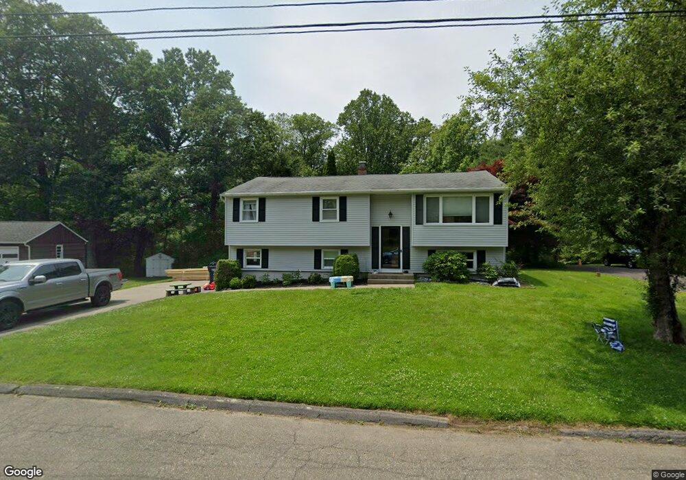
9 Glen Cir Seymour, CT 06483
Estimated Value: $445,000 - $481,000
3
Beds
1
Bath
1,176
Sq Ft
$391/Sq Ft
Est. Value
About This Home
This home is located at 9 Glen Cir, Seymour, CT 06483 and is currently estimated at $459,804, approximately $390 per square foot. 9 Glen Cir is a home located in New Haven County with nearby schools including Bungay Elementary School, Seymour Middle School, and Seymour High School.
Ownership History
Date
Name
Owned For
Owner Type
Purchase Details
Closed on
May 26, 2009
Sold by
National City Re Svcs
Bought by
Zwolinski Carl S
Current Estimated Value
Home Financials for this Owner
Home Financials are based on the most recent Mortgage that was taken out on this home.
Original Mortgage
$164,000
Outstanding Balance
$104,509
Interest Rate
4.93%
Estimated Equity
$355,296
Purchase Details
Closed on
Sep 8, 2004
Sold by
Mrowka Robert F and Mrowka Marie E
Bought by
Goulette Emile C and Goulette Tammy C
Home Financials for this Owner
Home Financials are based on the most recent Mortgage that was taken out on this home.
Original Mortgage
$250,000
Interest Rate
6.08%
Purchase Details
Closed on
Jan 22, 1998
Sold by
Conroy John D and Conroy Dolores A
Bought by
Mrowka Robert F and Mrowka Marie E
Create a Home Valuation Report for This Property
The Home Valuation Report is an in-depth analysis detailing your home's value as well as a comparison with similar homes in the area
Home Values in the Area
Average Home Value in this Area
Purchase History
| Date | Buyer | Sale Price | Title Company |
|---|---|---|---|
| Zwolinski Carl S | $205,000 | -- | |
| Goulette Emile C | $270,000 | -- | |
| Mrowka Robert F | $155,670 | -- |
Source: Public Records
Mortgage History
| Date | Status | Borrower | Loan Amount |
|---|---|---|---|
| Open | Mrowka Robert F | $164,000 | |
| Previous Owner | Mrowka Robert F | $298,000 | |
| Previous Owner | Mrowka Robert F | $250,000 |
Source: Public Records
Tax History Compared to Growth
Tax History
| Year | Tax Paid | Tax Assessment Tax Assessment Total Assessment is a certain percentage of the fair market value that is determined by local assessors to be the total taxable value of land and additions on the property. | Land | Improvement |
|---|---|---|---|---|
| 2025 | $6,867 | $247,730 | $52,920 | $194,810 |
| 2024 | $6,854 | $186,060 | $44,870 | $141,190 |
| 2023 | $6,694 | $186,060 | $44,870 | $141,190 |
| 2022 | $6,622 | $186,060 | $44,870 | $141,190 |
| 2021 | $6,458 | $186,060 | $44,870 | $141,190 |
| 2020 | $5,461 | $151,690 | $52,710 | $98,980 |
| 2019 | $5,461 | $151,690 | $52,710 | $98,980 |
| 2018 | $5,461 | $151,690 | $52,710 | $98,980 |
| 2017 | $5,461 | $151,690 | $52,710 | $98,980 |
| 2016 | $5,461 | $151,690 | $52,710 | $98,980 |
| 2015 | $5,363 | $155,050 | $57,960 | $97,090 |
| 2014 | $5,278 | $155,050 | $57,960 | $97,090 |
Source: Public Records
Map
Nearby Homes
- 106 Botsford Rd
- 88 Brookfield Rd
- 181 Great Hill Rd
- 22 Brookfield Rd
- 6 Stanley Dr
- 56 Kathy Dr
- 109 Davis Rd
- 56 Great Hill Rd
- 12 Great Meadow Rd
- 3 Deer Run Dr
- 70 Brookdale Rd
- 208 Bungay Rd
- 17 Tibbets Rd
- 41 Balance Rock Rd Unit 16
- 73 Brookdale Rd
- 37-14, 49-1, 79-2, 7 Balance Rock Rd
- 55 Tram Dr
- 32 Brookdale Rd
- 5 Ansmour Rd
- 93 Balance Rock Rd Unit 1