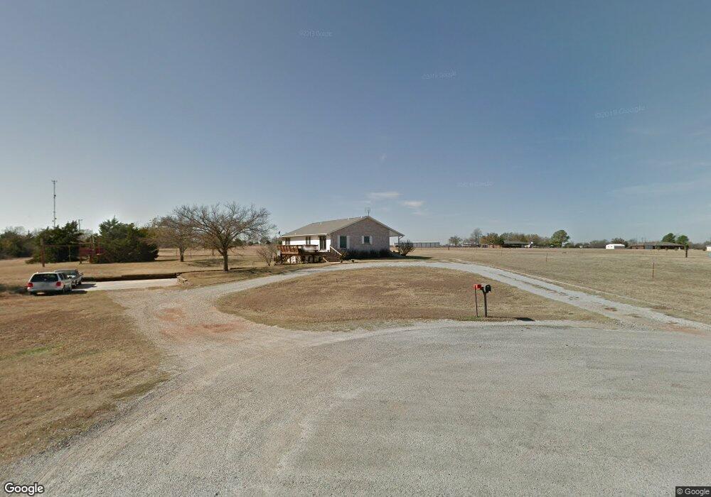
9 Grant Rd Morrison, OK 73061
Estimated Value: $204,000 - $263,384
4
Beds
3
Baths
1,650
Sq Ft
$141/Sq Ft
Est. Value
About This Home
This home is located at 9 Grant Rd, Morrison, OK 73061 and is currently estimated at $232,096, approximately $140 per square foot. 9 Grant Rd is a home located in Noble County with nearby schools including Morrison Elementary School and Morrison High School.
Ownership History
Date
Name
Owned For
Owner Type
Purchase Details
Closed on
Jul 23, 2009
Sold by
Rowland Even and Rowland Sara L
Bought by
Masters L Joe and Masters Susan M
Current Estimated Value
Purchase Details
Closed on
Jun 18, 2002
Sold by
Stephen J Hercyk
Bought by
Joe Ii Masters L
Purchase Details
Closed on
May 13, 2002
Sold by
Stephen J Hercyk
Bought by
Stephen J Hercyk
Purchase Details
Closed on
Jul 3, 1996
Sold by
Ricky D Mcswain
Bought by
Stephen J Hercyk
Purchase Details
Closed on
Jun 25, 1996
Sold by
Linda Darlene Marlow
Bought by
Ricky D Mcswain
Purchase Details
Closed on
Sep 19, 1991
Bought by
Linda Darlene Marlow
Create a Home Valuation Report for This Property
The Home Valuation Report is an in-depth analysis detailing your home's value as well as a comparison with similar homes in the area
Purchase History
| Date | Buyer | Sale Price | Title Company |
|---|---|---|---|
| Masters L Joe | -- | None Available | |
| Joe Ii Masters L | $143,000 | -- | |
| Stephen J Hercyk | -- | -- | |
| Stephen J Hercyk | $12,500 | -- | |
| Ricky D Mcswain | $9,000 | -- | |
| Linda Darlene Marlow | -- | -- |
Source: Public Records
Tax History Compared to Growth
Tax History
| Year | Tax Paid | Tax Assessment Tax Assessment Total Assessment is a certain percentage of the fair market value that is determined by local assessors to be the total taxable value of land and additions on the property. | Land | Improvement |
|---|---|---|---|---|
| 2025 | $2,081 | $20,919 | $1,377 | $19,542 |
| 2024 | $2,081 | $20,555 | $1,377 | $19,178 |
| 2023 | $2,041 | $19,956 | $1,377 | $18,579 |
| 2022 | $1,880 | $19,375 | $1,377 | $17,998 |
| 2021 | $1,796 | $19,375 | $1,377 | $17,998 |
| 2020 | $1,754 | $18,263 | $1,377 | $16,886 |
| 2019 | $1,693 | $17,731 | $1,377 | $16,354 |
| 2018 | $1,693 | $17,954 | $1,377 | $16,577 |
| 2017 | $1,739 | $18,146 | $1,377 | $16,769 |
| 2016 | $1,577 | $17,617 | $1,377 | $16,240 |
| 2015 | $1,512 | $17,104 | $1,377 | $15,727 |
| 2014 | $1,473 | $16,606 | $1,377 | $15,229 |
Source: Public Records
Map
Nearby Homes
- 1012 W Choctaw Ln
- 313 Osel
- 102 Taz
- 702 W Allyn Ave
- 4919 E Lone Chimney Rd
- 725 W Karen Ave
- 738 W Allyn Ave
- 7818 N Rebecca St
- 7812 N Rebecca St
- 7817 N Ora Ann St
- 7811 N Ora Ann St
- Parcel 002 County Road 180
- 7823 N Ora Ann St
- 731 W Karen Ave
- 728 W Karen Ave
- 5305 E Lone Chimney Rd
- 00 Yost Rd
- 29500 Harvest
- 106 W Burris Rd
- 00 Glencoe Oaks Range Rd